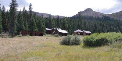
Carson was victim to the harsh winters of Colorado, situated almost directly on the Continental Divide at nearly 12,000 feet. It was founded as a mining camp and was one of the most inaccessible in Colorado. You’ll need a 4×4 if you plan on visiting the several remaining empty buildings and relics.
There are several sights to explore in the hills around town. Carson is sometimes confused with Old Carson, on the Pacific side of the Continental Divide. Old Carson was thought to be the earlier mining camp built south of the mountain at over 12,000 feet. The newer Carson had a wagon road to Lake City.
History
Founded in 1889 at 11,600 feet, Carson reached its peak at the turn of the century when some 500 miners worked the mountaintop. Gold and silver were mined. Eventually, the winters took their toll, and residents left for warmer climates.
Getting There
It’s 4×4 access only. From Lake City, take Highway 149, the Silver Thread Byway to the Alpine Loop, Co Rd 30, which is still in town. Then take the Wager Gulch trail to Carson.
Download the PDF of Area Map (from lakecity.com)
See Jeep Rentals for places to rent a Jeep in Lake City, Ouray, or Silverton, all within a day trip of Carson and other ghost towns.
Details
Nearby Town: Lake City
County: Hinsdale
Roads: 4WD
Season: Summer to early fall

