Hiking to the Ice Lakes is one of the most popular trails in Colorado. Located in the San Juan National Forest, the trail winds through some of the Rocky’s most picturesque scenery with a crystal clear aquamarine alpine lake to boot!
Discover everything you need to know about hiking to Ice Lakes with our guide below.
Ice Lakes Hiking Trail
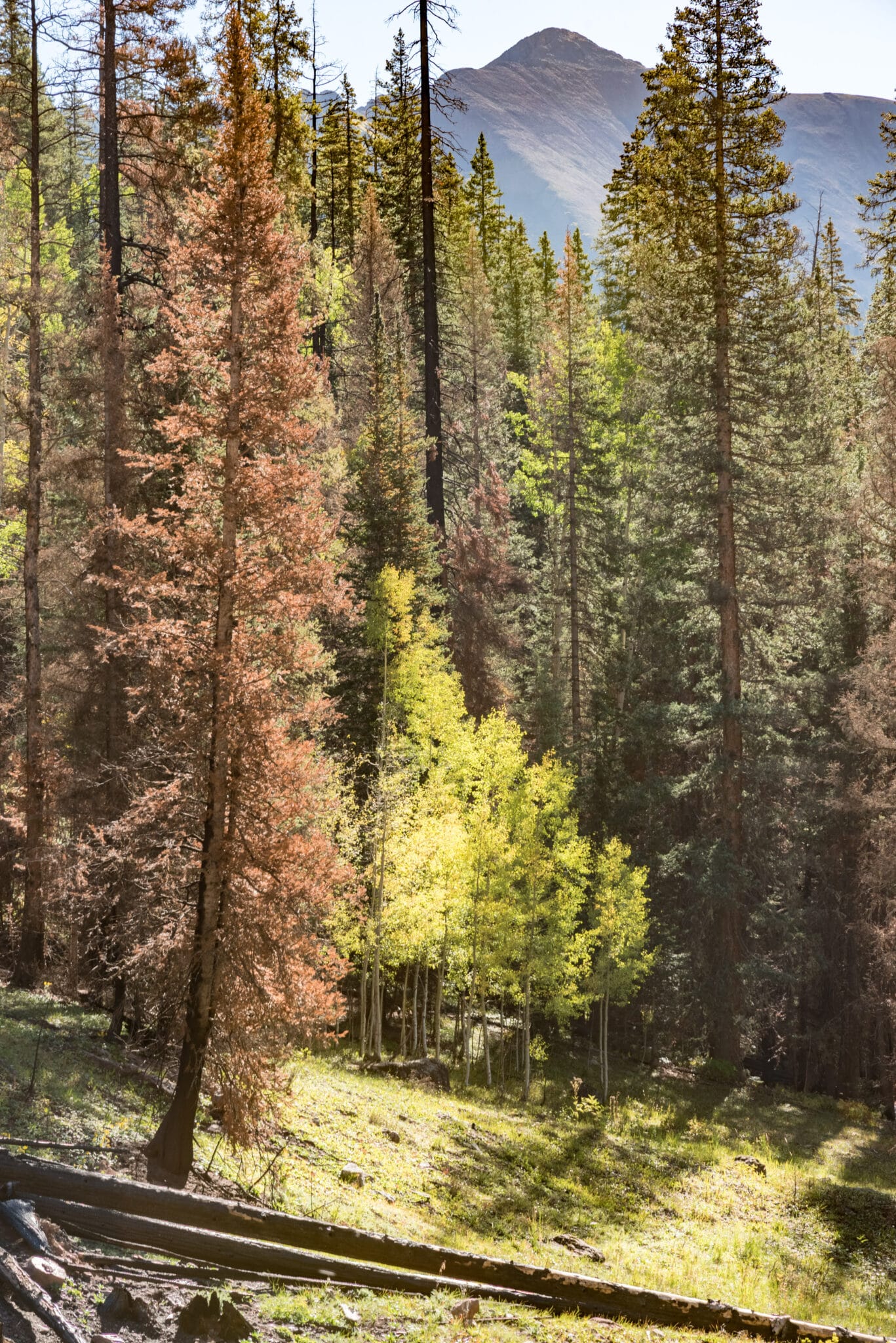
The trail is rated as hard due to its climb of almost 3,000 feet of elevation in 3.75 miles. Most of the heart-pounding climb is towards the end as you approach the upper lake. The first half is below timberline, with moderate switchbacks passing through aspen and conifer trees.
The trailhead is located at the South Mineral Campground, near Silverton, where the hike begins from the top of the South Mineral Valley. Here you will be instantly greeted with mountain views. Quickly emerge into a canopy of trees, where the trail begins a series of switchbacks.
You will notice a lot of debris from the fire that struck the area in October 2020. The trail was closed for roughly a year to clear out the lower part of the trail and make it safe for hikers. It has since re-opened with remnants of the fire still remaining.
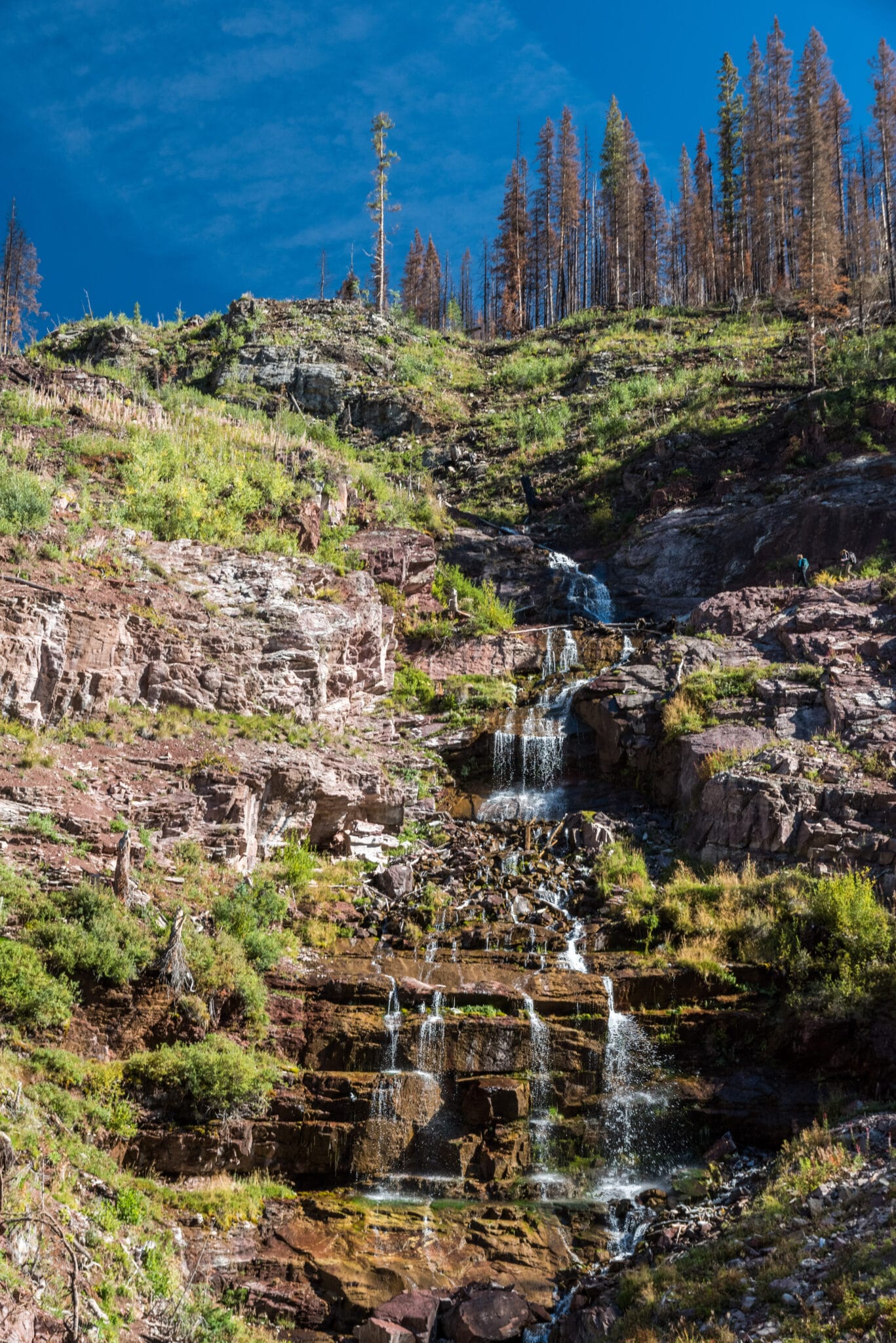
At roughly half of a mile, hikers will cross Clear Creek on a footbridge. Take a look around and you will notice a soothing waterfall flowing from the cliff above. Continue along to be greeted by a spur trail that will bring you closer to the waterfall.
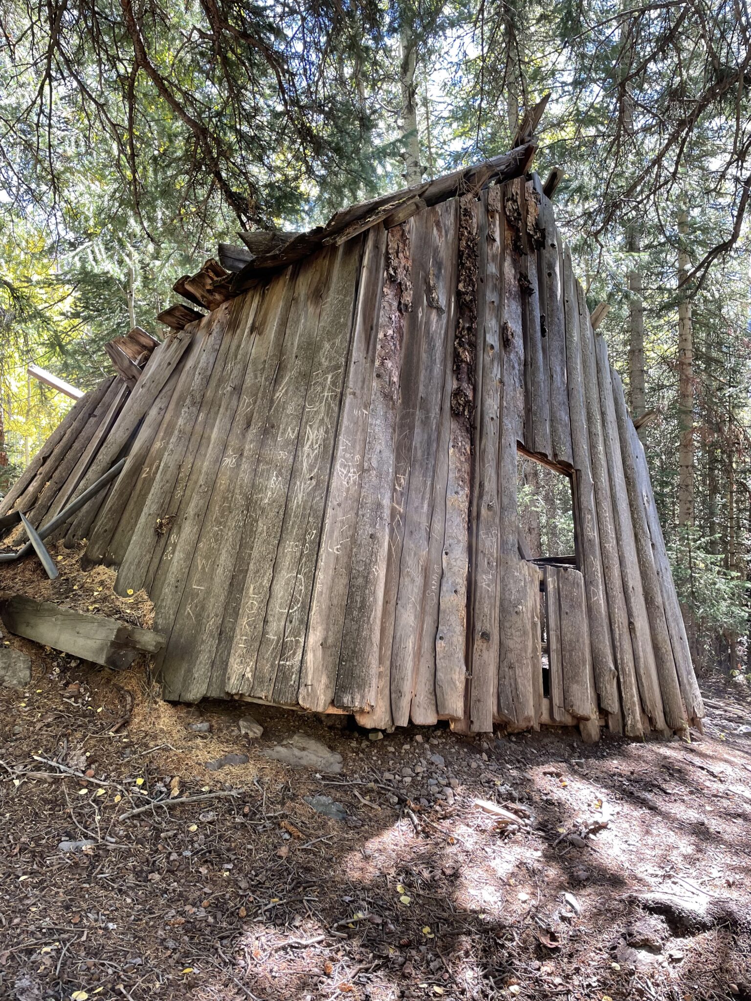
Remnants from an old mining operation can also be seen by another spur trail to the left. It’s a unique stop along this hike and worth the sidestep. After viewing the mine the trail rises quickly and starts a more strenuous climb to the lakes.
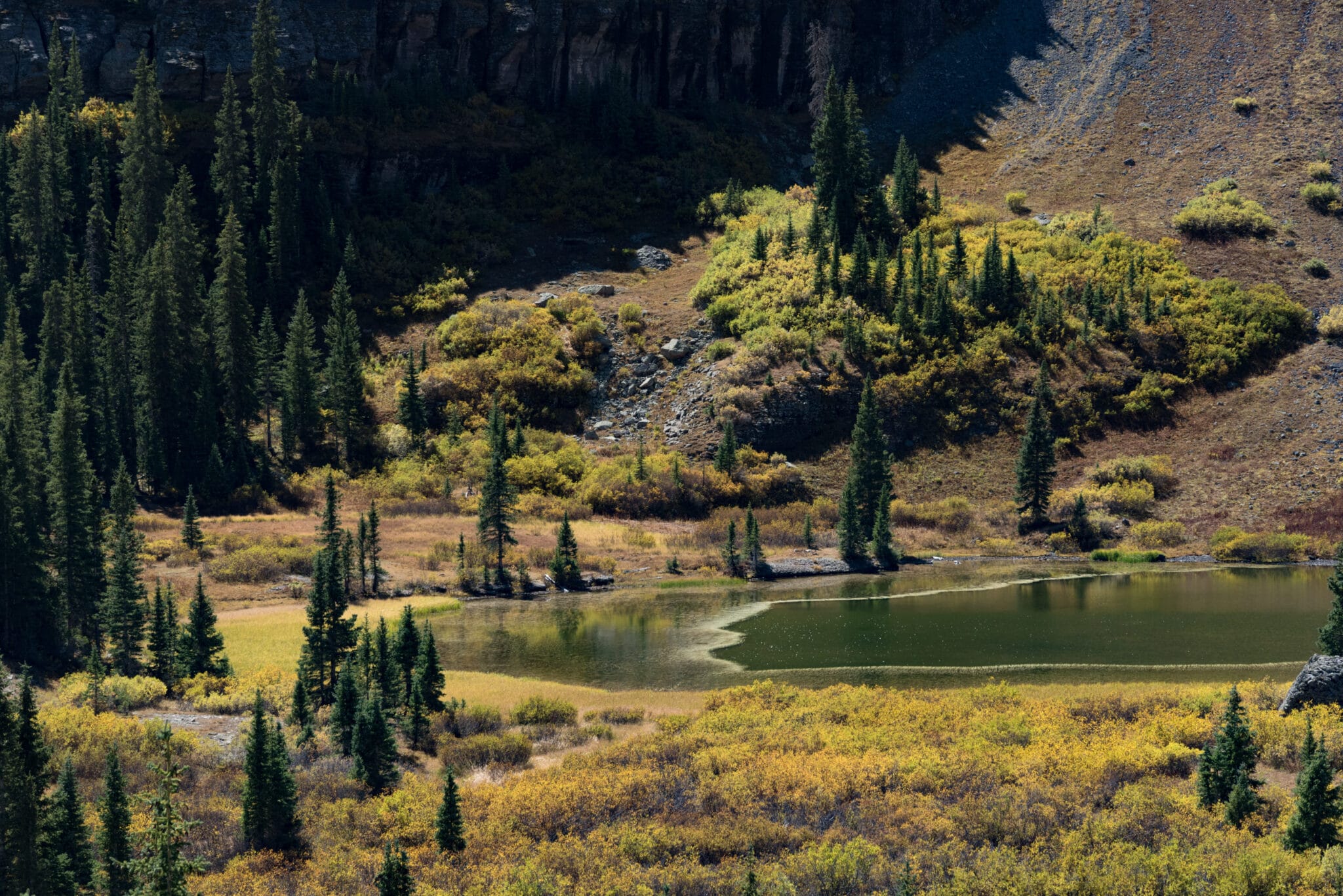
At about two miles, hikers will emerge from the forest and from here the hike opens up an expansive valley. You will soon come upon the lower Ice Lake to the left, access is limited to the lake.
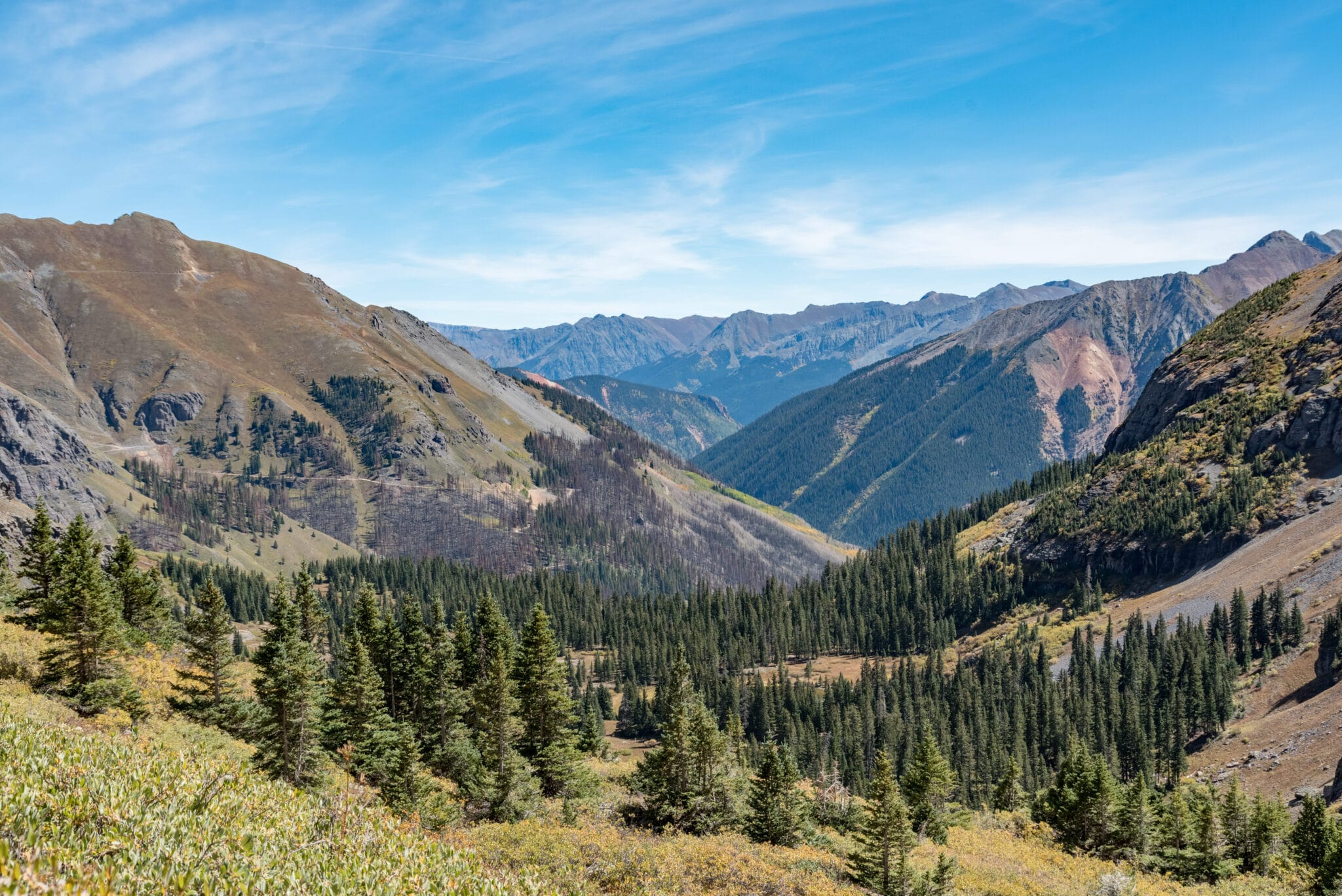
A towering ridgeline lies ahead, which is where you will approach the upper lake. Keep your eyes peeled for a large waterfall on the right, cascading from the rocky cliffs above. As you start the approach to the ridgeline, the upper half of the trail begins steep switchbacks and eventually levels out once hikers reach the basin.
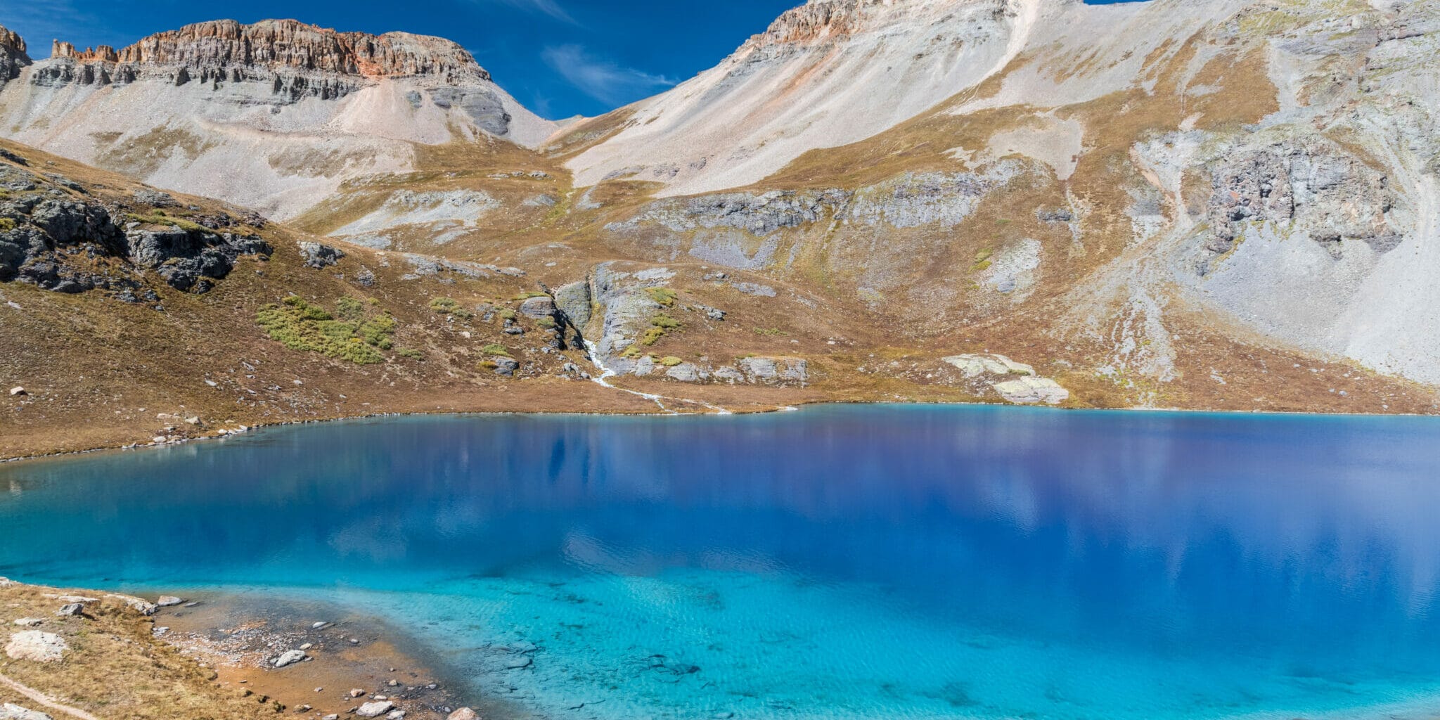
Once at the basin, hikers will be greeted by upper Ice Lake, a large alpine lake with aquamarine-colored waters. Its intense ice-blue colors are made by several factors, one of which includes something called glacial flour, or rock flour.
Rock flour forms as things begin to warm and glaciers melt, filling up the basin with water. The finely ground rock is so light that it sits near the lake’s surface where it reflects light back to our eyes, making the water appear both opaque and bright. And because of its composition, it also absorbs most of the blue light, and reflects some blue and green, as well as yellow, orange, and reds. Trust us, the photos do not lie, the waters are this brilliantly blue!
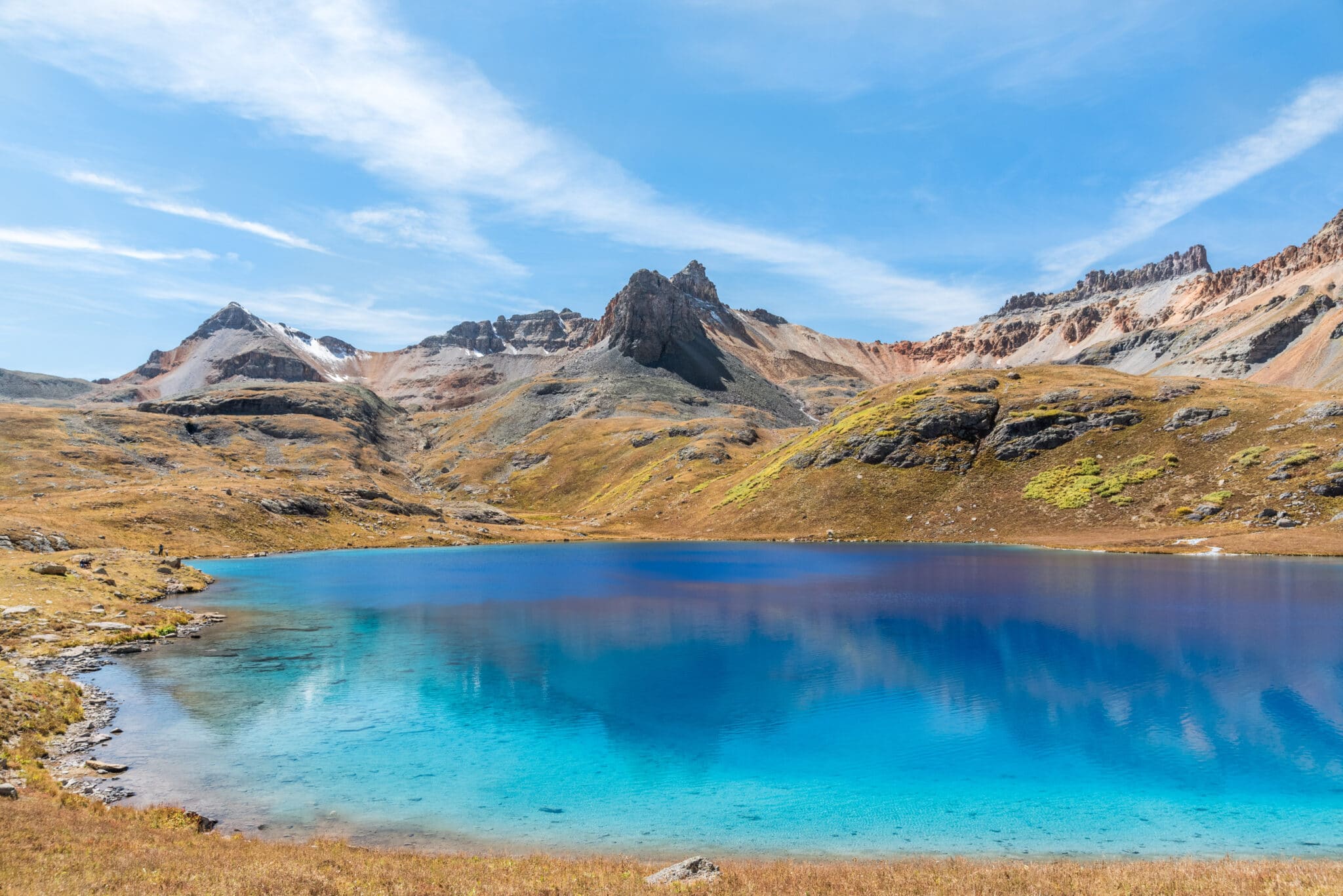
Once you reach the upper ice lake, hikers can walk the around lake for different vantage points and stunning photos. Trekkers can also cast in a line and fish for book and cutthroat trout. Some will dive into the crystal blue waters for a quick dip, which can be quite cold!
In the summer, the basin is typically covered by wildflowers in late July and August. In the fall, autumn-colored tundra covers the landscape. Access in the winter is difficult and not advised.
Directions to trailhead
The trailhead lies at the intersection of Highway 550 and the turnoff to Silverton (Highway 110). Drive two miles north on HWY 550 to County Road 7, turn left here with signs for South Mineral Campground listed. Follow the gravel road for roughly 4.5 miles to the parking lot, across from the campground.
Because this is a very popular trail in the San Juan NF, parking can be crowded. Plan to arrive early. Forest Service advises to not park along the meadow or in the campground parking lot.
If you’re looking for a place to pitch your tent or park your camper, check out the campgrounds around Silverton. There are plenty of options all over the San Juans. And here’s a look at some of the other things to do in Silverton.
Details
Address: 37. -773 806, WA-107, Durango, CO 81301 (much closer to Silverton – 7 miles versus 54 mi)
R64G+P8 Ophir, Colorado
Distance: 3.75 miles one way
Minimum/starting elevation: 9,840 feet
Maximum/ending elevation: 12,260 feet
Note: This tail has felt the effects of overuse, so as always, remember to leave no trace and stick to the designated trail.
Website: fs.usda.gov/recarea/sanjuan/recarea/?recid=42984&actid=50