• Menu
  • Skip to right header navigation
  • Skip to main content
  • Skip to primary sidebar
  • Skip to footer

Uncover Colorado Logo

  • Blog
  • Activities
    • Year-round
      • Brewery Tours
      • Casinos & Gaming
      • Colorado Brands
      • Federal Lands
      • Food & Dining
      • Ghost Towns
      • Gondola & Chairlifts
      • Hot Springs
      • Mine Tours
      • Museums
      • Paintball
      • Public Parks
      • Scenic Drives
      • Shopping
      • Sports Teams
      • State Parks
      • Train Rides
      • Transportation
      • Wildlife
      • Zip Lines & Aerial Parks
    • Spring, Summer & Fall
      • Amusement Parks
      • ATV Rentals
      • Biking
      • Boating
      • Camping
      • Drive-In Theaters
      • Fishing
      • Golf Courses
      • Hiking
      • Horseback Riding
      • Rock Climbing
      • Tubing & Paddling
      • Waterfalls
      • Whitewater Rafting
    • Winter
      • Cross Country Skiing
      • Dog Sledding
      • Ice Climbing
      • Ice Fishing
      • Ice Skating
      • Skiing & Snowboarding
      • Sleigh Rides
      • Snow Tubing
      • Snowmobiling
      • Snowshoeing
  • Events
    • January
    • February
    • March
    • April
    • May
    • June
    • July
    • August
    • September
    • October
    • November
    • December
  • Lodging
    • Budget Hotels
    • Historic Hotels
    • Luxury Hotels
    • Bed & Breakfasts
    • Cabins & Glamping
    • Casinos with Lodging
    • Dude Ranches
    • Hot Spring with Lodging
    • Wineries with Lodging
    • Campgrounds
  • Towns
  • Trip Planner
  • Search
  • Blog
  • Activities
  • Events
  • Lodging
  • Towns
  • Trip Planner
Mount Sherman, CO
Mount Sherman. Photo: Ben Schmitt

Mount Sherman – near Leadville

FacebookTwitter

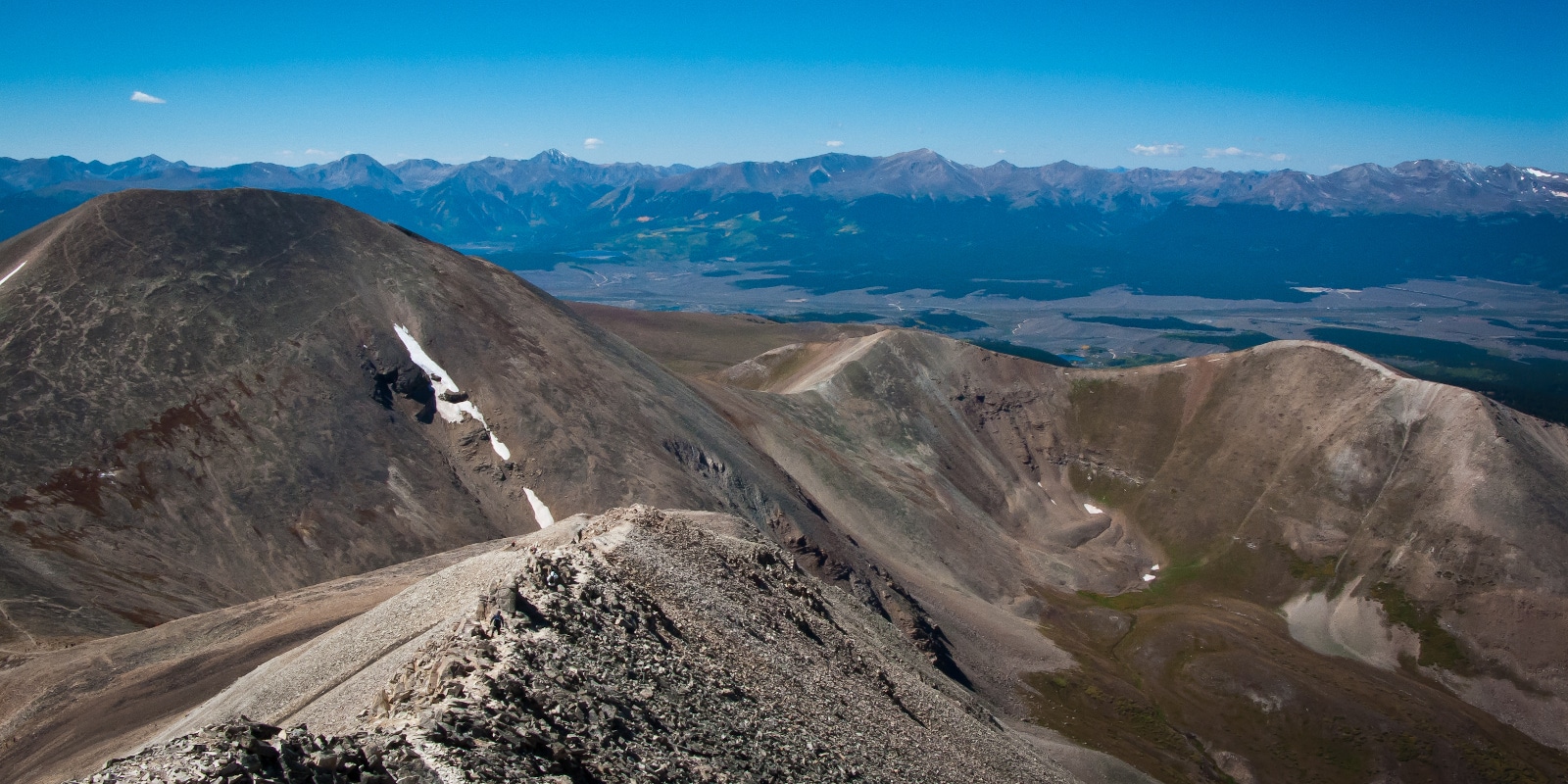
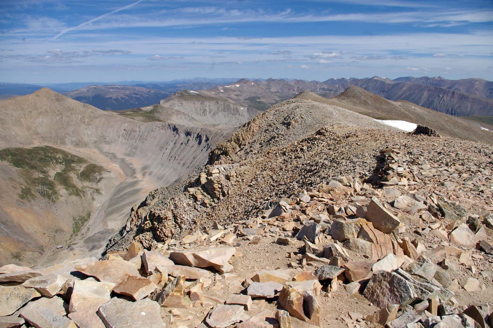
Mt Sherman is a gentle beast among the other 14ers with delicate slopes and is often missed when scanning the horizon for its peak. Reaching an altitude of 14,036 ft, this stunner is an absolute must for testing the waters of peaking 14ers.

Near Leadville, Colorado, it was named in honor of General William Tecumseh Sherman and is located in the Mosquito Range. Between the years of 1968 and 1982, over 10 million ounces of silver had been mined from the Sherman Mine.

Trail Routes

Three trail routes are available in the area, one of which is recommended as snow-only.

The standard route of Southwest Ridge is an 8.5-mile roundtrip if starting at the Leavick site, 5.25-mile roundtrip from the 12,000-foot gate, and 10.5-mile roundtrip from the winter closure starting point. Driving south on U.S. 285, turn right onto County Road 18.

About 8 miles in is the winter closure parking area with the Leavick site roughly 10 miles in. From here the road can be incredibly rough and 4WD vehicles are highly advised. Between Leavick and the 12,000-foot gate are a few pull-offs before reaching the parking area. Expect a 5-6 hour hike.

West Slopes from Iowa Gulch is a 4.5-mile roundtrip. Driving south on U.S. 24, turn left onto Monroe Street, and turn right on Toledo Street. Once reaching the fork, take the left turn which takes you to the Iowa Gulch trailhead.

South Slope is an 8.5-mile roundtrip snow-only route. You can reach this trailhead the same way as the standard Southwest Ridge route.

Activities

Hike up mount Sherman, CO
Hike up mount Sherman. Photo: Miriam

Camping – Along County Road 18, car camping spots are available. Be aware of any private property signs as they are common in the area.

For campgrounds near Fourmile trailhead (standard route), the convenient Horseshoe and Fourmile campgrounds are the best bet. If entering from the Iowa Gulch trailhead, thereโ€™s a campground a few miles west of Leadville at Turquoise Lake.

Read about theย camping near Leadville and Twin Lakes.

Hiking – An out-and-back hike, itโ€™s fairly easy to traverse the well-marked trails. However, the majority of the hike is above treeline and temperatures can drop dramatically.

High wind, lack of water sources, and the possibility of weather change demand hikers come prepared with proper attire such as hats, gloves, and an extra jacket, as well as snacks and plenty of water.

Photography – With gorgeous flora and fauna alongside the ruins of historic buildings, photographers can enjoy capturing the rich mining history of the area or the breathtaking nature around them. The Hilltop Mine showcases a lot of these incredible structures.

Details

Address: Pike National Forest, Lake and Park County, Colorado

Elevation: 14,036 feet (4,278 meters)

Pets: Yes – on leash

Season: Year-round

Primary Sidebar

Join our Colorado travel community

Enter your email below and grab our free locals' guide and monthly what's up designed to help you live your Colorado life and uncover fun things to do. โ€”and never miss out again.

Recent Posts

  • Things to do in February in Colorado
  • 15 Summer County Fairs in Colorado
  • 20 Cool Colorado Winter Activities To Try
  • 5 Reasons to Visit Mesa Verde this Winter
  • The Top Events in Alamosa, Colorado

Footer

Get In Touch

  • Home
  • About Us
  • Contact Us
  • Privacy Policy
  • Resources
  • Disclaimer
Facebook Instagram Pinterest Twitter

Disclosure: Uncover Colorado is a participant in the Amazon Services LLC Associates Program, an affiliate advertising program designed to provide a means for sites to earn advertising fees by advertising and linking to Amazon.com.

Things To Do

  • Travel Blog
  • Colorado Activities
  • Colorado Events
  • Colorado Towns
  • Colorado Hotels
  • Colorado Restaurants
  • Colorado Transportation
  • Made in Colorado

Cheers! Mile High Happy Hour shares showcases Denver neighborhoods' restaurant happy hours.

Winter Activities

  • Federal Lands
  • Ghost Towns
  • Hot Springs
  • Ice Skating
  • Ski Resorts
  • Snow Tubing
  • State Parks
  • Train Rides

Copyright © 2023 ยท Uncover Colorado | Sitemap | Advertise