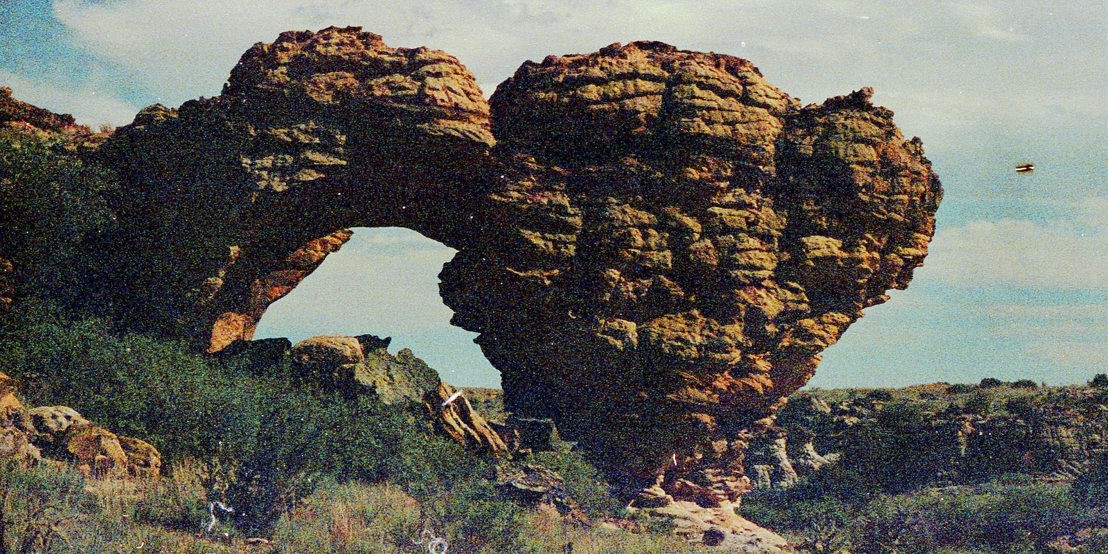
Named for its solar-inspired Plains Indian rock art, Picture Canyon is an open area in the Comanche National Grassland filled with rolling hills, scenic views, and unique rock formations. It’s located just west of Campo, Colorado, approximately 45 minutes south of Springfield.
Picture Canyon is found about one mile north of the Oklahoma border on the great plains of Baca County. The area is 24 hours a day, seven days per week, with seasonal wildflowers in the spring and early summer.
Picture Canyon History
Featured in the 1984 PBS documentary, History on the Rocks, historians estimate that the Picture Canyon area has been inhabited since nearly 10,000 B.C. From the Paleo-Indian era to the Tipi ring period of the 14h century, archaeologists have discovered projectile points, stone tools, charred bones, and rock shelter sites, which can be attributed to several unique cultures dating back over 12,000 years.
Most recently, there is a large set of red and black petroglyphs depicting human and animal figures on the south walls of Picture Canyon that is likely to have been created around the turn of the 18th century. Next to pictures, there are a few lines of writing that have been translated to include information related to the sun, planting, and travel.
About one mile from the parking lot, Crack Cave is the area’s main attraction, which features 1,000-year-old markings about 20 feet deep into the narrow rock crevice. Now protected by a steel and wire gate, the markings are illuminated twice per year, during the sunrise of the spring and fall equinoxes for a short period of time.
Accessibility & How to Get There
The route to Picture Canyon is suitable for most passenger vehicles, but motorists should be prepared to drive on bumpy dirt and gravel roads. To get there, navigate to Highway 375 between Campo and Springfield, then head west onto Baca County Road M for 8 miles.
From County Road M, turn left to go south on County Road 18 and continue for another 8 miles, then make a right at the sign and keep driving. The parking lot will be straight ahead in 2 miles. Vehicles are permitted to park in designated areas only and there is a bathroom and several picnic tables onsite.
Picture canyon is generally uncrowded, barring the equinox celebrations, and the facilities managed by the USDA Forest Service are very limited. There is no potable water available at Picture Canyon, and the area is occasionally subject to heavy afternoon winds.
Activities near Picture Canyon
Out on the open plains, the Picture Canyon area is great for both stargazing and enjoying the unique landscape, rock formations, and local history throughout the day. The area is dog and family-friendly, but visitors should be cautious of potential rattlesnakes and other dangerous wildlife encounters.
Archaeology: Picture Canyon visitors are free to conduct self-guided tours of the area’s archaeological sites, with helpful information posted near the parking lot. To learn more about the human history of Picture Canyon, both the US Forest Service and private tour operators offer immersive, educational expeditions for small groups. During equinox celebrations, reservations must be made in advance.
Birding: Throughout the grasslands, woodlands, cliffs, and springs, Picture Canyon is a tremendous birding area. Birdwatchers have the opportunity to spot dozens of unique species including the Bullock’s oriole, the Eastern Phoebe, Scaled quail, eagles, burrowing owls, towhees, wrens, sparrows, woodpecker, and grosbeaks.
Camping: Near the parking lot, free dispersed overnight camping is permitted in Picture Canyon, with many obvious sites already established around the area. Campers may only use existing fire rings and park in designated areas, with first-come, first-serve availability for all spots.
Read about the camping near La Junta and Lamar.
Hiking, biking, and horseback riding: The most popular trail in Picture Canyon is the Arch Rock Trail, which is a 4.2-mile loop named after a unique land formation also known as the “Wisdom Tooth.” For a bit more of an adventure, hikers, mountain bikers, and horseback riders can connect the Arch Rock, Homestead, and Outlaw Trails for a full 13-mile round trip with about 900 feet of elevation gain.
With lots of sun exposure and well-maintained trails, the 13-mile loop is considered moderately difficult, and visitors will enjoy a mix of gentle sandstone canyons and open grasslands with seasonal streams abundant early in the year.
Hunting: Although it is located in the Comanche National Grassland, shooting is off-limits in Picture Canyon.
Picnicking: Near the parking lot at Picture Canyon, there is a vault toilet and picnic area with tables and BBQ grills that are free for visitors to use. Tables cannot be reserved in advance and picnickers must bring their own water and pack out all of their trash.
Wildlife viewing: Due to its remote location, wildlife encounters are very likely while hiking near Picture Canyon. In addition to possible cow grazing in the area, visitors should stay on the lookout for rattlesnakes, foxes, turtles, pronghorn, badgers, salamanders, lizards, and other wildlife.
Details
Address: Picture Canyon, Comanche National Grasslands, Campo, CO 81029
Coordinates: 37°00’42.9″N 102°44’42.9″W
County: Baca County
Phone: 719-523-6591 (Forest Service in Springfield, CO)
Season: Year-round
Hours: 24/7
Fees: None

