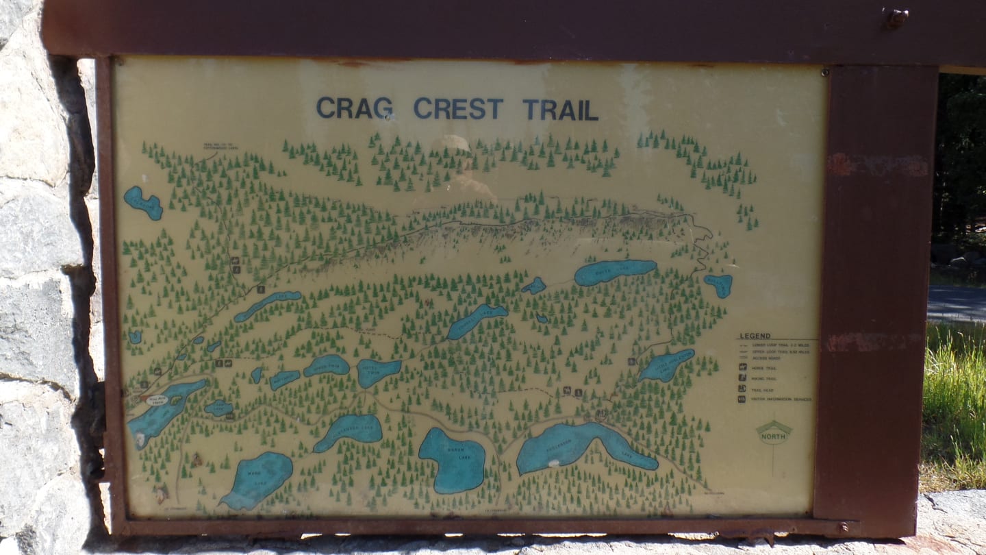
Resting on top of the mesa is an amazing natural marvel, the Crag Crest Trail. It’s among the highest points and one of the nineteen beautiful trails that traverse Grand Mesa.
Grand Mesa National Forest or “The Mesa” as it is called by the Coloradans, is a wonder! It’s the largest flat-top mountain in the world with an area of 500 square miles.
Hiking, Biking, and Horseback Riding
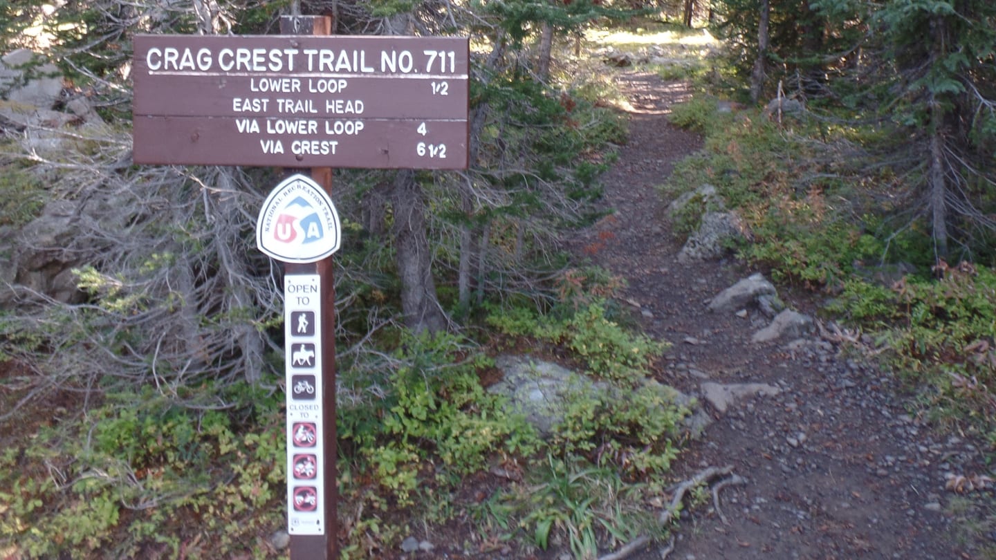
Crag Crest Trail, located by Highway 65 north of Cedaredge, is a strenuous 11-mile backcountry loop-type trail. It was designated as a National Recreation Trail in 1978.
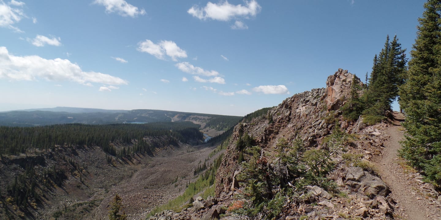
It’s a distinguished trail with an eye-catching panoramic landscape of the great Book and Roan Cliffs and West Elk and the San Juan Mountains. No doubt it is heavily trafficked and visited by people from across the world, especially during the months of March to September.
Crag Crest National Recreation Trail can be hiked in a loop in two ways, starting from the east trailhead at the Crag Crest Campground next to the Eggleston Lake or from the west, located near marker mile 27 across Island Lake. Both trailheads will eventually lead to the lower part of the trail (loop trail).
For a shorter hike, it can be done one-way either from the upper (6.6 miles) or lower trail (3.4 miles).
Note that biking and horseback riding is allowed only on the lower loop trail or the upper part of the trail from the west trailhead to the center of the ridge ONLY.
Trail Route
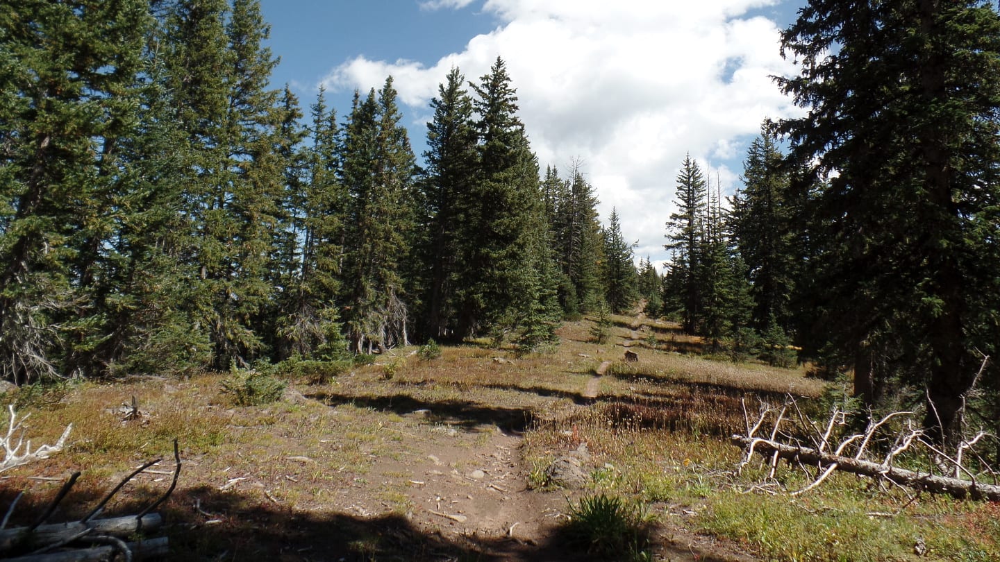
Let’s walk through this acclaimed site using Crag Crest West Trail. From the trailhead, follow the Crag Crest Trail signage for half a mile with a steady and gradual climb up to the Crest Trail and the lower loop junction. Turn left to head to the Crag Crest Loop and Cottonwood Lakes Trail and continue for another half a mile.
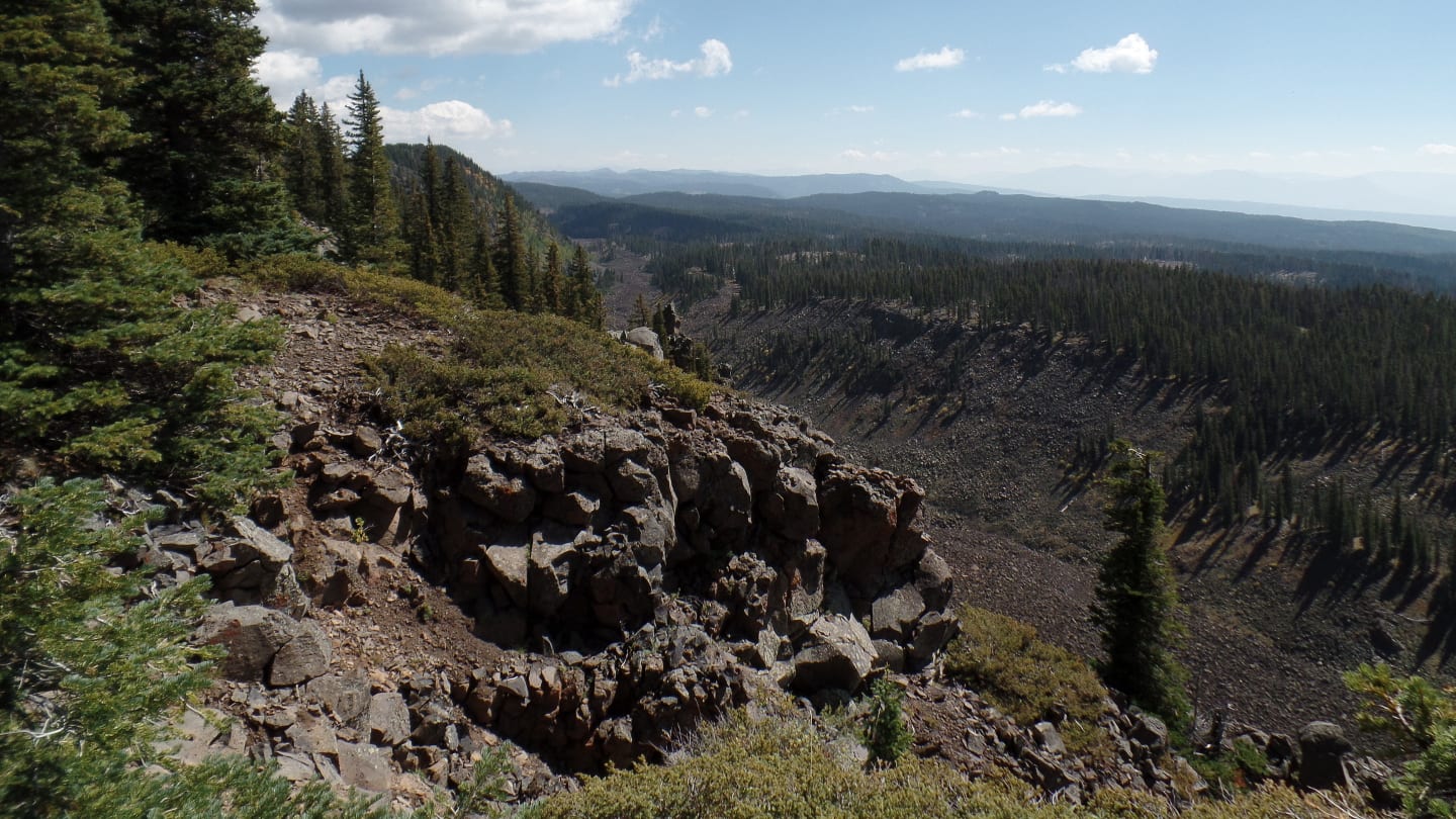
Up a mile ahead, the slope will be more steep continuing to the Cottonwood Lakes Trail junction. Approaching the ridge will require more effort because of the elevation but you’ll be rewarded by the scenic view of multiple mountains that cover the horizon.
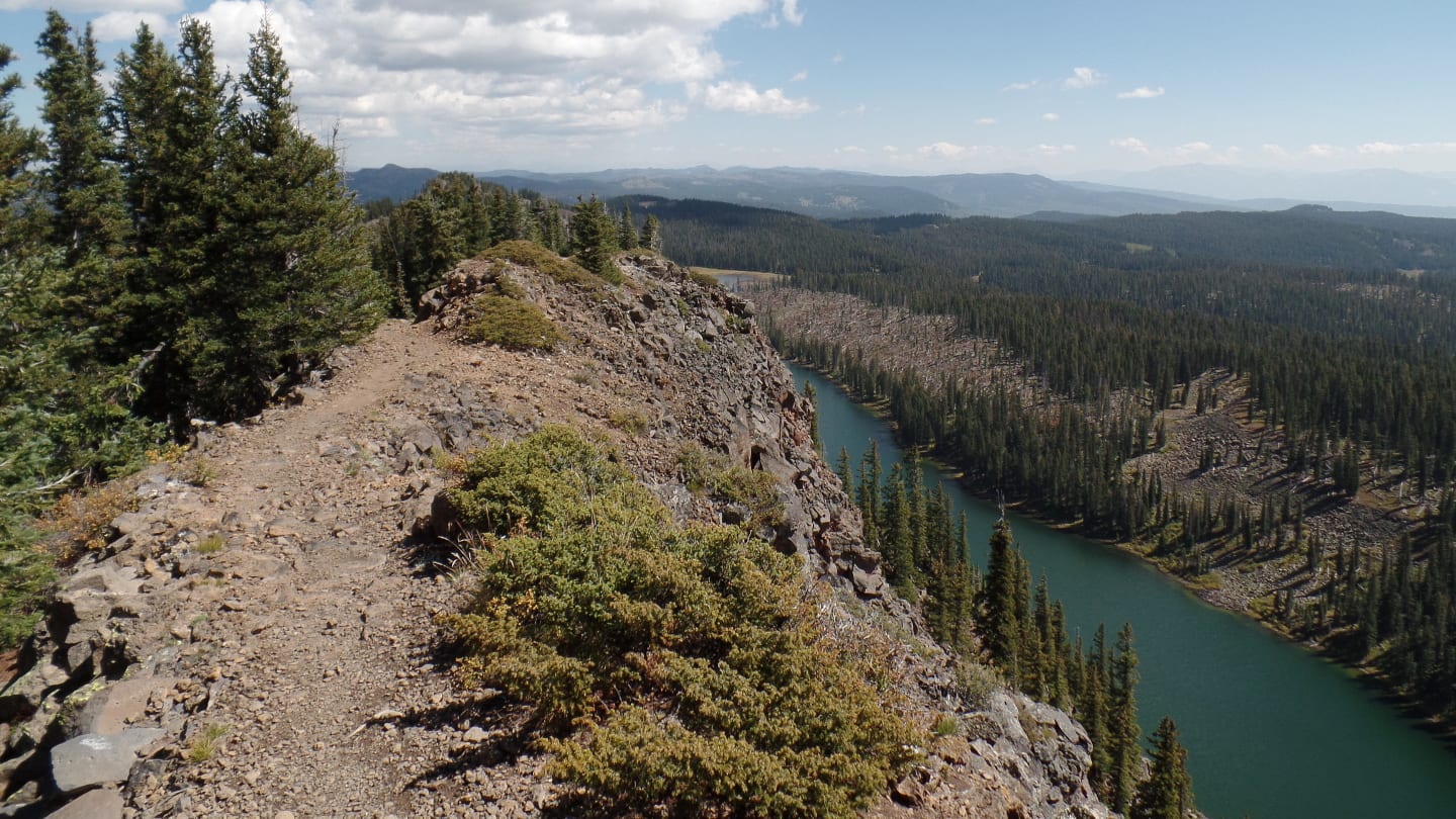
Hiking the ridge is outstanding! Hundreds of feet from the ground, you will see the majesty of Colorado’s prized skyline. Hiking the ridge will last for 3 miles. There will be narrow areas and steep drop-offs, so be extra careful.
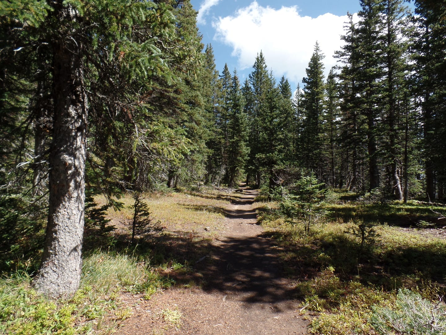
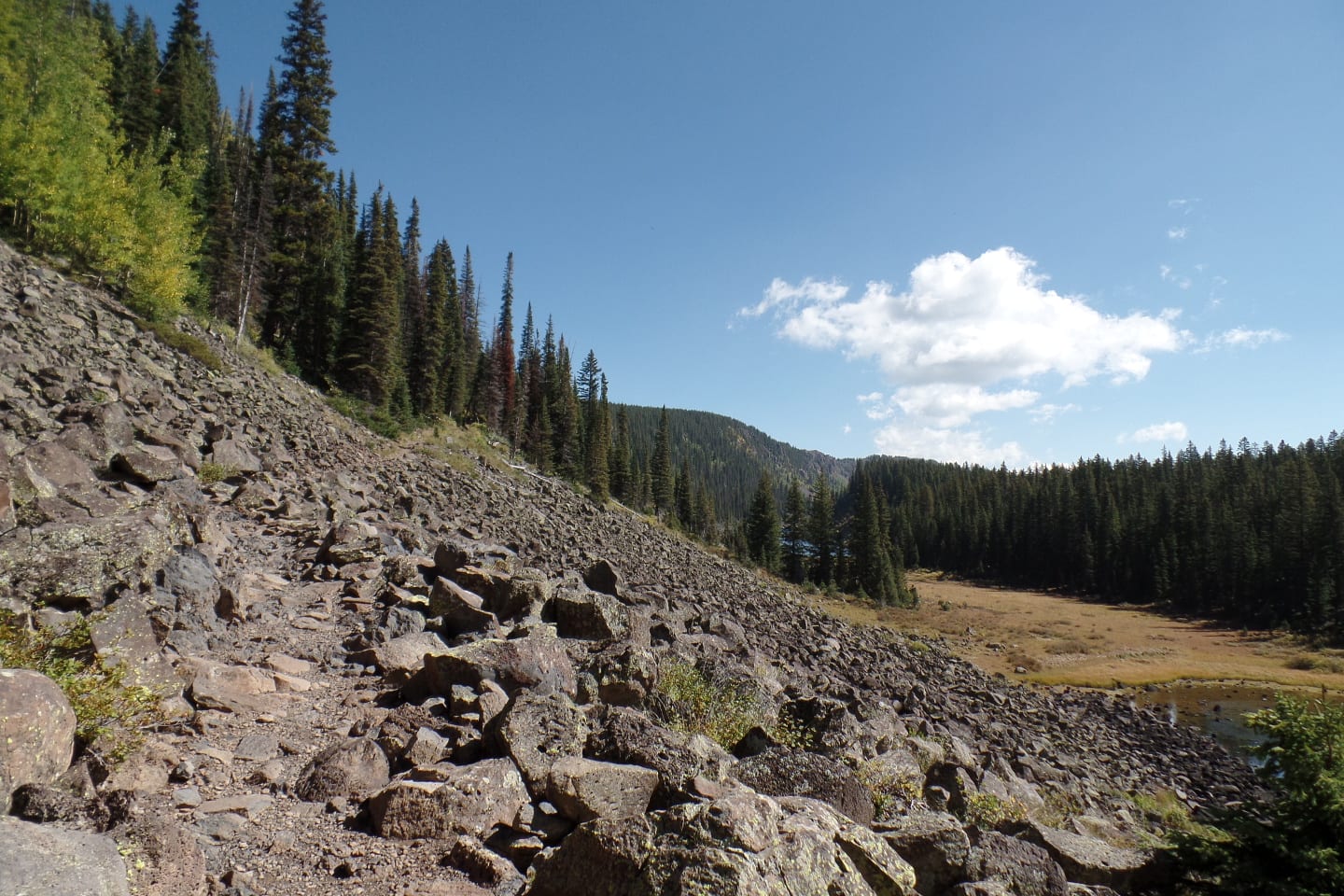
From the end of the ridge, the trail will go on descent for two miles to the Lower Trail junction. Revel at the chance of going downhill to regain your energy because once you arrive at the lower trail, you’ll hike up again to the east trailhead. Expect going across pine forests and open hillsides with pretty wildflowers up ahead.
Up ahead, turn right at the Visitor Center Trail junction and continue traversing the trail until the east trailhead- the end of the hike. The whole hike takes 6 hrs. and 45 mins. depending on your skill and pace.
It should be mentioned that motorized vehicles are prohibited and dogs must be kept on a leash. Also, we suggest you start early to avoid thunderstorms and mosquitos, so don’t forget to apply an insect repellant. Finally, bring plenty of water and enjoy your hike!
Getting There
From Cedaredge, drive on Highway 65 and travel 15.7 miles north to the Island Lake Campground. The trailhead for Crag Crest Trail is found here. Now prep for an all-day nearly 7-hour hike!
Details
Address: Cedaredge, CO
Season: June – October is best
Length: 10.3 miles (loop)
Time: ~6 hours 45 minutes
Website: fs.usda.gov/