• Menu
  • Skip to right header navigation
  • Skip to main content
  • Skip to primary sidebar
  • Skip to footer

Uncover Colorado Logo

  • Blog
  • Activities
  • Events
  • Towns
  • Lodging
  • Dining
  • Transport
  • Shop
  • Search
  • Blog
  • Activities
  • Events
  • Towns
  • Lodging
  • Dining
  • Transport
  • Shop
  • Search
Raton Pass Colorado Summit I-25
Summit of Raton Pass, looking north into Colorado. Photo: Jeffrey Beall

Raton Pass – Trinidad-Raton

FacebookTwitter

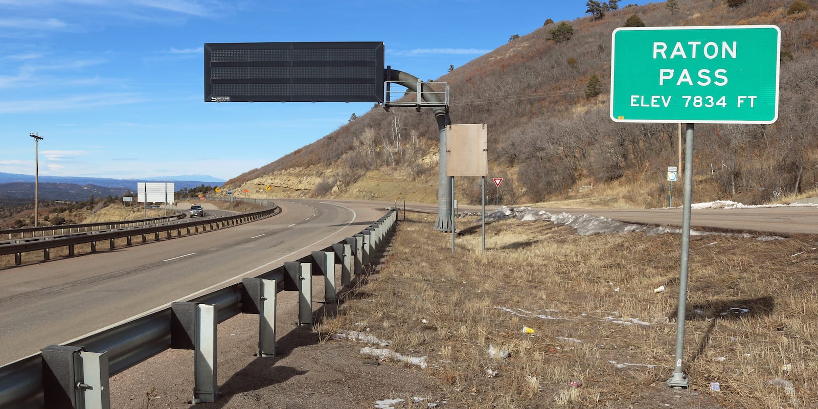
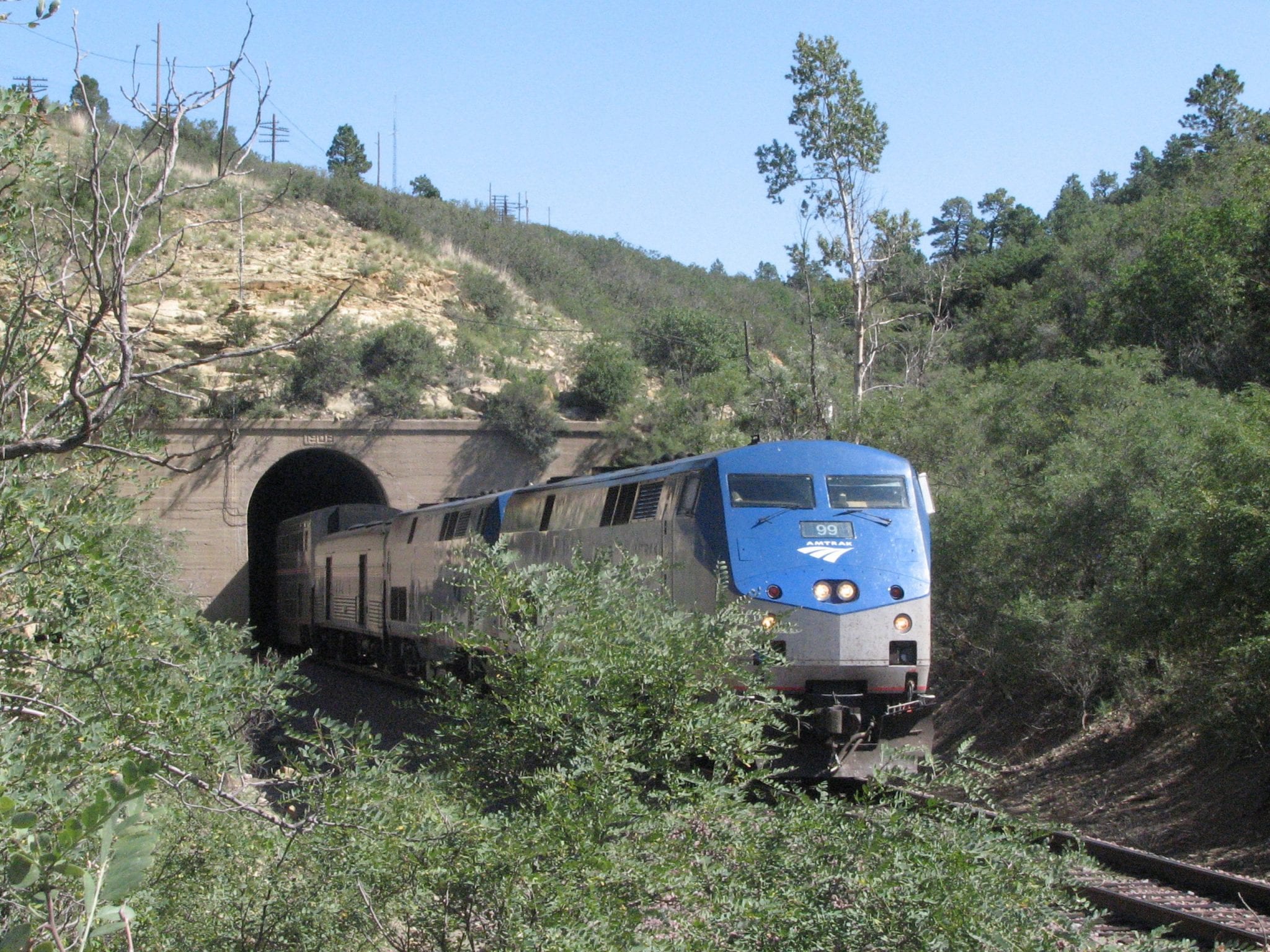
Raton Pass is a National Historic Landmark and the highest elevation point along the Santa Fe Trail, located on the state border between Trinidad, Colorado and Raton, New Mexico. The pass sits at 7,834 ft (2,388 m) and can be reached via Interstate 25 or by railroad on the Amtrak Southwest Chief passenger train.

History of Raton Pass

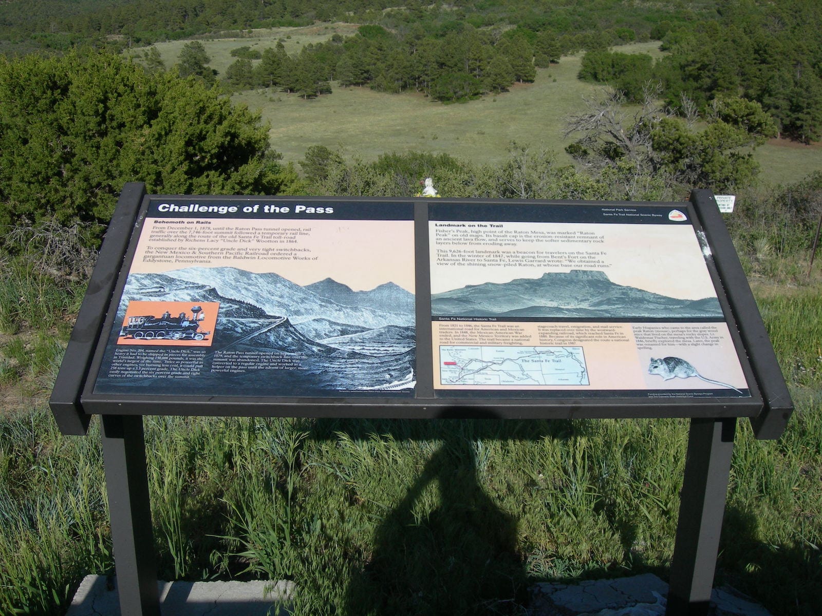
In the early 19th century, the Santa Fe Trail was used by pioneers traveling between Santa Fe, New Mexico and Franklin, Missouri. East of Santa Fe, travelers could take either the Cimarron Route or the Mountain Route, which traversed Raton Pass en route to Bent’s Old Fort National Historic Site. The route was also used by Stephen W. Kearny to bring troops to New Mexico during the Mexican-American War.

Raton Pass Tunnel Santa Fe Trail
Raton Tunnel on the Santa Fe Trail. Photo: Peetlesnumber1

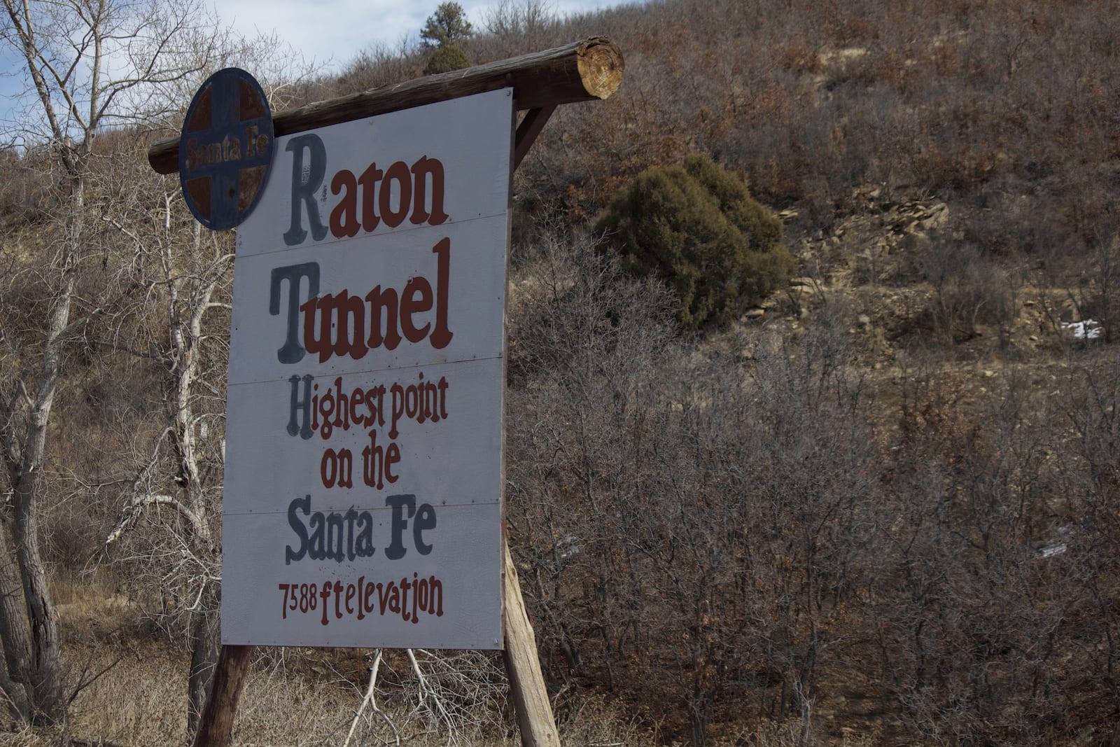
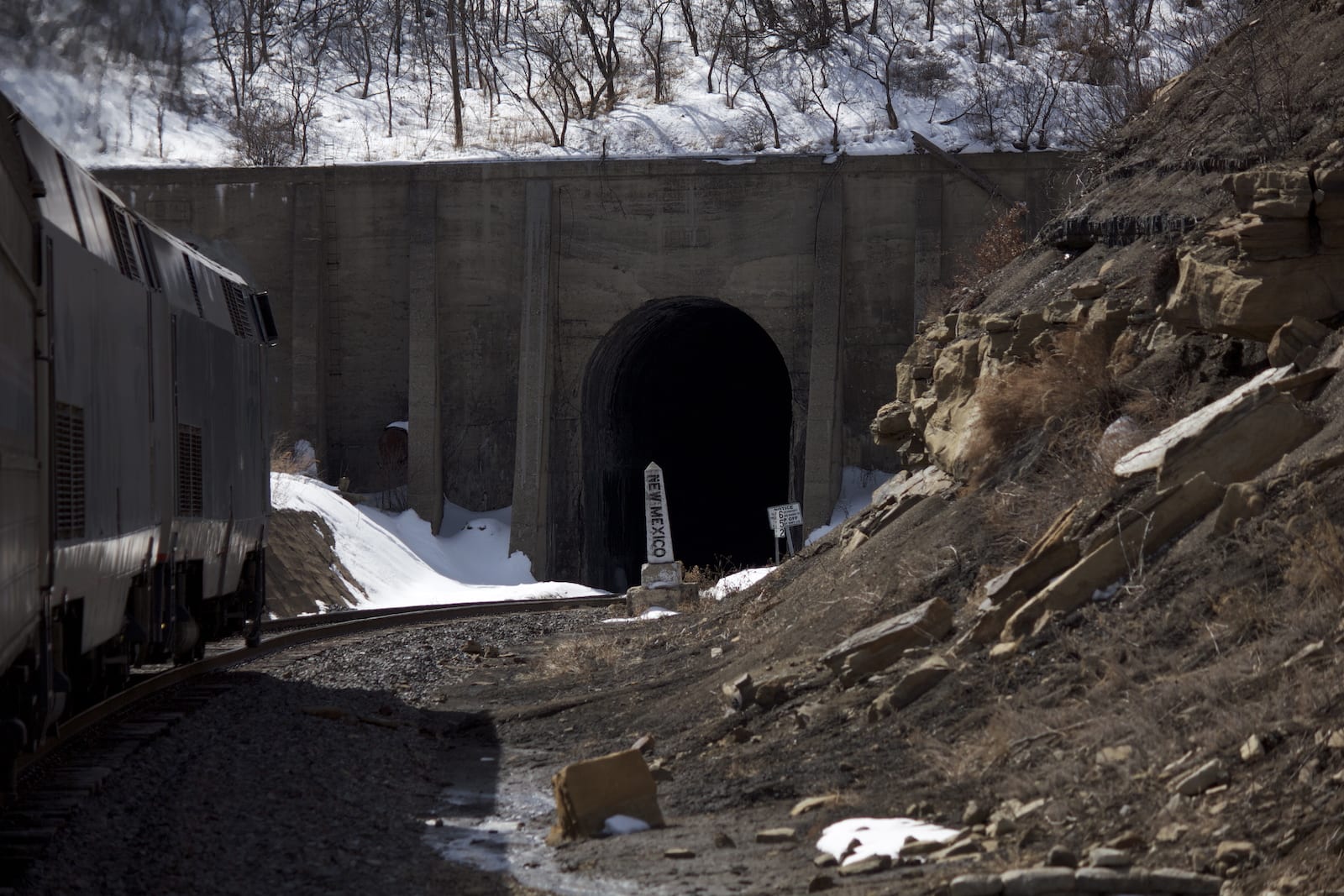
In the second half of the 19th century, the Atchison, Topeka and Santa Fe Railway established a railroad route over Raton Pass. The railway was a large point of contention in a business rivalry with the Denver and Rio Grande Railroad. In 1996, the route was adopted by the BNSF Railway Company.

Raton Pass has been referenced in many southwest American pieces of music, art, and film. Notably, ascents over the pass (and trouble with possible snowstorms) have been recounted by Townes Van Zandt, C.W. McCall, & Clint Black.

Raton Pass Historic Sign I-25 Colorado
Historic sign on Colorado side of Raton Pass. Photo: Jimmy Emerson, DVM

The Raton Range of the eastern Sangre de Cristo Mountains shares the namesake with the pass, nearby
basin, and Mexican town. The word “raton” translates to “mouse” from Spanish, as the nearby mountain range was said to have been infested with rodents, some of which carried the bubonic plague.

Raton Pass Accessibility

Raton Pass Amtrak Train Westbound Southwest Chief
Westbound on Amtrak’s Southwest Chief on Raton Pass. Photo: Hinge of fate

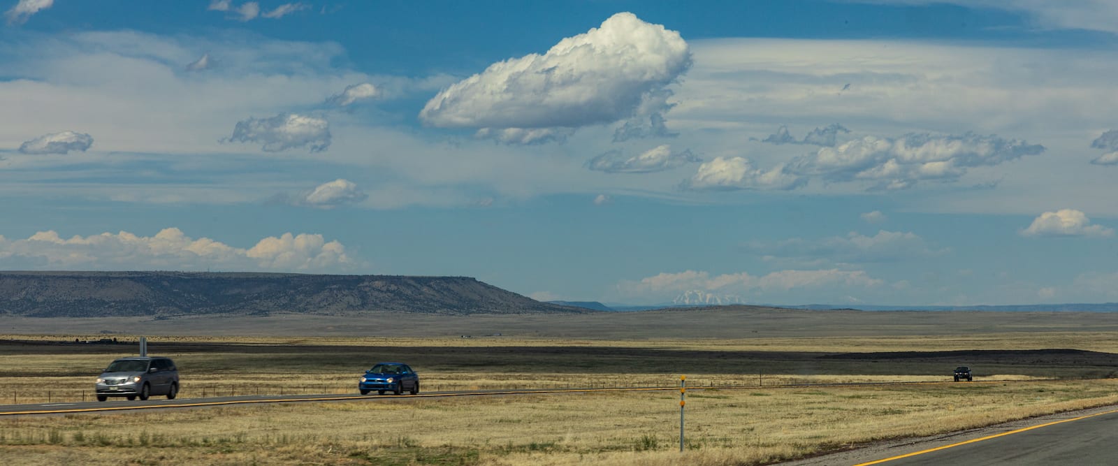
Raton Pass is easily accessible along the paved Interstate 25 (US-85 / US-87) between New Mexico and Colorado. The route is well maintained and has a maximum grade of 6%. In good conditions, Raton Pass is relatively easy to traverse. There is an area to pull off and safely park at the “Welcome to Colorful Colorado” sign.

You can also board the Amtrak train at the depot in Trinidad, and ride that all the way to Los Angeles if you wanted.

Raton Pass Tunnel Amtrak Train
Amtrak train and tunnel on Raton Pass. Photo: Peetlesnumber1

Seasonality – In general, Raton Pass can be traversed all year round. However, it may become subject to close in dangerous winter weather conditions.

Vehicle Restrictions – There are no restrictions on vehicles along I-25 to reach Raton Pass. However, the area is subject to fast moving winter storms. Vehicles should be prepared and proceed with caution in unfavorable weather conditions.

Activities near Raton Pass

Raton Pass Colorado Autumn Scenery
Autumn scenery on Raton Pass. Photo: Scrubhiker

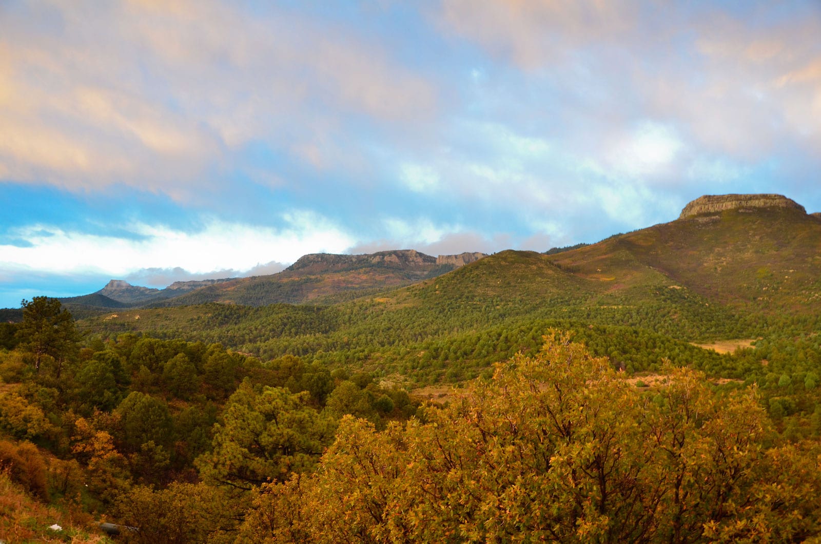
Raton Pass sits along the eastern side of the Sangre De Cristo Mountains, which provide astounding views and ample outdoor opportunities in southern Colorado and northern New Mexico.

The pass is roughly halfway between Trinidad, CO and Raton, NM. Each town has shops, restaurants, and accommodations. Most commonly, travelers can hike, camp, boat, and fish in either Sugarite Canyon State Park (NM) or Trinidad Lake State Park (CO).

Raton Pass Border Between Colorado and New Mexico I-25
Raton Pass border between Colorado and New Mexico. Photo: Simon Foot

Details

Address: CanAm Hwy, Trinidad, CO 81082 / Raton, NM 87740

Season: Year round

Elevation: 7,834 ft (2,388 m)

County: Las Animas County (Colorado) & Colfax County (New Mexico)

Mountain Range: Sangre de Cristo Mountains

Coordinates: 36°59′28″N 104°29′12″W

Access: Paved Highway I-25 (US 85 & US 87) or via Railroad

Primary Sidebar

Join our Colorado travel community

Enter your email below and grab our free locals' guide and monthly what's up designed to help you live your Colorado life and uncover fun things to do. —and never miss out again.

Colorado Mountain Passes

  • All Activities
  • All Scenic Drives
  • Argentine Pass
  • Berthoud Pass
  • Boreas Pass
  • Buffalo Pass
  • Cameron Pass
  • Cinnamon Pass
  • Coal Bank Pass
  • Cochetopa Pass
  • Cordova Pass
  • Cottonwood Pass
  • Cuchara Pass
  • Cumberland Pass
  • Dallas Divide
  • Dunckley Pass
  • Engineer Pass
  • Fall River Pass
  • Georgia Pass
  • Guanella Pass
  • Hagerman Pass
  • Hermit Pass
  • Hoosier Pass
  • Iceberg Pass
  • Independence Pass
  • Jones Pass
  • Kebler Pass
  • Kenosha Pass
  • La Poudre Pass
  • La Veta Pass
  • Loveland Pass
  • Marshall Pass
  • McClure Pass
  • Milner Pass
  • Molas Pass
  • Monarch Pass
  • Mosquito Pass
  • Muddy Pass
  • North Pass
  • Ophir Pass
  • Poncha Pass
  • Rabbit Ears Pass
  • Raton Pass
  • Red Cone Pass
  • Red Mountain Pass
  • Rollins Pass
  • Schofield Pass
  • Shrine Pass
  • Slumgullion Pass
  • Spring Creek Pass
  • Squaw Pass
  • Stony Pass
  • Tennessee Pass
  • Tincup Pass
  • Ute Pass
  • Vail Pass
  • Waunita Pass
  • Webster Pass
  • Weston Pass
  • Wilkerson Pass
  • Wolf Creek Pass

Footer

Get In Touch

  • Home
  • About Us
  • Write For Us
  • Advertise
  • Contact Us
  • Resources
Facebook Instagram Pinterest Twitter

Disclosure: Uncover Colorado is a participant in the Amazon Services LLC Associates Program, an affiliate advertising program designed to provide a means for sites to earn advertising fees by advertising and linking to Amazon.com.

Things To Do

  • Travel Blog
  • Colorado Activities
  • Colorado Events
  • Colorado Towns
  • Colorado Hotels
  • Colorado Restaurants
  • Colorado Transportation
  • Made in Colorado

Visit Mile High Happy Hour for Denver neighborhoods' restaurant happy hours.

Winter Activities

  • Camping
  • Cross Country Skiing
  • Federal Lands
  • Hot Springs
  • Ice Skating
  • Skiing and Snowboarding
  • Snow Tubing
  • State Parks

Vacation like a VIP! Leisurely Lifestyle shares life and travel hacks, as well as cheap luxury travel.

Copyright © 2021 · Uncover Colorado - Vacations, Travel & Tourism | Sitemap | Privacy Policy | Disclaimer