• Menu
  • Skip to right header navigation
  • Skip to main content
  • Skip to primary sidebar
  • Skip to footer

Uncover Colorado Logo

  • Blog
  • Activities
    • Year-round
      • Brewery Tours
      • Casinos & Gaming
      • Caves
      • Colorado Brands
      • Escape Rooms
      • Federal Lands
      • Food & Dining
      • Ghost Towns
      • Gondola & Chairlifts
      • Hot Springs
      • Lakes
      • Landmarks
      • Mine Tours
      • Mountains
      • Museums
      • Paintball
      • Performing Arts
      • Public Parks
      • Rivers
      • Scenic Drives
      • Sightseeing Tours
      • Shopping
      • Sports Teams
      • State Parks
      • Train Rides
      • Transportation
      • Winery Tours
      • Wildlife
      • Zip Lines & Aerial Parks
    • Spring, Summer & Fall
      • Amusement Parks
      • ATV Rentals
      • Biking
      • Boating
      • Camping
      • Drive-In Theaters
      • Fishing
      • Golf Courses
      • Hiking
      • Horseback Riding
      • Jeep Rentals
      • Rock Climbing
      • Tubing & Paddling
      • Waterfalls
      • Whitewater Rafting
    • Winter
      • Cross Country Skiing
      • Dog Sledding
      • Ice Climbing
      • Ice Fishing
      • Ice Skating
      • Skiing & Snowboarding
      • Sleigh Rides
      • Snow Tubing
      • Snowbiking
      • Snowmobiling
      • Snowshoeing
  • Events
    • January
    • February
    • March
    • April
    • May
    • June
    • July
    • August
    • September
    • October
    • November
    • December
  • Lodging
    • Budget Hotels
    • Historic Hotels
    • Luxury Hotels
    • Bed & Breakfasts
    • Boutique Hotels
    • Cabins & Glamping
    • Casinos w/ Lodging
    • Hot Spring w/ Lodging
    • Wineries w/ Lodging
    • Best Hotels
    • Dude Ranches
    • Campgrounds
  • Towns
  • Trip Planner
  • Search
  • Blog
  • Activities
  • Events
  • Lodging
  • Towns
  • Trip Planner
Cuchara Pass, CO
Cuchara Pass, CO. Photo: Cuchara Pass, CO. Photo: Kent Kanouse

Cuchara Pass – Cuchara-Monument Park

FacebookTwitter

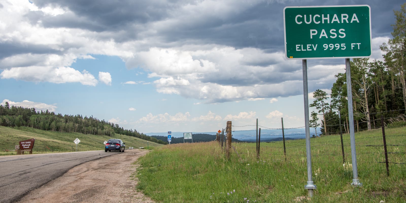
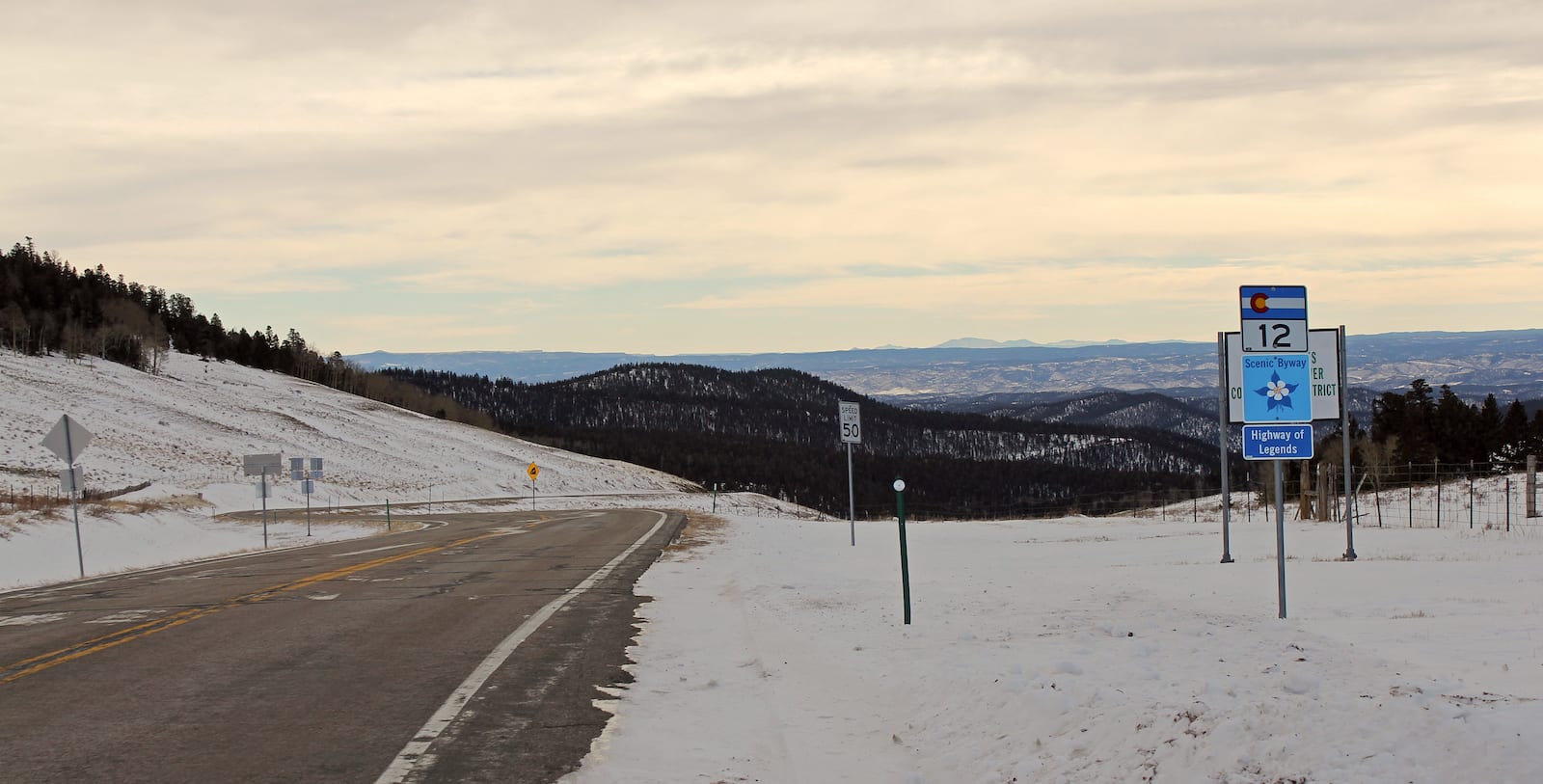
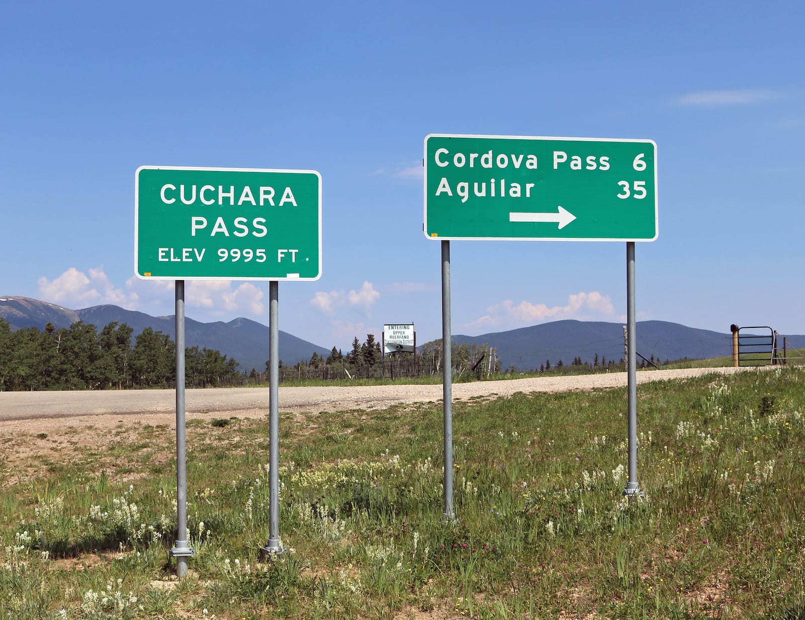
On Colorado’s Highway of Legends National Scenic Byway, Cuchara Pass reaches nearly 10,000’ in the Sangre de Cristo Mountains. It can be traversed along State Highway 12, about 33 miles southwest of Walensburg, Colorado.

History

Cuchara Pass, CO
Cuchara Pass, CO. Photo: Jeffrey Beall

Cuchara Pass, and the nearby town of Cuchara, Colorado get their name from the Spanish word “cuchara” meaning “spoon.” The region’s valley is said to imitate the shape of a spoon.

The earliest known use of Cuchara Pass is by Spanish settlers heading south to Stonewall, Colorado. In the late 1800’s the area became heavily infiltrated with international prospectors searching for gold. The population and use of the pass continued to grow steadily into the next century when coal was found in the area.

The section of State Highway 12 ,which provides access to Cuchara Pass was designated as a National Forest Byway in 1988.

Cuchara Pass Accessibility

Cuchara Pass, CO
Cuchara Pass, CO. Photo: Jeffrey Beall

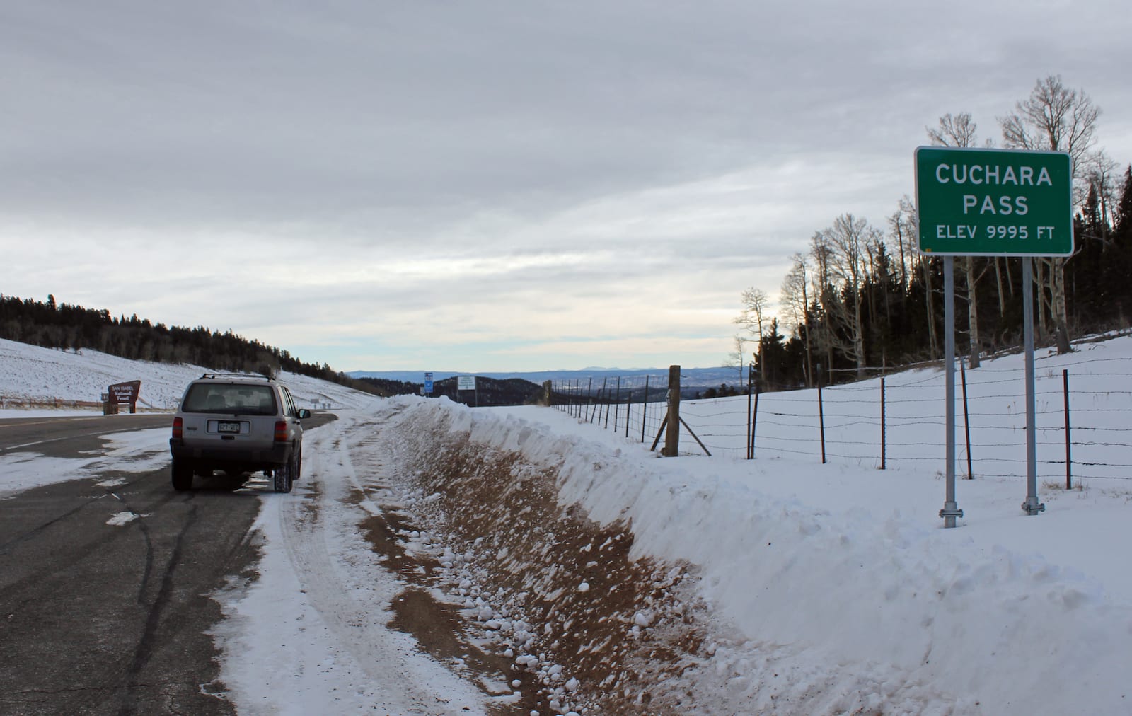
Cuchara Pass is traversed via State Highway 12, a paved road without excessive switchbacks or steep grades. Most passenger vehicles can easily traverse Cuchara Pass. At the summit, there is room for cars to pull off and take in the views. Otherwise, you can turn onto Forest Road 415 and travel a half of a mile to the John B. Farley Wildflower Overlook.

Seasonality – In general, SH 12 remains open year round and is well maintained in all seasons.

Vehicle Restrictions – There are no restrictions on vehicles traveling over Cuchara Pass. However, motorists should be aware of Colorado traction and chain laws and prepared for inclement weather.

Activities near Cuchara Pass

The Highway of Legends Byway is an incredible journey through beautiful bits of wilderness and human history. Cuchara Pass sits 6 miles south of the small mountain town of Cuchara, CO. Outside of town, there is the Cuchara Mountain Park, a designated backcountry ski area.

Surrounding the pass, there are many opportunities to hike or camp in the San Isabel National Forest.

Cuchara Pass, CO
Cuchara Pass sign, CO. Photo: Jeffrey Beall

Details

Address: SH 12, between Cuchara and Monument Park, CO

Season: Year Round

Elevation: 9,938 ft (3,029 m)

County: Huerfano County / Las Animas County

Mountain Range: Sangre de Cristo Mountains

Coordinates: 37°19′13″N 105°04′25″W

Access: State Highway 12

Primary Sidebar

Join our Colorado travel community

Enter your email below and grab our free locals' guide and monthly what's up designed to help you live your Colorado life and uncover fun things to do. —and never miss out again.

Recent Posts

  • Things to do in June in Colorado
  • Things to do in May in Colorado
  • Top Beer Festivals in Colorado in 2023
  • Colorado’s Top Wine Festivals in 2023
  • 8 Great Springtime Colorado Festivals

Footer

Get In Touch

  • Home
  • About Us
  • Contact Us
  • Privacy Policy
  • Resources
  • Disclaimer
Facebook Instagram Pinterest Twitter

Disclosure: Uncover Colorado is a participant in the Amazon Services LLC Associates Program, an affiliate advertising program designed to provide a means for sites to earn advertising fees by advertising and linking to Amazon.com.

Things To Do

  • Travel Blog
  • Colorado Activities
  • Colorado Events
  • Colorado Towns
  • Colorado Hotels
  • Colorado Restaurants
  • Colorado Transportation
  • Made in Colorado

Cheers! Mile High Happy Hour shares showcases Denver neighborhoods' restaurant happy hours.

Spring Activities

  • Amusement Parks
  • Federal Lands
  • Ghost Towns
  • Hot Springs
  • Ski Resorts
  • State Parks
  • Train Rides
  • Waterfalls

Copyright © 2023 · Uncover Colorado | Sitemap | Advertise