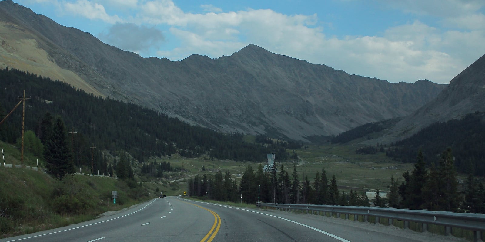
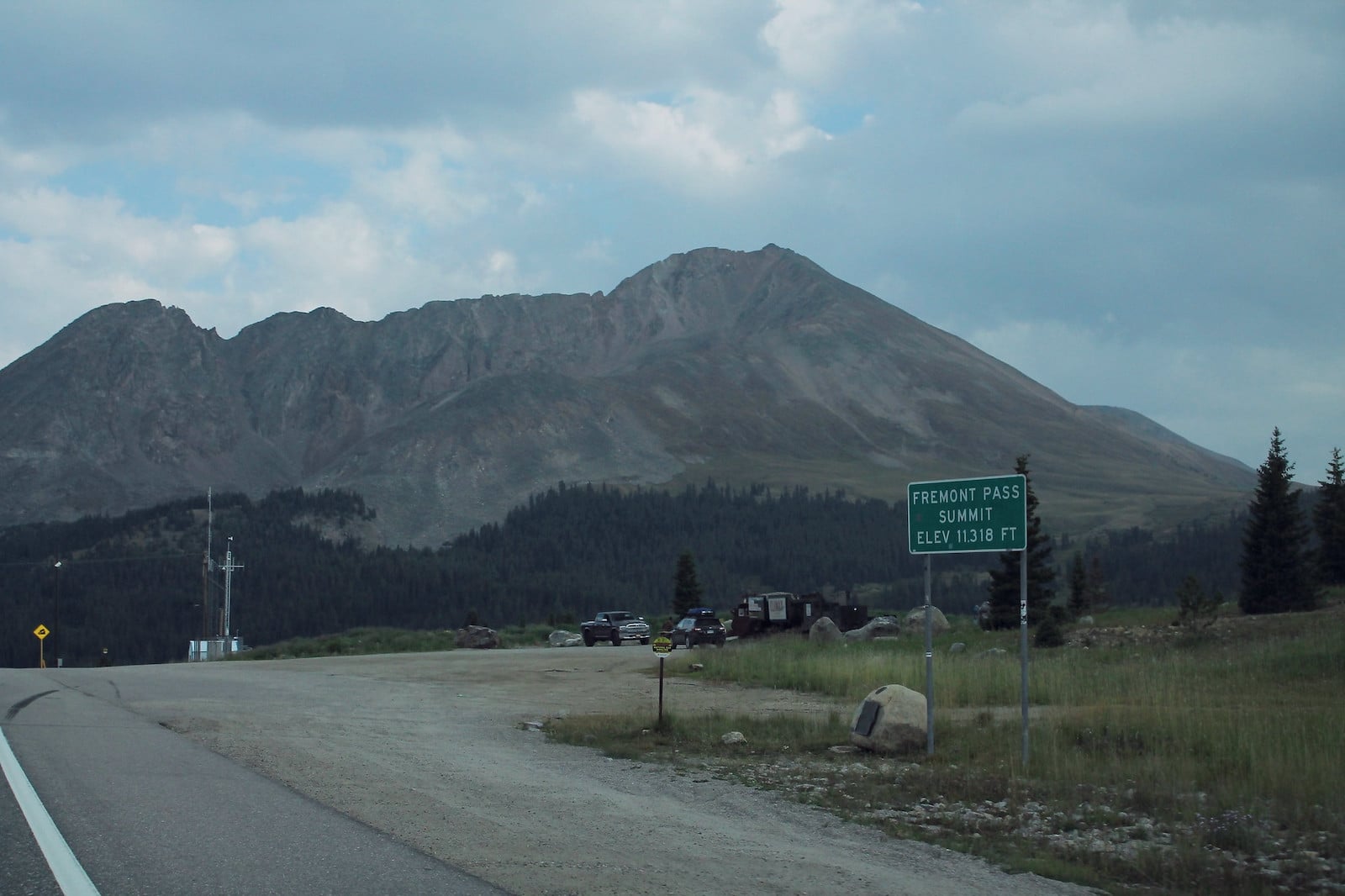
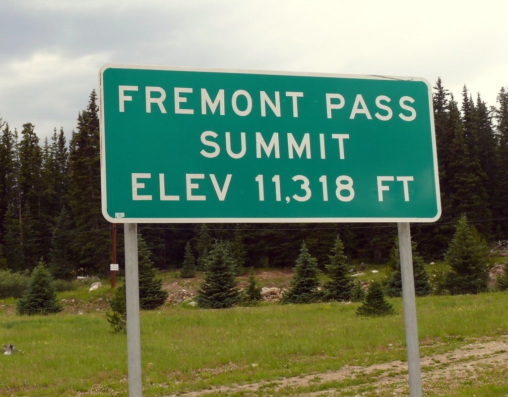
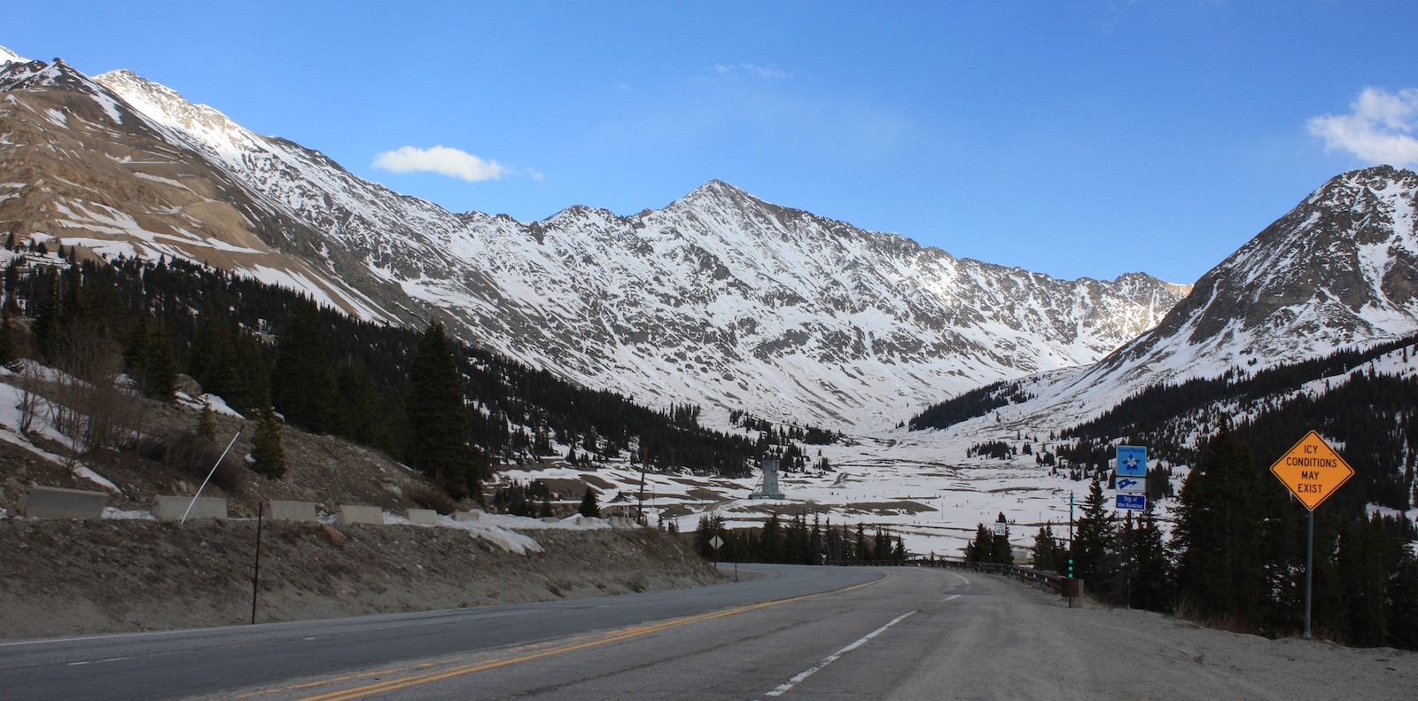
Fremont Pass is one of the highest, most scenic roads in Colorado, and is named after famed American west explorer John C. Frémont. With an elevation of 11,319 feet, this route winds high up along the Continental divide separating the Summit and Lake counties.
It connects the upper valley of the Blue River to the headwaters of the Arkansas River to the south, as well as the towns of Copper Mountain and Leadville. Paved, hugely scenic, and surprisingly straight for being such an elevated road, Fremont Pass is a solid option for casual drivers seeking to take in some spectacular mountain views.
This famous Colorado route is located along the Top of the Rockies Byway, which connects Aspen, Minturn, Leadville, and Copper Mountain.
History
Explorer John C. Frémont is credited for being the first person of European descent to discover the Fremont Pass. Frémont visited the pass during his travels in pre-statehood Colorado in the 1840s.
In 1889, the Denver, South Park & Pacific Railroad built a narrow gauge railway over the pass, which changed hands shortly after to a new owner and ceased operations in 1937.
Accessibility
This pass is paved, mostly straight, and steep only in one section. It’s open year-round, save for closings due to significant weather events. Conventional vehicles will have no problem on Fremont Pass. It’s found within the San Isabel National Forest.
Fremont Pass, which travels along CO-91, is 21.7 miles long and reaches a peak elevation of 11,318 feet. The south entrance can be accessed just north of the town of Leadville and the north section is located off of I-70 east of Copper Mountain.
Nearby activities
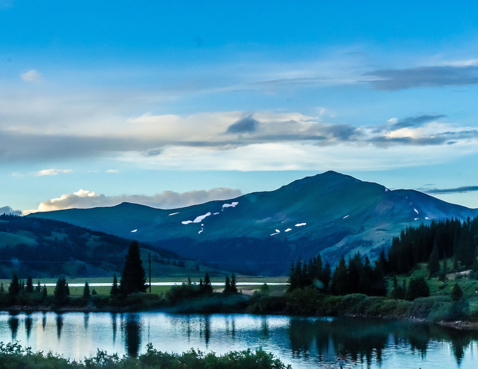
Fremont Pass winds its way below some of Colorado’s most iconic 14ers, including Mt Sherman, Mt Lincoln, and Quandary Peak, and opportunities for mountain climbing along the route are plentiful. The area is locally loved and well known for all manner of outdoor mountain recreational activities, ranging from zip lining to hiking to snowmobiling.
The Climax Mine Museum offers a fascinating look at the area’s local mining legacy, and the nearby Fremont Pass Trail boasts an unforgettable high elevation hiking experience and arresting views of the surrounding peaks.
Read about the camping near Leadville and Twin Lakes.
Read about the camping near Copper Mountain and Summit County.
Details
Address: CO-91, between Copper Mountain and Leadville, CO
County: Lake County
Season: Year-round, weather pending
Elevation: 11,319 ft (3,450 m)