The Colorado Plateau encompasses a massive land area featuring a series of plateaus or mesas, which are located within an enormous basin surrounded by mountainous highlands. It’s named for the Colorado River that dissects much of the canyons and other formations of the area.
Home to some of the most spectacular and colorful landscapes in North America, consider heading west and visiting the Colorado Plateau.
Where is the Colorado Plateau?
The Colorado Plateau spans 150,580 square miles in the southwestern United States and covers the southeastern half of Utah, western and southwestern Colorado, northwestern New Mexico, and the northern half of Arizona.
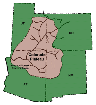
The land area is cradled by the Rocky Mountains and Uinta Mountains of Utah to the north, with the Rio Grande Rift Valley of New Mexico forming the eastern edge. And finally, to the west by the Great Basin, and the Sonoran Desert to the south.
How was the Colorado Plateau formed?
Tens to hundreds of millions of years ago, the Colorado Plateau was uplifted nearly one mile in length. This uplift was mainly caused by a reactivation of pre-existing faults and a tilting of the land to the north. Sedimentary rocks cut by rivers and streams formed and shaped what we see today.
You will mostly see shales, sandstones, and limestones, along with impressive rock formations and towering buttes, such as the ones in Monument Valley in the far northeast corner of Arizona, all molded over time by wind and water. Volcanic rock is also commonly seen in areas with historic volcanic activity, such as the Sunset Crater and Hopi Buttes in Arizona.

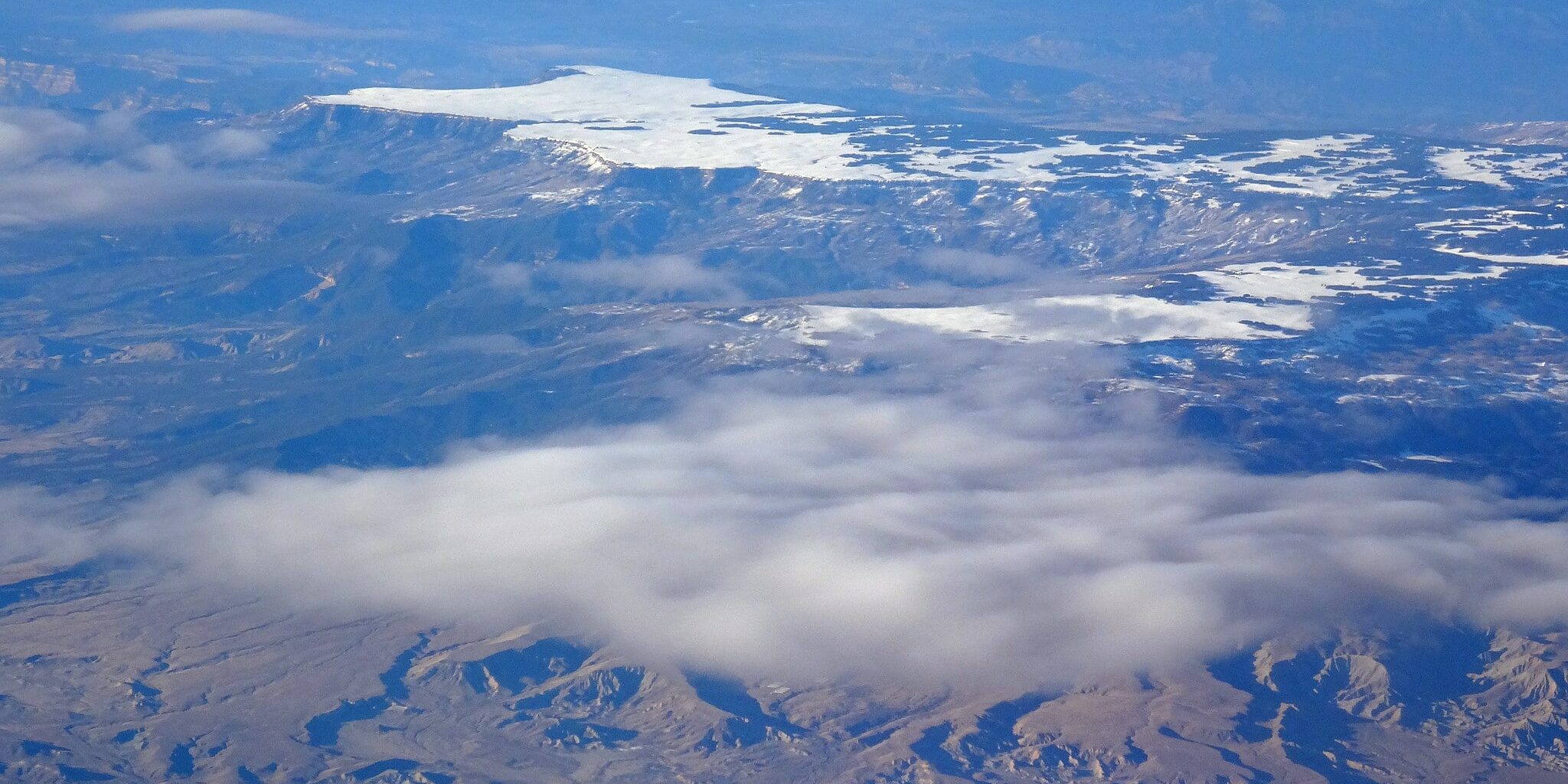
The Plateau’s topography is predominantly made of towering mountains that are cut by river canyons and detailed with dry gullies and washbasins made by sporadic streams. Other topographic features include large shallow basins, sunken deserts, picturesque buttes and mesas, and a few verdant valleys.
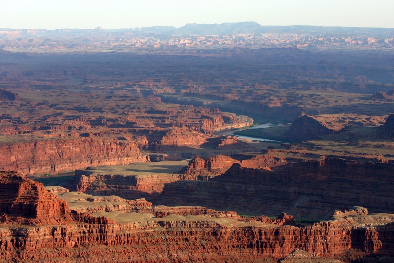
Its most notable geographical feature is the Grand Canyon, where the Colorado River system has carved deep and lengthy gorges throughout the Plateau.
Climate and Vegetation
The average elevation on the Plateau is 6,352 feet, but the elevation ranges greatly, with canyon floors at less than 2,461 feet in the Grand Canyon and its mountain peaks reaching 12,600 feet above sea level in the La Sal Mountains in Utah.
The climate in the Colorado Plateau varies with its elevations. At lower elevations, temperatures range from the low 20s to the mid-90s. At higher elevations, temperatures hardly ever exceed 70 degrees, while in winter, single digits are fairly common. Precipitation is minimal, with an average of eight inches per year.
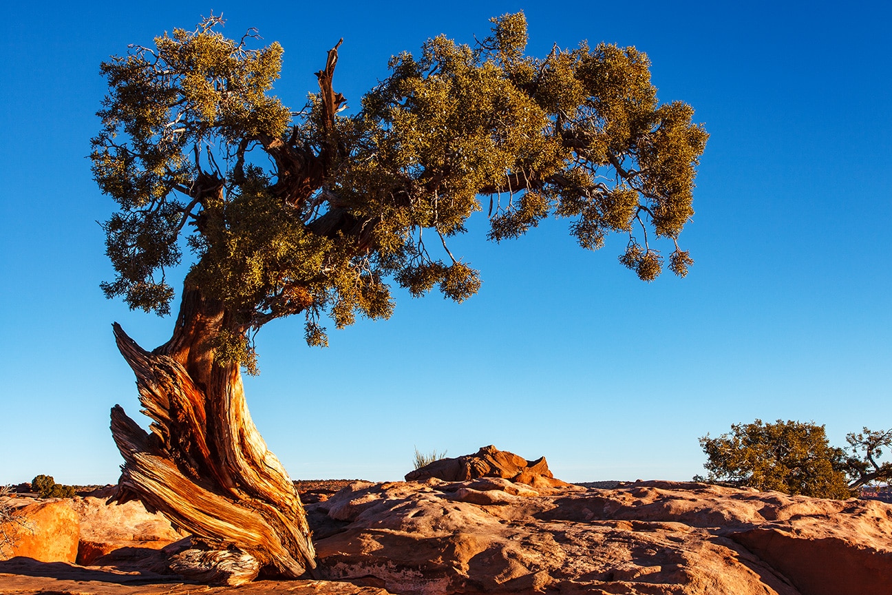
The vegetation, along with the elevation, varies throughout the plateau. At low elevations, the land is covered by arid shrublands and grasses, with sagebrush as the main vegetation. Higher elevations grow wooded areas dominated by pinyon pine, juniper, and shrubs. And in even higher elevations, growth mainly consists of ponderosa pine, Douglas fir, lodgepole pine, and aspen.
Preserved Land
The Colorado Plateau is well-known for having the greatest concentration of U.S. National Parks and National Monuments in the country (other than the Washington, DC metropolitan area).
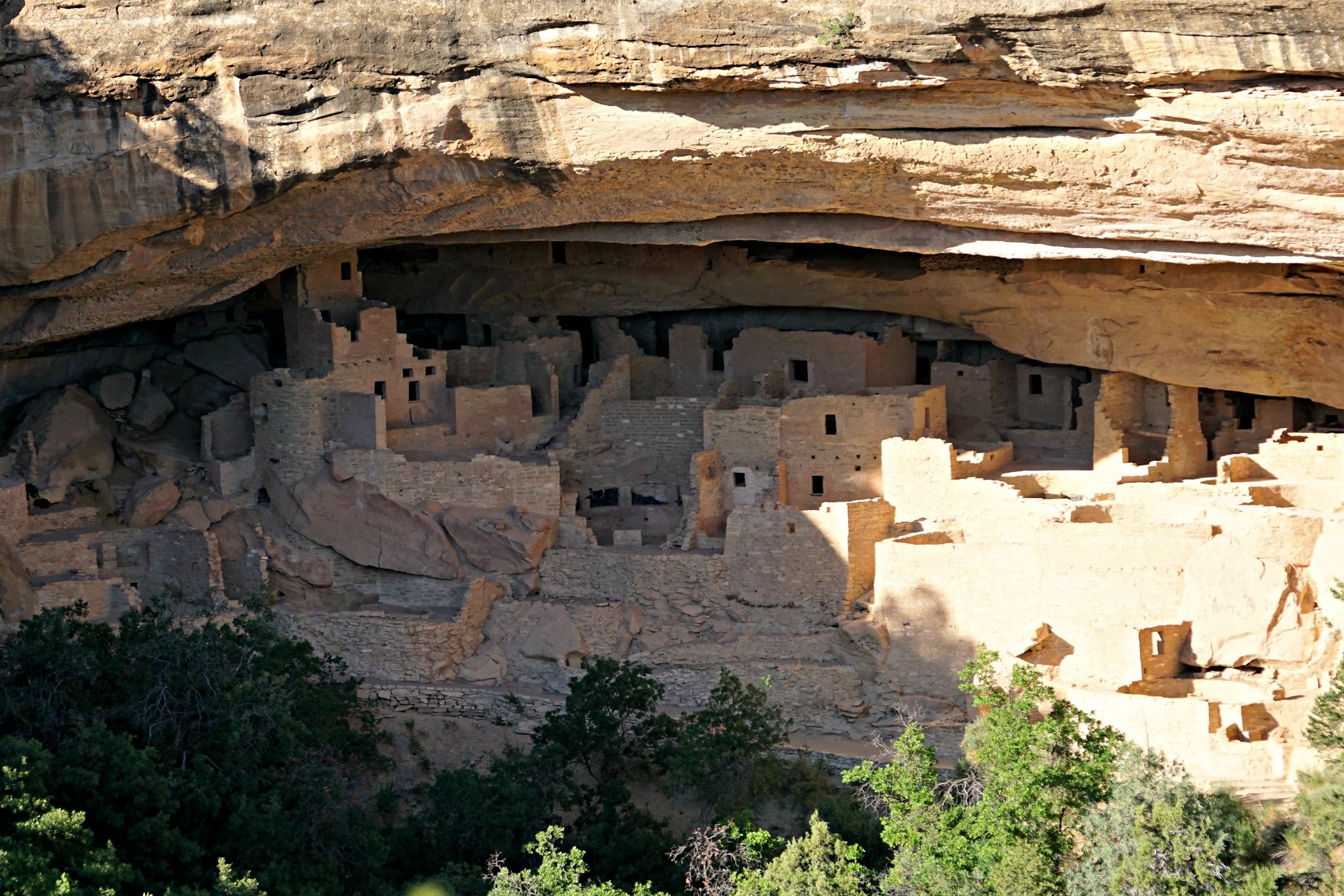
Among its nine national parks are the Grand Canyon and Petrified Forest in Arizona, Zion, Bryce Canyon, Capitol Reef, Canyonlands, and Arches in Utah, plus Mesa Verde in Colorado.
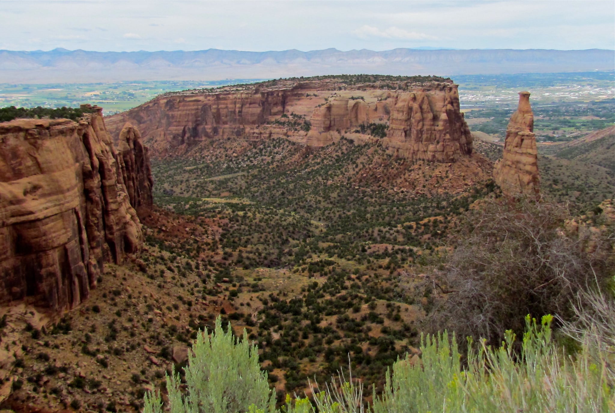
In addition to the National Parks, there are 18 national monuments, including Bears Ears, Natural Bridges, Hovenweep, and Grand Staircase-Escalante in Utah, Dinosaur and Colorado National Monument and Canyons of the Ancients in Colorado, plus Wupatki and Sunset Crater Volcano in Arizona and Chaco Culture National Historical Park in New Mexico.
Six Sections of the Colorado Plateau
Six different sections make up the Colorado Plateau, including Canyonlands, Grand Canyon, High Plateaus, Uinta Basin, Navajo, and the Datil sections.
Canyonlands
The Canyonlands occupy the central section of the Colorado Plateau and feature many deeply cut canyons, which contain large mountains like the La Sal Mountains, the Henry Mountains, the Carrizo Mountains, and the Abajo Mountains. Mainly carved by the drainage systems of the Green and Colorado Rivers, this area offers stunning vista views and is where you will find Canyonlands and Arches National Parks in Utah.
Grand Canyon
The Grand Canyon section, as the name suggests, is dominated by the Grand Canyon itself. Carved by the Colorado River through continuous weathering and geological processes over time. This area is best known for its size, deep canyon walls, and colorful landscape.
The formation of the Grand Canyon is interconnected with the rise of the Colorado Plateau and is where the San Francisco Volcanic Field is found, the largest volcanic field in the U.S.
Uinta Basin
The Uinta Basin is the northernmost section of the Colorado Plateau, where its northern boundary is formed by the Uinta Mountains in Utah, where the highest peak (Kings Peak at 13,528 feet) in Utah is found. The Basin is drained by several creeks and rivers that flow from the Uinta Mountains.
High Plateaus
This section is the highest portion of the Colorado Plateau and is located along the western and northwestern parts of the Plateau. It is detailed by large plateaus that are separated by other faults. This area is home to the geological formations of Zion and Bryce Canyon National Parks in Utah.
Navajo
The Navajo section is distinguished by fewer not-so-deep canyons in the states of Arizona, New Mexico, and small areas of Colorado and Utah. The section is home to the Four Corners area of the Southwest, where the borders of all four states meet in one corner.
Several national monuments like Canyon de Chelly and Navajo Tribal Parks, Lake Powell, and Monument Valley, plus Mesa Verde National Park in Colorado.
Datil
The Datil section is the Plateau’s southeastern area in Arizona and New Mexico. It is mainly characterized by mesas, valleys, and a large volcanic area featuring prehistoric lava flows.
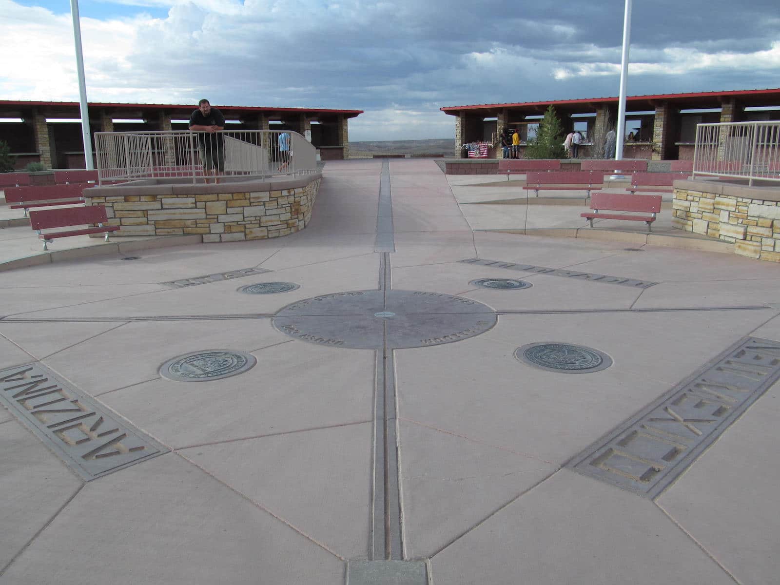
As mentioned above, the Colorado Plateau encompasses the very western edge of Colorado, from the north at Dinosaur National Monument down to the Four Corners Monument. In the middle of this lies the Colorado National Park, between Grand Junction and Fruita.
The aforementioned Mesa Verde National Park lies in the Southwest region near the town of Cortez, as well as the Canyons of the Ancients and a portion of Hovenweep National Monument.
 7 Best Hiking Trails near Dinosaur and Meeker, Colorado