• Menu
  • Skip to right header navigation
  • Skip to main content
  • Skip to primary sidebar
  • Skip to footer

Uncover Colorado Logo

  • Blog
  • Activities
  • Events
  • Towns
  • Lodging
  • Dining
  • Transport
  • Made in CO
  • Search
  • Blog
  • Activities
  • Events
  • Towns
  • Lodging
  • Dining
  • Transport
  • Made in CO
  • Search
Vail Pass Trail Paved Bike Path
Passing section on two lane paved bike path, looking westbound.

Vail Pass Trail

FacebookTwitter

[Passing section on two lane paved bike path, looking westbound.] 
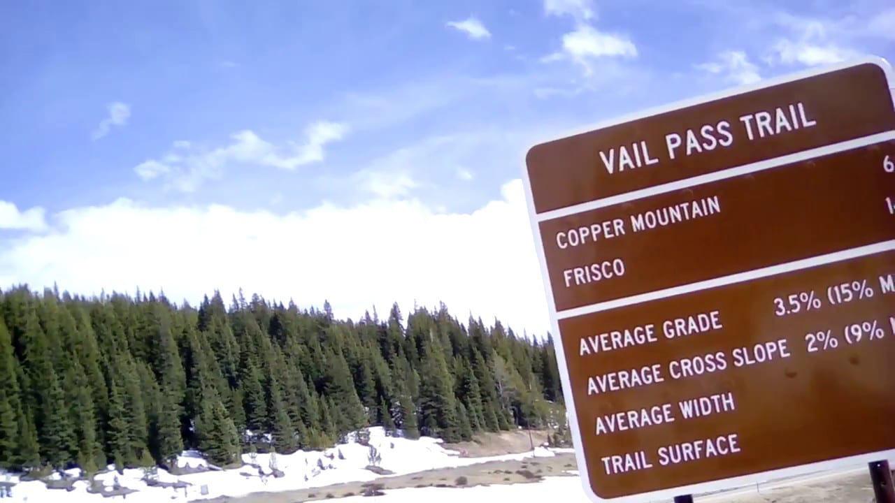
Also called the Vail Pass Bike Path, Vail Pass Trail is a wonderful paved way with fantastic scenery that anyone should not miss when in Colorado- it offers both adventure and serenity in one! In 1980, it was designated as a National Recreation Trail and has since been favored by hikers, skaters, and especially bikers.

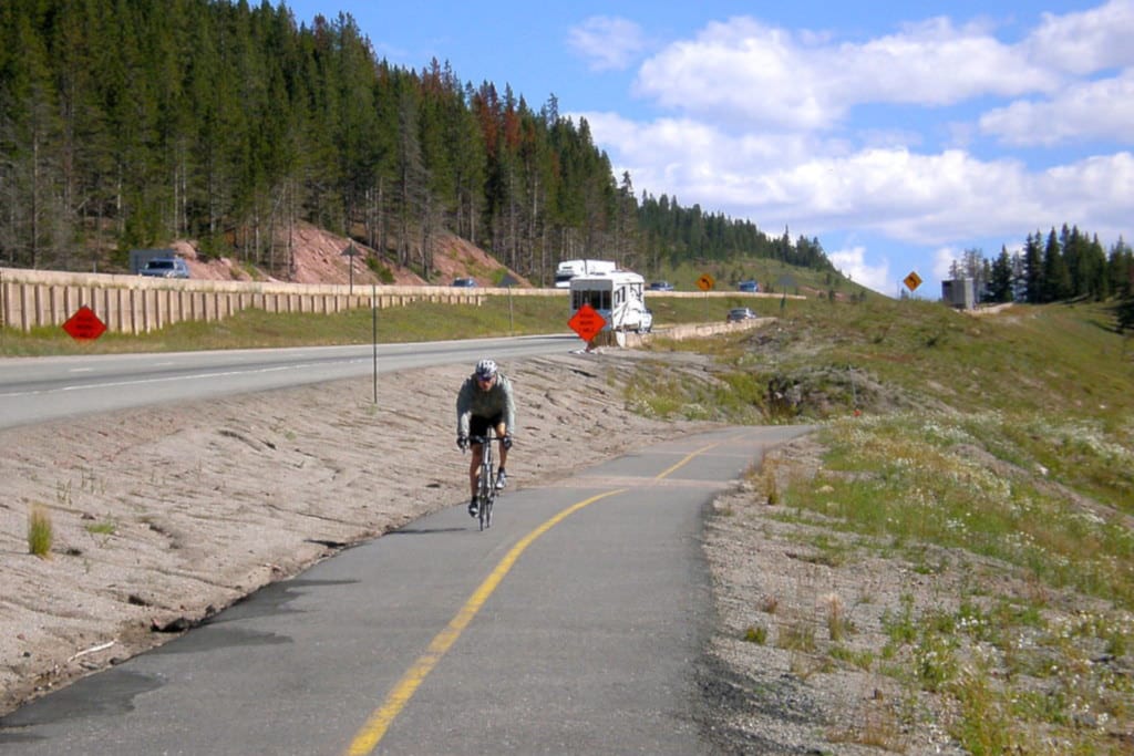
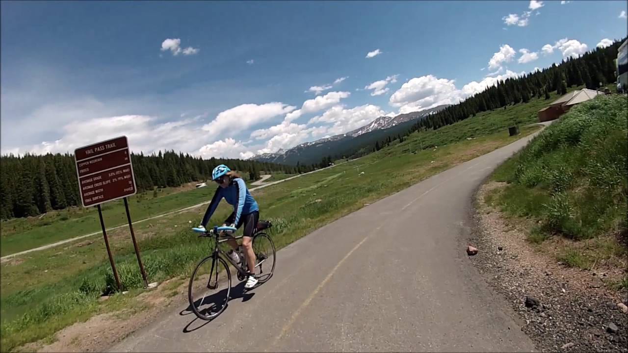
The trail traverses along the famous Vail Pass, the only mountain pass in the state with bike lanes on both sides!

NRT Hiking and Mountain Biking Trail
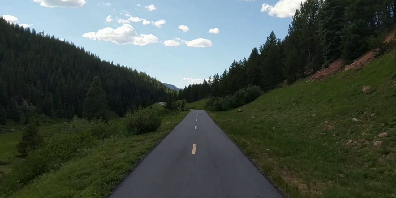
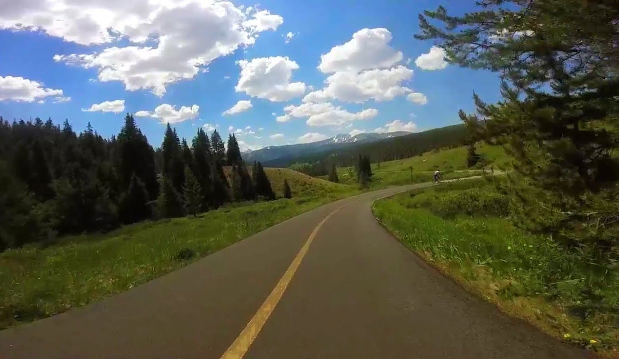
 near Copper Mountain, CO

Vail Pass Bike Path Biker
Paved, dedicated bike route from Vail to Copper Mt. Photo: Ericshawwhite

Vail Pass National Recreation Trail is 18 miles long out and back, fitness type trail that features scenic views of the Gore and Tenmile Ranges and Copper Mountain Ski Resort. The trail traverses from Gore Creek Campground to the base of Copper Mountain and gains an elevation of 1,831 feet.

Trail Route

Vail Pass Trail Sign Milage Marker
Millage marker sign for Vail Pass Trail.

From the trailhead at Gore Creek Campground, follow the trail that was once Highway 6 for 3.5 miles until you reach a junction. Turn right to continue the trail to Vail Pass. From here, continue on a descending hike to Copper Mountain. This is a very popular descent for bikers who usually ride a shuttle up to the top of Vail Pass and bike down to Copper Mountain.

For hikers, the trail can be heavily used by bikers so keep to your side of the road (right). While for bikers, manage your speed and be extra careful for some sharp turns along the way down. Once to Copper Mountain, simply retrace your steps back to the trailhead to complete the Vail Pass National Recreation Trail hike or continue to Breckenridge and Frisco for more amazing hike or ride experience.

Vail Pass National Recreation Trail is not short of beautiful natural views. During this 9 mile long hike to Copper Mountain, you will be passing through evergreen and aspen forests, creeks, meadows, and fascinating mountain views.

Tips for Biking/Hiking Vail Pass Trail

Vail Pass Trail Biker Colorado
Biking the Vail Pass Bike Path.

The trail begins in an elevation of 8,772 feet with the highest elevation of 10,603 feet, so before you rush to Vail, get yourself acclimated to high elevations. Should you plan to bike your way up to Vail Pass, make sure to also be in good shape. Also, Vail Pass Trail has no entry and parking fee and is heavily trafficked especially during summer.

Quick reminders. Off-trail riding is not permitted. Do a quick brake test for your bike, the downhill section can be tricky.

Getting There

Vail Pass Trail Paved Bike Path Colorado
No passing section on two lane paved bike path.

Get on Interstate 70 East in Vail. Follow Interstate 70 East to Big Horn Road. Take exit 180 towards Vail. Continue on Big Horn Road and to Forest Road 721 and past the Gore Creek Campground. Park just beyond at the road closure gate.

Vail Pass Trail Bikers Colorado
Bikers on the trail.

Details

Address: Copper Mountain and Vail

Season: Year round – late Spring to early Fall are best

Length: 18 miles out and back, 9 miles one way

Map: fs.usda.gov/Internet/FSE_DOCUMENTS/stelprdb5186526.pdf

Website: nrtdatabase.org/trailDetail.php?recordID=176

Primary Sidebar

Join our Colorado travel community

Enter your email below and grab our free locals' guide and monthly what's up designed to help you live your Colorado life and uncover fun things to do. —and never miss out again.

National Recreation Trails

  • All Hiking
  • Alamosa South Bluff
  • Apex
  • Barr
  • Bear Creek
  • Big Dry Creek
  • Calico
  • Clear Creek
  • Crag Crest
  • Devils Head
  • Fish Creek Falls
  • Grays Peak
  • Greyrock Mountain
  • Highline Canal
  • Highline Loop
  • Lake Fork
  • Mineral Belt
  • Monte Vista Walking
  • Mount Evans
  • Mount McConnel
  • Petroglyph Point
  • Platte River Greenway
  • Poudre River
  • Rio Grande Nature
  • Rocky Mountain Arsenal
  • Round Mountain
  • Sand Creek Regional Greenway
  • Swamp Park
  • Two Elk
  • Two Ponds
  • Vail Pass
  • West Lost Trail Creek
  • Wheeler Ten Mile
  • White House Ranch

Footer

Get In Touch

  • Home
  • About Us
  • Write For Us
  • Advertise
  • Contact Us
  • Resources
Facebook Instagram Pinterest Twitter

Disclosure: Uncover Colorado is a participant in the Amazon Services LLC Associates Program, an affiliate advertising program designed to provide a means for sites to earn advertising fees by advertising and linking to Amazon.com.

Things To Do

  • Travel Blog
  • Colorado Activities
  • Colorado Events
  • Colorado Towns
  • Colorado Hotels
  • Colorado Restaurants
  • Colorado Transportation
  • Made in Colorado

Visit Mile High Happy Hour for Denver neighborhoods' restaurant happy hours.

Winter Activities

  • Camping
  • Cross Country Skiing
  • Federal Lands
  • Hot Springs
  • Ice Skating
  • Skiing and Snowboarding
  • Snow Tubing
  • State Parks

Vacation like a VIP! Leisurely Lifestyle shares life and travel hacks, as well as cheap luxury travel.

Copyright © 2021 · Uncover Colorado - Vacations, Travel & Tourism | Sitemap | Privacy Policy | Disclaimer