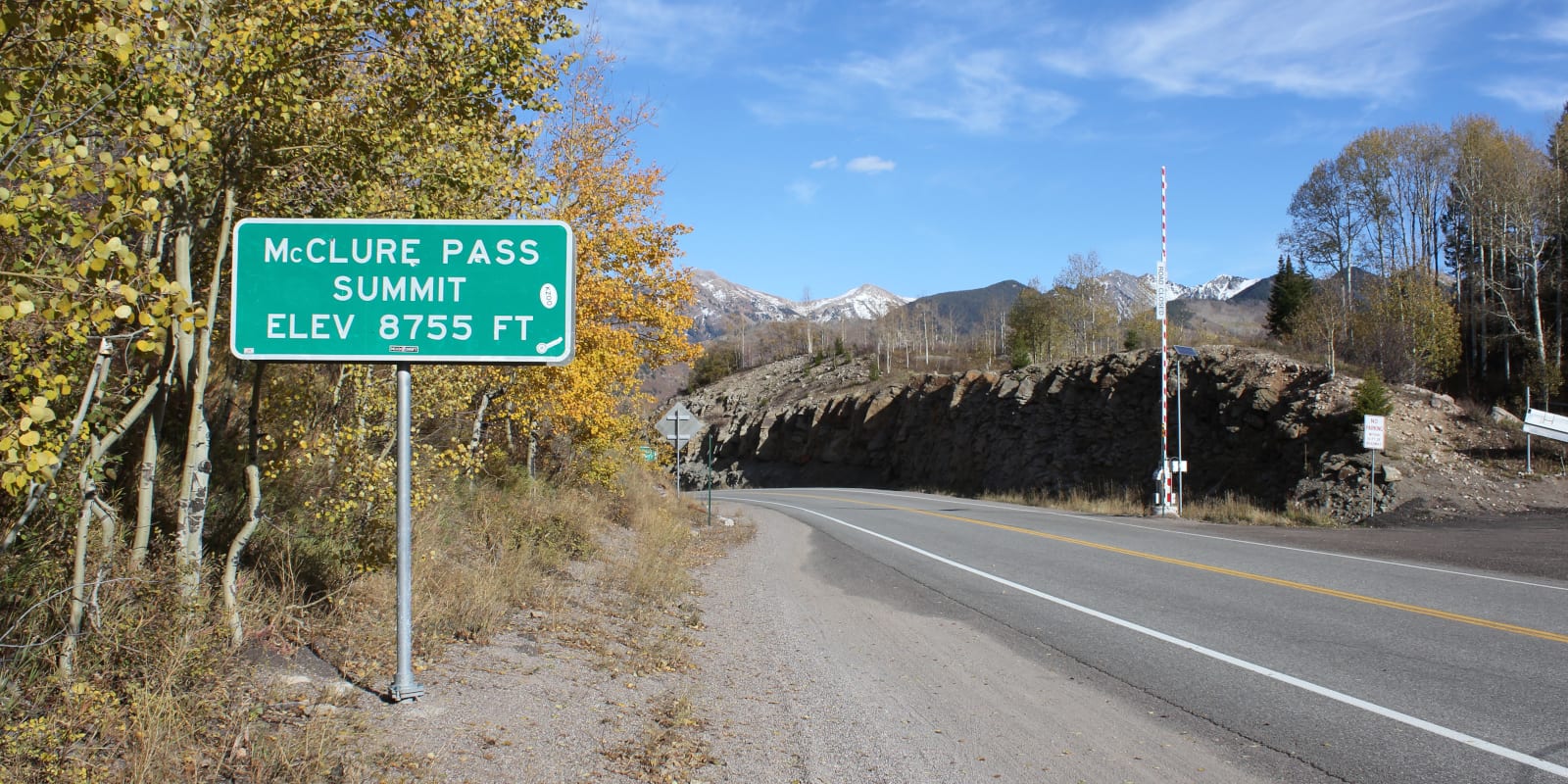
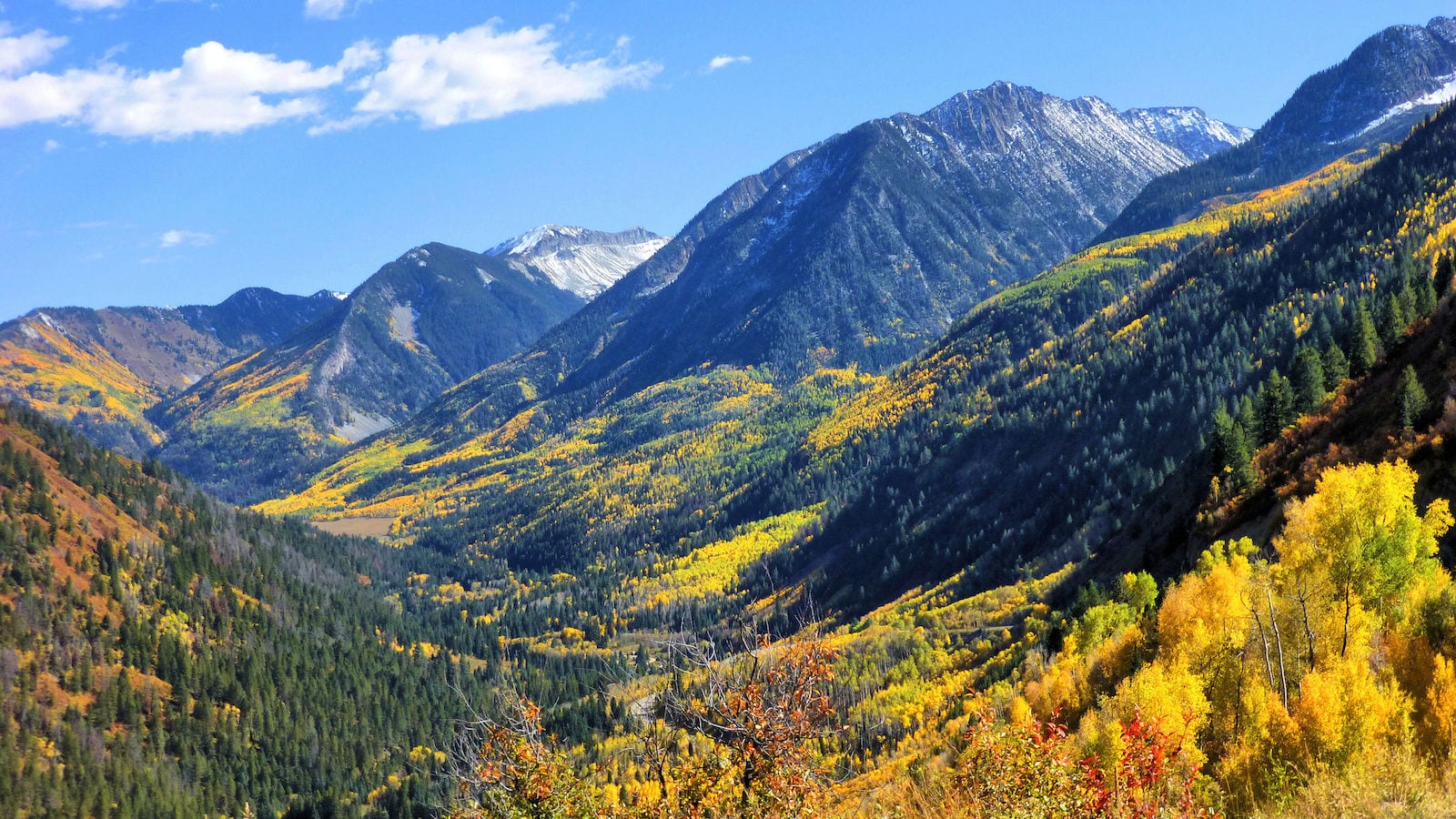
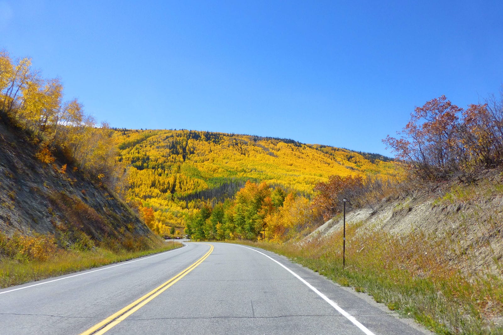
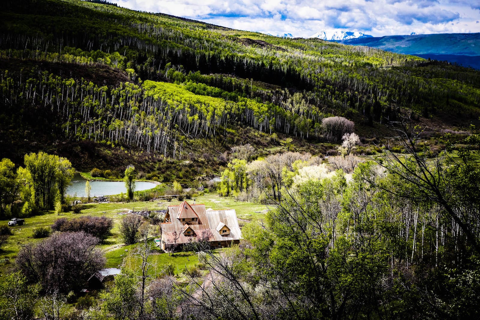
McClure Pass is a 8,770 foot high mountain pass that is traversed along the West Elk Loop Scenic Byway in western Colorado. It resides between the towns of Redstone and Somerset, nearby Carbondale and Paonia, respectively. With panoramic views of some of the state’s most dramatic wilderness areas, McClure Pass is a great place to stop and camp or explore along State Highway 133.
History
The Ute Indians are among the first known humans to use McClure Pass while inhabiting the Crystal and Muddy Valleys. In 1776 Spanish settlers began exploring the area, which would be later settled by miners, farmers and ranchers.
Over the course of a century, the trail along McClure Pass was transformed from a hunting route to a wagon road by the late 1800’s. In 1947, the route was improved to its modern form and was named for “Mac” McClure, who built and ran a hotel along the railroad nearby.
McClure Pass Accessibility
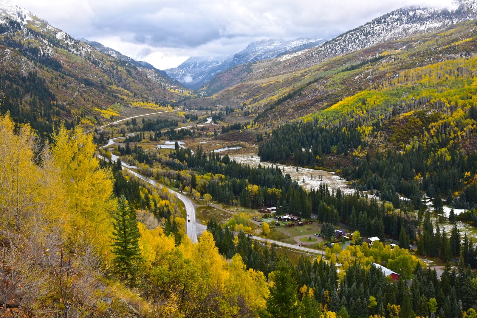
At less than 9,000 feet, McClure Pass may be considered somewhat accessible in comparison to some of Colorado’s other high elevation mountain passes. However, the roadway does become very steep (8% grade) on both sides of the pass, with one major switchback on the north end.
Near the summit, there is a park area and overlook on the south side of the road. Use extreme caution, as the area is busy with cars pulling over to park.
Seasonality – In general, the paved State Highway 133 is open all year round. In severe winter snowstorms, access to McClure Pass may be closed until the road can be safely cleared.
Vehicle Restrictions – All passenger vehicles can access McClure Pass along State Highway 133. However, winter travelers should be aware of Colorado traction and chain laws.
Activities near McClure Pass
At the crest of McClure Pass, there is a 4.5 mile dirt road that is open for visitors to hike, mountain bike, and horseback ride. The route is known as Ragged Mountain Road or Forest Service Road #898.
It’s dog friendly and is rated as medium difficulty. 2.75 miles into the trail, serious outdoors adventures can turn onto the more isolated Raggeds Trail which travels through 14 miles of the Raggeds Wilderness.
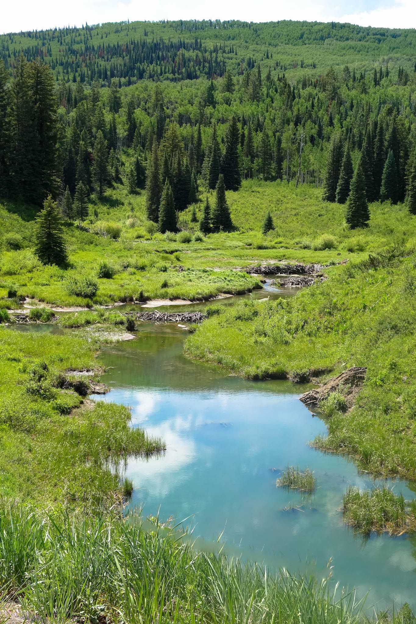
Located within the Gunnison National Forest, the USFS operates the McClure Campground at the summit of the pass. The campground has no fee and is first come, first served with sites containing a fire pit/grill, picnic table, and a shared vault toilet. Beyond the campground, the area is full of dramatic peaks, beautiful meadows, and opportunities for trout fishing and spotting wildlife like beavers, bears, mountain goats, and more.
Read about the camping near Paonia, Hotchkiss and Crawford.
The greater West Elk Loop Byway begins to the north in Carbondale, going south on Highway 133 to Paonia and connects with Kebler Pass over to Crested Butte. Then it travels south on Highway 135 to Gunnison, west on Highway 50 past Blue Mesa Reservoir, then back north on Highway 92 to Hotchkiss, passing Crawford and the North Rim of the Black Canyon of the Gunnison on the way.
Details
Address: State Highway 133, between Redstone (near Carbondale) and Somerset, CO (near Paonia)
Season: Year Round
Elevation: 8,770 ft (2,673 m)
County: Pitkin County / Gunnison County
Mountain Range: Elk Mountains
Coordinates: 39.12901°N 107.28298°W
Access: Paved Highway (SH 133)
[sc name=”ad-activity-bottom”]