• Menu
  • Skip to right header navigation
  • Skip to main content
  • Skip to primary sidebar
  • Skip to footer

Uncover Colorado Logo

  • Blog
  • Activities
  • Events
  • Towns
  • Lodging
  • Dining
  • Transport
  • Made in CO
  • Search
  • Blog
  • Activities
  • Events
  • Towns
  • Lodging
  • Dining
  • Transport
  • Made in CO
  • Search
Dallas Divide, CO
Dallas Divide, CO. Photo: Dallas Divide, CO. Photo: Jeffrey Beall

Dallas Divide – Ridgway-Placerville

FacebookTwitter

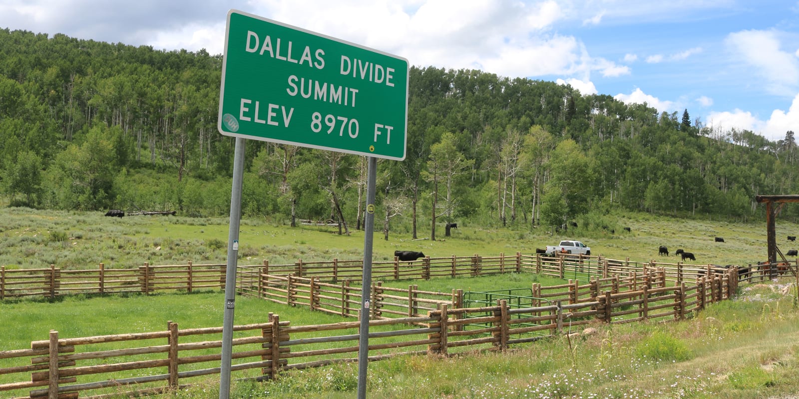
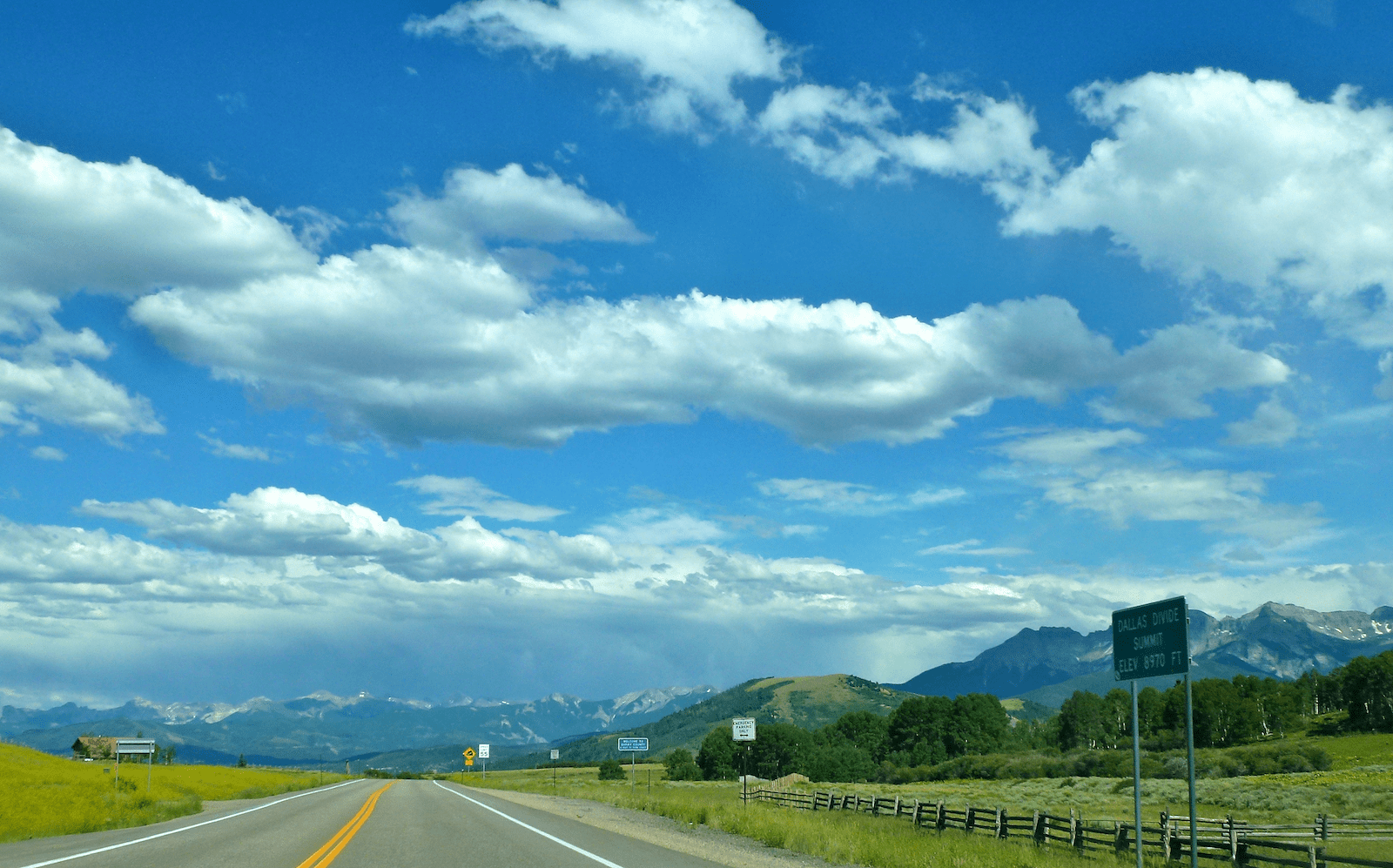
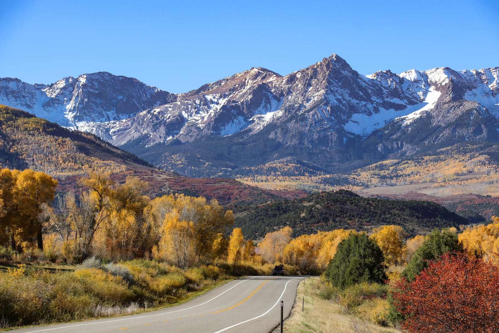
The Dallas Divide is a high mountain pass located in Southwest Colorado between Ridgway and Placerville. The 8,983-foot pass is often used to access the city of Telluride and serves as the geological divide between the San Juan Mountains and the Uncompahgre Plateau.

The Dallas Divide splits the Ouray and San Miguel counties and sits roughly 10 miles north of the prominent points of Dallas Peak and Mt. Sneffels. It also divides the watersheds between the Uncompahgre and San Miguel Rivers.

History

Dallas Divide, CO
Dallas Divide, CO. Photo: Simon Foot

The Dallas Divide gets its name from the 11th Vice President of the United States, George M. Dallas, whom the nearby peak and large city in Texas are also named for.  In 1880, the first toll road was built that crossed over the Dallas Divide. In 1890, the route became part of the Rio Grande Southern Railroad, connecting Ridgway and Telluride.

There is another parallel route from Telluride to Ridgway nicknamed “Last Dollar Road” in reference to a desert transition from the “Million Dollar Highway” to the south. Dallas Divide is located on the San Juan Skyway, a national scenic byway, which also includes the aforementioned stretch of Million Dollar Highway.

Dallas Divide Accessibility

Dallas Divide, CO
Strange Clouds over Dallas Divide, near Ridgway, Colorado. Photo: Simon Foot

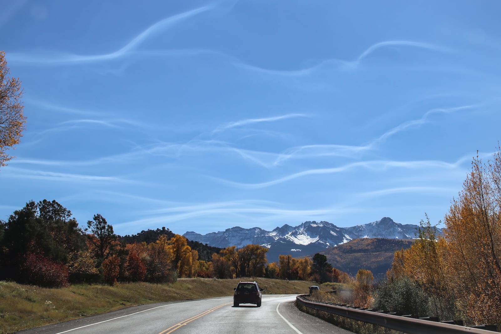
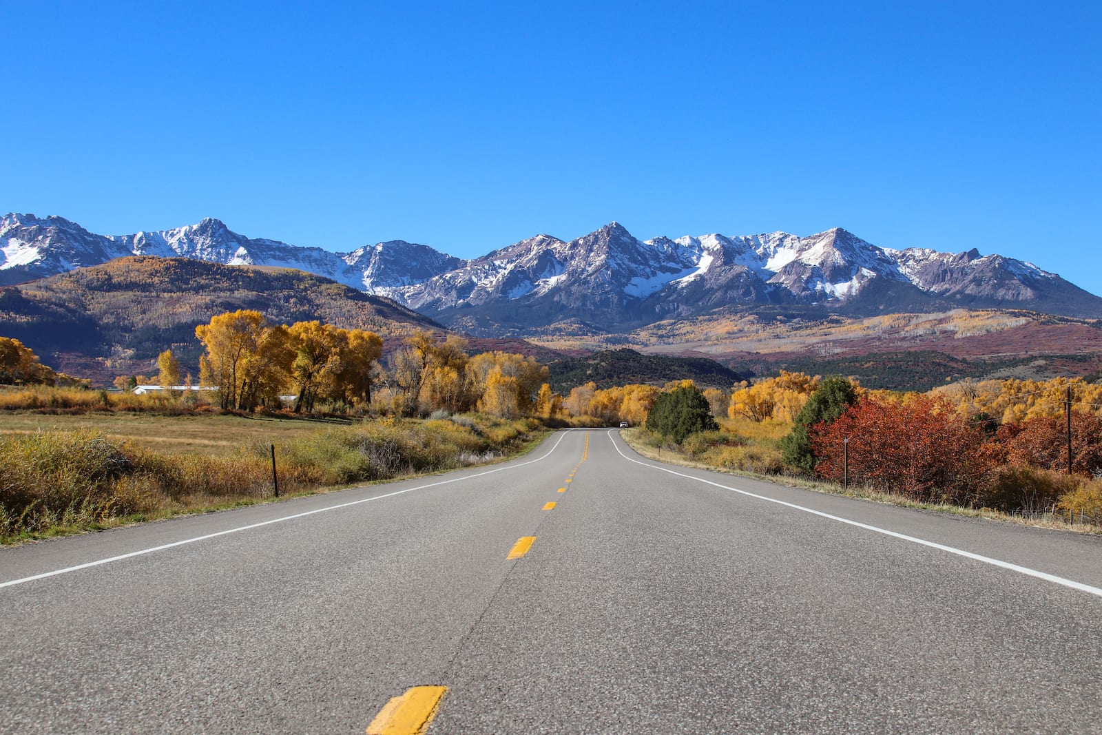
Compared to other state passes, the route to the Dallas Divide is somewhat easy and free of dangerously steep grades or continuous tight turns. State Highway 62 is a paved, asphalt road with a steady grade of roughly 4%.

Seasonality – Typically, Dallas Divide is open year round and is extremely popular in the fall for the vibrant colors of its many aspen groves.

Vehicle Restrictions – There are no vehicle restrictions on the Dallas Divide, other than those opposed by the State of Colorado.

Activities by Dallas Divide

Dallas Divide Summit, CO
Dallas Divide Summit. Photo: Granger Meador

The Dallas Divide lies in an expansive, high elevation, and scenic part of Colorado. The nearby towns of Telluride and Ouray and extremely popular for winter activities or all-season types of getaway. Thanks to the area’s interesting topography, there are hiking, mountain biking, and off road opportunities in desert and mountainous conditions.

Dallas Divide, near Ridgway, Colorado
Dallas Divide, near Ridgway, Colorado. Photo: Simon Foot

Details

Address: Ridgway to Placerville, CO

Season: Year round

Elevation: 8,983 ft (2,738 m)

County: Ouray / San Miguel

Mountain Range: San Juan Mountains / Uncompahgre Plateau

Coordinates: 38°05′40″N 107°53′18″W

Access: State Highway 62

Primary Sidebar

Join our Colorado travel community

Enter your email below and grab our free locals' guide and monthly what's up designed to help you live your Colorado life and uncover fun things to do. —and never miss out again.

Colorado Mountain Passes

  • All Activities
  • All Scenic Drives
  • Argentine Pass
  • Berthoud Pass
  • Boreas Pass
  • Buffalo Pass
  • Cameron Pass
  • Cinnamon Pass
  • Coal Bank Pass
  • Cochetopa Pass
  • Cordova Pass
  • Cottonwood Pass
  • Cuchara Pass
  • Cumberland Pass
  • Dallas Divide
  • Dunckley Pass
  • Engineer Pass
  • Fall River Pass
  • Georgia Pass
  • Guanella Pass
  • Hagerman Pass
  • Hermit Pass
  • Hoosier Pass
  • Iceberg Pass
  • Independence Pass
  • Jones Pass
  • Kebler Pass
  • Kenosha Pass
  • La Poudre Pass
  • La Veta Pass
  • Loveland Pass
  • Marshall Pass
  • McClure Pass
  • Milner Pass
  • Molas Pass
  • Monarch Pass
  • Mosquito Pass
  • Muddy Pass
  • North Pass
  • Ophir Pass
  • Poncha Pass
  • Rabbit Ears Pass
  • Raton Pass
  • Red Cone Pass
  • Red Mountain Pass
  • Rollins Pass
  • Schofield Pass
  • Shrine Pass
  • Slumgullion Pass
  • Spring Creek Pass
  • Squaw Pass
  • Stony Pass
  • Tennessee Pass
  • Tincup Pass
  • Ute Pass
  • Vail Pass
  • Waunita Pass
  • Webster Pass
  • Weston Pass
  • Wilkerson Pass
  • Wolf Creek Pass

Footer

Get In Touch

  • Home
  • About Us
  • Write For Us
  • Advertise
  • Contact Us
  • Resources
Facebook Instagram Pinterest Twitter

Disclosure: Uncover Colorado is a participant in the Amazon Services LLC Associates Program, an affiliate advertising program designed to provide a means for sites to earn advertising fees by advertising and linking to Amazon.com.

Things To Do

  • Travel Blog
  • Colorado Activities
  • Colorado Events
  • Colorado Towns
  • Colorado Hotels
  • Colorado Restaurants
  • Colorado Transportation
  • Made in Colorado

Visit Mile High Happy Hour for Denver neighborhoods' restaurant happy hours.

Winter Activities

  • Camping
  • Cross Country Skiing
  • Federal Lands
  • Hot Springs
  • Ice Skating
  • Skiing and Snowboarding
  • Snow Tubing
  • State Parks

Vacation like a VIP! Leisurely Lifestyle shares life and travel hacks, as well as cheap luxury travel.

Copyright © 2021 · Uncover Colorado - Vacations, Travel & Tourism | Sitemap | Privacy Policy | Disclaimer