• Skip to main content
  • Skip to header right navigation
  • Skip to site footer
Uncover Colorado Logo

Free Colorado Travel Guide | Vacations, Travel and Tourism

  • Blog
  • Activities
  • Events
  • Lodging
  • Towns
  • Trip Planner

McCoy, Colorado

McCoy Colorado Highway 131 Town Sign
Entering McCoy, CO on Highway 131. Photo: Jeffrey Beall

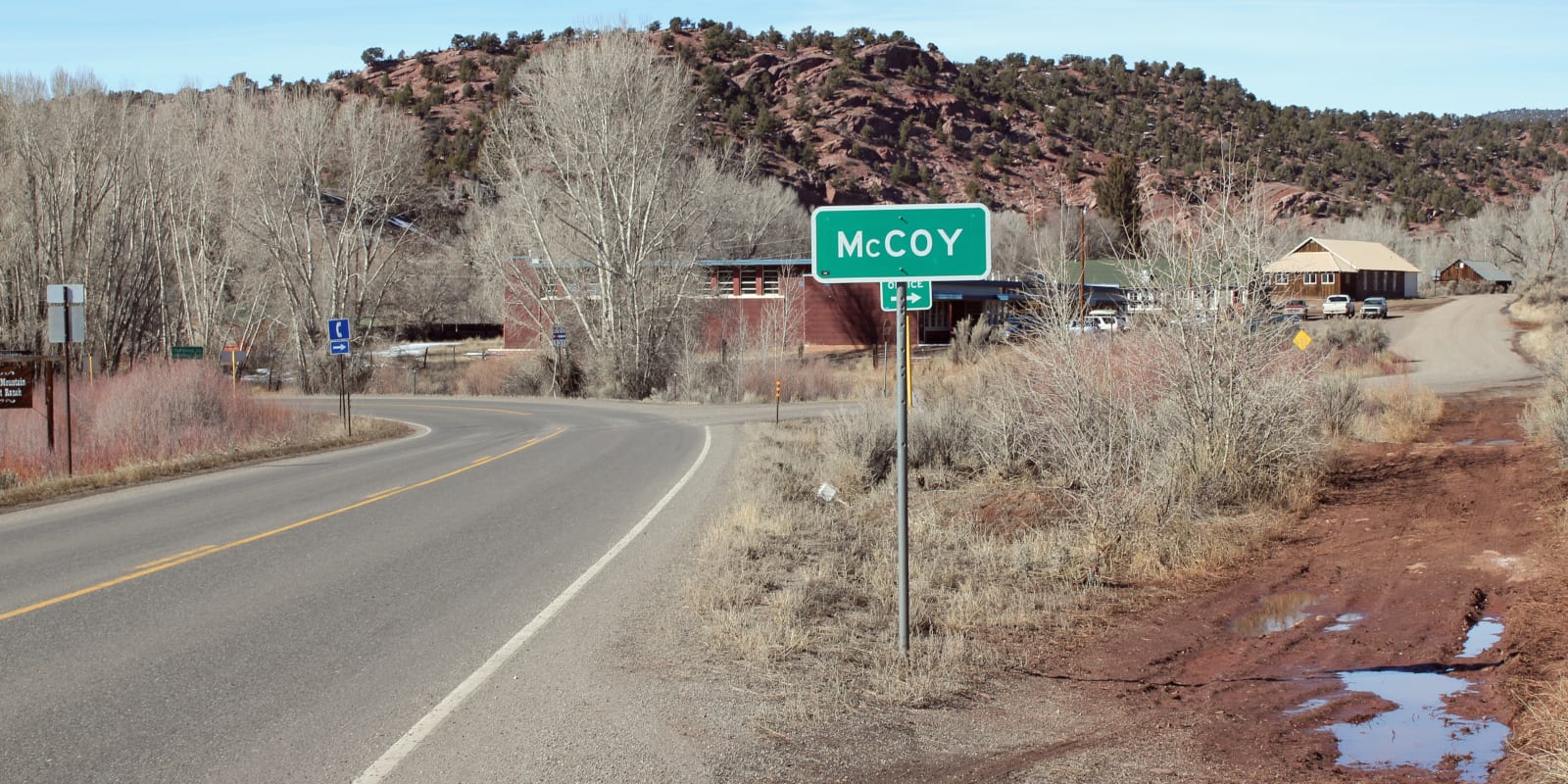
McCoy is a rural community and census-designated place (CDP) located on Highway 131 between Steamboat Springs and Wolcott, CO. It’s located about 20 miles north of Interstate 70.

The town had a miniature population of 30 at the time of the 2020 census. While there isn’t much but some housing in town, there is a McCoy Post Office with a zip code of 80463. It’s been in use since 1891.

The town is situated in Eagle County. It was named after a local cattleman, Charles H. McCoy. Yarmony Creek Ranch is also located within the town limits.

McCoy Colorado Yarmony Creek Ranch
Yarmony Creek Ranch. Photo: K. Todd Storch

Activities near McCoy

Dog Sledding:

  • Mountain Musher (4mi)

Dude Ranches:

  • Black Mountain Colorado Dude Ranch (6mi)

Towns:

  • Avon (31mi)
  • Beaver Creek (33mi)
  • Bond (4mi)
  • Dotsero (43mi)
  • Eagle (30mi)
  • Eagle-Vail (34mi)
  • Gypsum (38mi)
  • Glenwood Springs (61mi)
  • Minturn (37mi)
  • Oak Creek (39mi)
  • Phippsburg (35mi)
  • Red Cliff (46mi)
  • Steamboat Springs (60mi)
  • Toponas (13mi)
  • Vail (40mi)
  • Wolcott (20mi)
  • Yampa (22mi)

Transportation:

  • Eagle County Regional Airport (EGE) (34mi)
  • Eco Transit


Sidebar

Eagle County

  • All Towns
  • Eagle County
  • Avon
  • Basalt
  • Beaver Creek
  • Bond
  • Dotsero
  • Eagle
  • Eagle-Vail
  • Edwards
  • El Jebel
  • Gypsum
  • McCoy
  • Minturn
  • Red Cliff
  • Vail
  • Wolcott
  • Home
  • About Us
  • Contact Us
  • Privacy Policy
  • Resources
  • Disclaimer—Terms of Service

Copyright © 2025 · Free Colorado Travel Guide | Vacations, Travel and Tourism · All Rights Reserved