Everyone has heard of the Continental Divide that runs north and south throughout North America. But so much of what makes up the divide is only read about or experienced in pieces and is only seen from end to end by those (200 people a year) who attempt to hike its entire length.
A large section of the divide runs through Colorado and is home to some of the best scenic views in the state. The Continental Divide Trail offers many different ways to experience the divide, from multi-day backpacking trips to scenic road trips.
What is the Continental Divide?
But what is a continental divide? A continental divide, according to National Geographic, is a naturally occurring boundary or ridge separating a continent’s river systems. Each river system feeds into a distinct ocean, basin, bay, or sea.
Separating drainage basins or watersheds, a continental divide indicates precipitation that falls to one side of the divide will flow to one basin, while on the other side, precipitation will flow to another – often creating a distinct directional water flow.
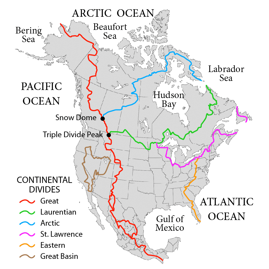
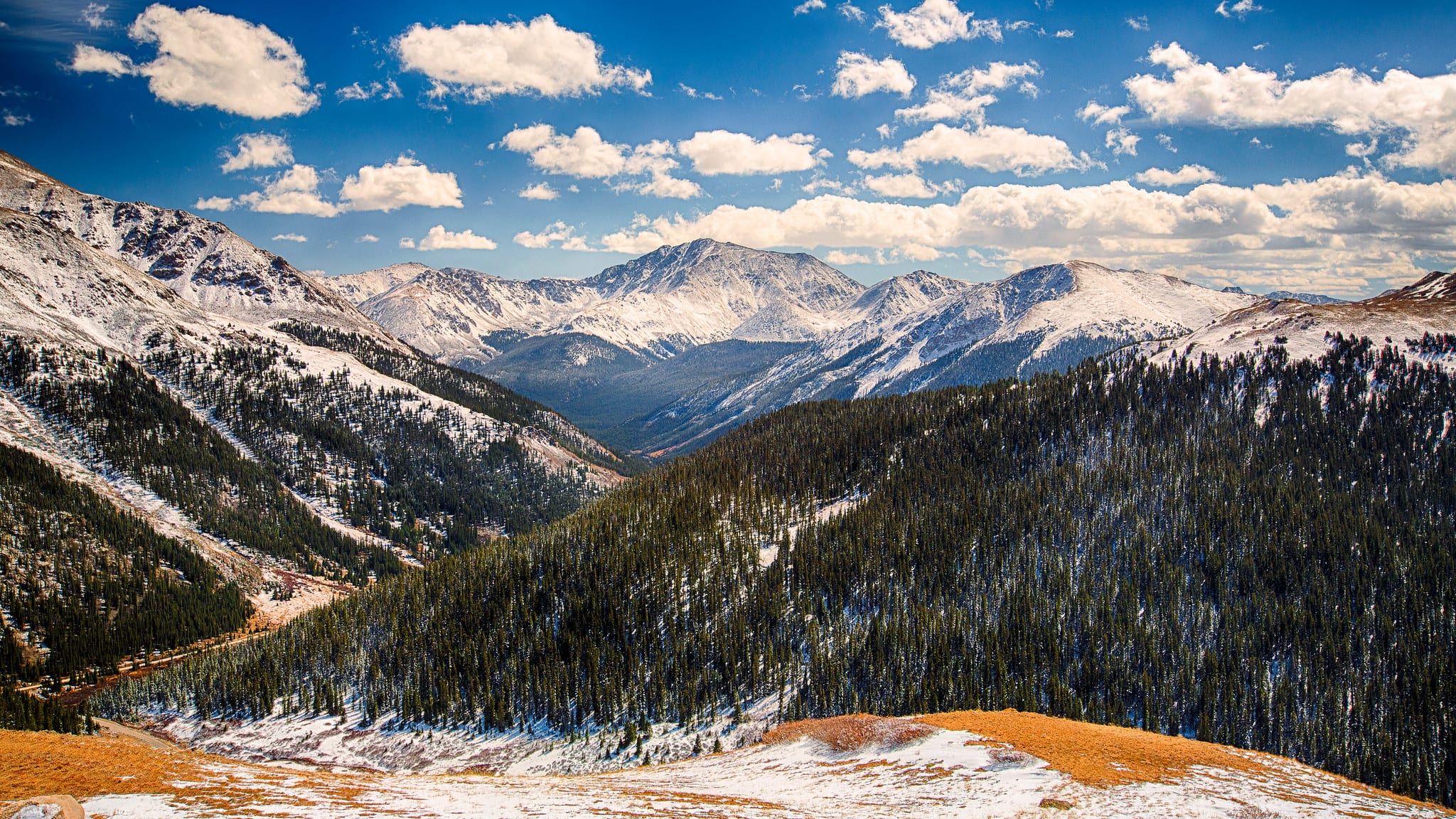
There is a continental divide found on every continent. North America, alone, has between three and five divides. The one we are most familiar with here in the United States is the Continental Divide of the Americas, or rather the Great Divide. The divide separates the water that flows to the Pacific Ocean from the water that flows to the Atlantic and Arctic Oceans, and the Gulf of Mexico.
Spanning from Cape Prince of Wales in Alaska, down to the Rockies of Colorado, and into Central America and eventually ending in the Andes of South America, the Continental Divide of the Americas is the longest continental divide in the world. In Colorado, it divides the Front Range and the Western Slope mountains.
There are two primary ways along and over the Continental Divide:
- Hiking
- Driving
Hiking the Continental Divide Scenic Trail
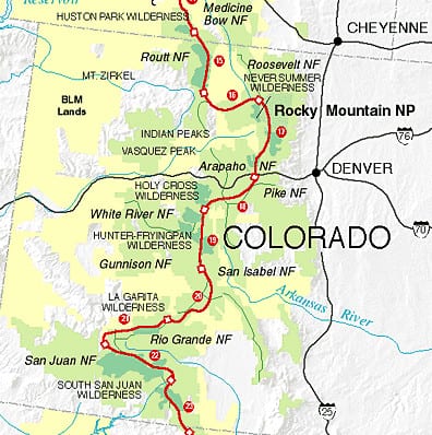
Adventure enthusiasts from all over the world seek to conquer and travel, sometimes by foot or bike, the entire length of the Great Divide along the scenic trail. The entire Continental Divide Scenic Trail (CDT) is 3,100 miles long, 740 of which reside in the state of Colorado, running through the United States from the Mexico/U.S. border to the Canada/U.S. border.
Here are a few quick facts about the CDT:
- The CDT runs 3,100 miles in total
- It takes six months to finish the average thru-hike
- The highest point of the trail is in Colorado at Grays Peak, at 14,270 feet
- The lowest point is in Waterton Lake in Montana at 4,200 feet
The 740 miles of the CDT in Colorado offer ample hiking and backpacking opportunities along the Continental Divide. The route is broken out into nine segments, each of which provides its own unique opportunity for hiking and backpacking along the Continental Divide.
CDT – Mount Zirkel Wilderness
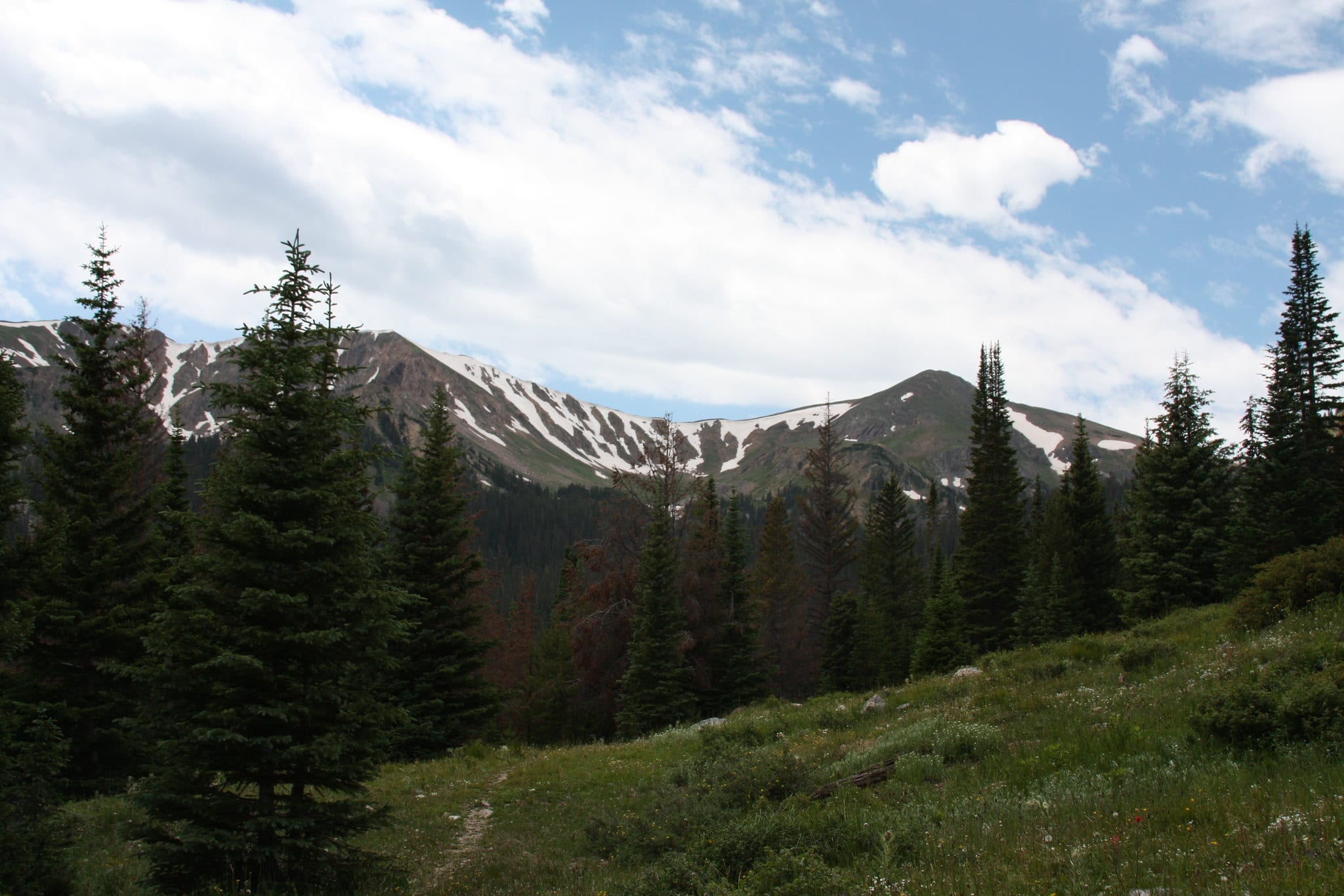
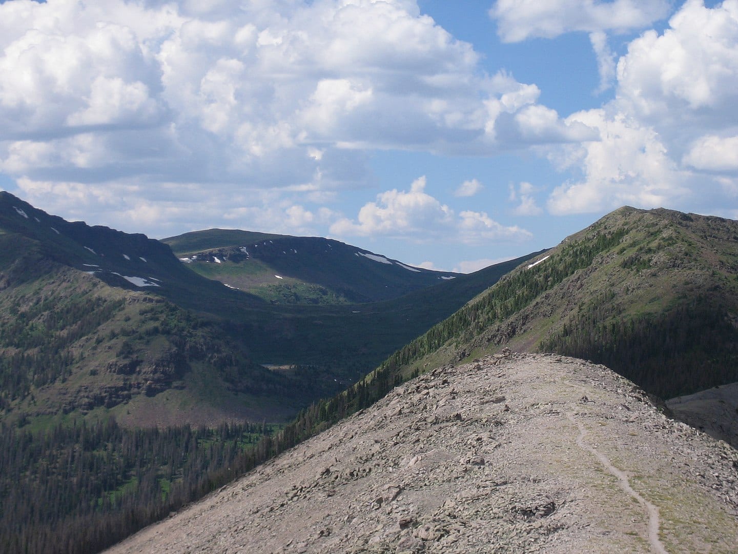
The Mount Zirkel Wilderness lies within the Routt National Forest, in northern Colorado, and is one of the prime sections of the CDT, stretching for 36 miles on the divide. Spanning over 160,000 acres, the wilderness area straddles the divide in the Park Range and the Sierra Madre. Within its confines, the wilderness offers a diverse ecosystem, 70 lakes, and 15 peaks over 12,000 feet.
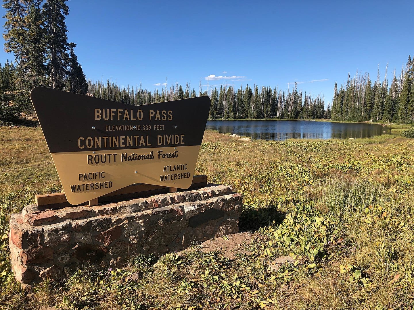
Over 150 trails provide access, with notable areas near alpine lakes along the Continental Divide, such as the section from North Lake to Buffalo Pass. This 21-mile section of the trail starts at North Lake and encounters beautiful vistas, high alpine meadows, and glistening glaciated lakes. The hike ends atop Buffalo Pass at 10,180 feet.
CDT – Rabbit Ears Range
Also, in northern Colorado, the Rabbit Ears Range is a lesser-known range in the Rockies compared to its neighbors of the Park Range and the Never Summer Range. The range runs west to east and is mainly made up of volcanic rocks. There are several trails that run throughout the range, with the CDT being the most popular.

Designated as an official CDT Gateway Community, Steamboat Springs is a great place to start your adventure along the divide. A popular backpacking route is a 15-mile point-to-point trail from Rabbit Ears Pass to Buffalo Pass. For a shorter day option, hike the section of the CDT between Fishhook and Lost Lakes.
CDT – Never Summer Range
Tucked high in the clouds of northwest Colorado, the famed Never Summer Range offers 21,000 acres of outdoor paradise. The wilderness overlaps the Continental Divide with 20 miles of trails extending up gulches and the CDT on two mountain passes – both offering incredible scenic views.
A popular backpacker loop is the Baker Gulch to Bowen Gulch route. The 19-mile loop offers plenty of chances to see moose, a thicket of flowers, and two pristine alpine lakes. At the top of the ridge of the Continental Divide, views of Mt. Cumulus, Nimbus, and Stratus can all be seen.
CDT – Front Range
The Front Range section of the CDT runs along Rocky Mountain National Park and the Indian Peaks Wilderness. Six of the 58 14ers in the state reside in the Front Range, including the highest point of the Continental Divide – Grays Peak.
Perhaps one of the most popular hikes in Colorado and along the Front Range is the Devil’s Thumb Loop. Encounter diverse terrain, elk-inhabited meadows, stunning views of the snow-capped divide, and the granite spire known as Devil’s Thumb. Rising over 12,000 feet above Devil’s Thumb Lake, this popular route is not for the faint of heart. The easiest access is via the Hessie Trailhead near Nederland.
Another well-maintained section of the CDT in the Front Range runs from Herman’s Gulch to Berthoud Pass. Almost 22 miles, point to point, this section follows the ridgeline for miles, passing by Jones Pass and ending with the last three miles above the treeline, arriving at Berthoud Pass.
CDT – Vasquez-Gore
The Vasquez-Gore section of the CDT runs through the town of Silverthorne, continuing to the village of Copper Mountain. Portions of the trails are found in Vasquez Peak, Ptarmigan Peak, and Eagles Nest wilderness areas. A 15-mile out-and-back trail at the Vasquez Peak Trailhead takes hikers to the divide once reaching the peak.
CDT – Sawatch Range
The beautiful Sawatch Range is found in central Colorado and contains the highest peak in the state, Mt. Elbert, along with 14 other 14ers. A long section of the divide is found in this mountain range, with parts of it in both forests and above the treeline.
A popular hike along the CDT is at Twin Lakes, near Leadville. Here, the Colorado Trail and the CDT run together from Tennessee Pass to Turquoise Lake and around Twin Lakes to Interlaken. From here, the CDT heads up Hope Pass, leaving the Colorado Trail behind.
Enjoy a 4-mile loop around Twin Lakes for an easy hike filled with history, scenic views, and recreational activities like fishing.
CDT – Cochetopa Hills
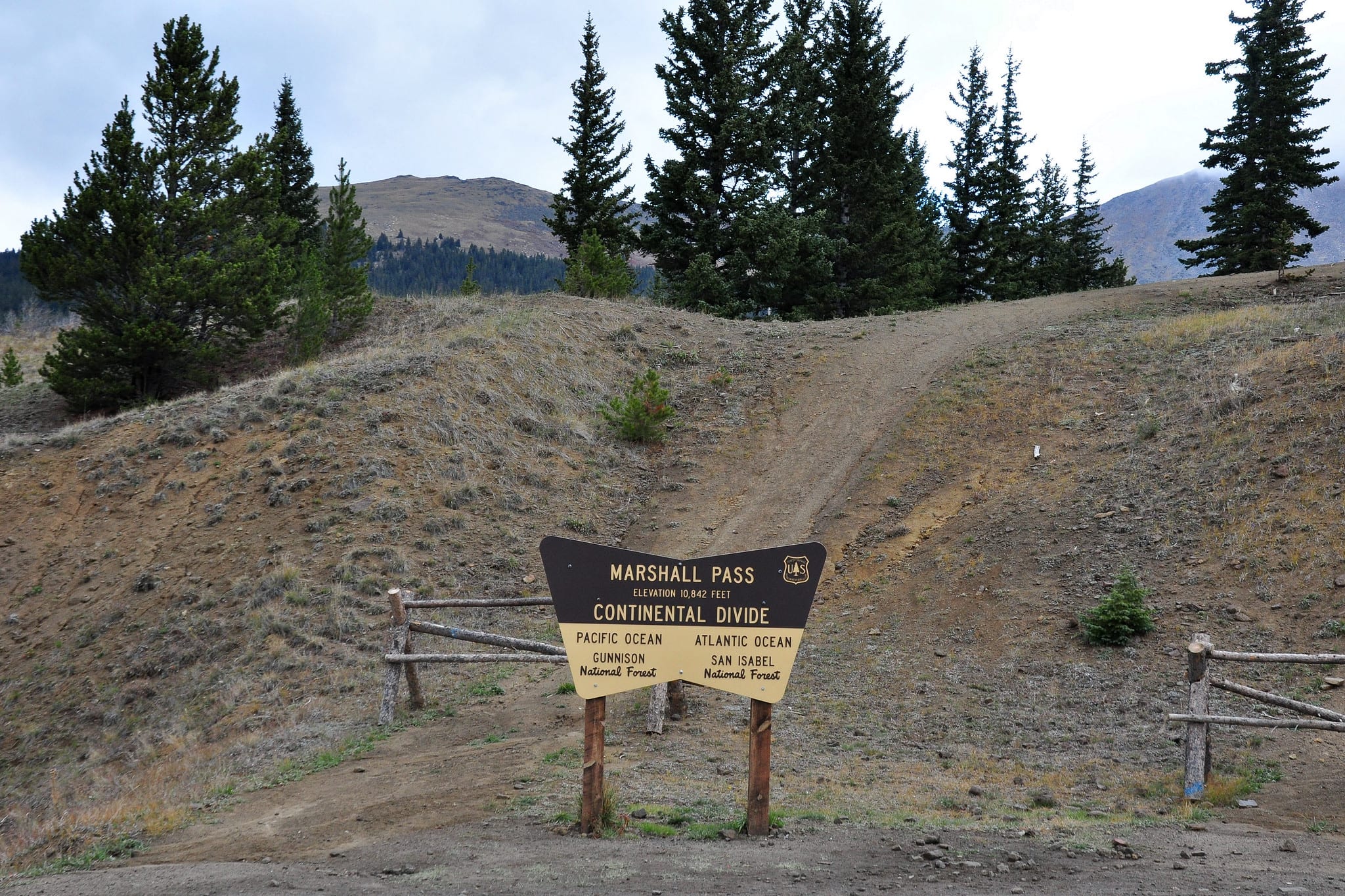
Found between the towns of Gunnison and Saguache, the Cochetopa Hills section of the CDT is a less-populated part of the trail. Plans to re-route a section of the Colorado Trail, which follows the CDT, are in place. The 22-mile Summit Trail follows the CDT and CT for its entire length. Following Lujan Creek until it ascends along the Continental Divide, it continues past Windy Peak until it meets Marshall Pass.
CDT – San Juan Mountains
Excellent for backcountry hiking, the San Juan Mountains, in southern Colorado, offer some of the best landscapes in the state, with the best found in the Weminuche Wilderness. Rugged and beautiful, the Weminuche contains 70 miles of the CDT at or above 11,000 feet.
Reach the westernmost turn of the Continental Divide at Cataract Lake. A 13-mile loop between the Weminuche and La Garita Wilderness, this section of the CDT overlooks the headwaters of the Rio Grande and offers views of the San Juan Mountains.
CDT – South San Juan Mountains
The South San Juan Mountains span 160,000+ acres that include steep slopes, high peaks and cliffs, 32 lakes, and turbulent rivers. The section of the CDT brings you to the Colorado/New Mexico border and includes Wolf Creek Pass. The divide crosses the heart of the South San Juan Wilderness for 42 miles.
As a designated Continental Divide Gateway Community, Pagosa Springs is a great jumping-off point to explore the CDT in the South San Juans. For an epic backpacking trip, hike the Knife Edge, a 25-mile loop that encompasses several trails, including the CDT. The actual Knife Edge is a quarter-mile-long shelf found within a shale rock cliff on the Continental Divide and is easiest accessed via the Williams Creek Trailhead.
Driving the Continental Divide in Colorado
Ok, so you want to see the Great Divide but don’t feel like hiking all over the state to encounter it? Many popular spots along the divide are accessible by car or a short walk.
Trail Ridge Road
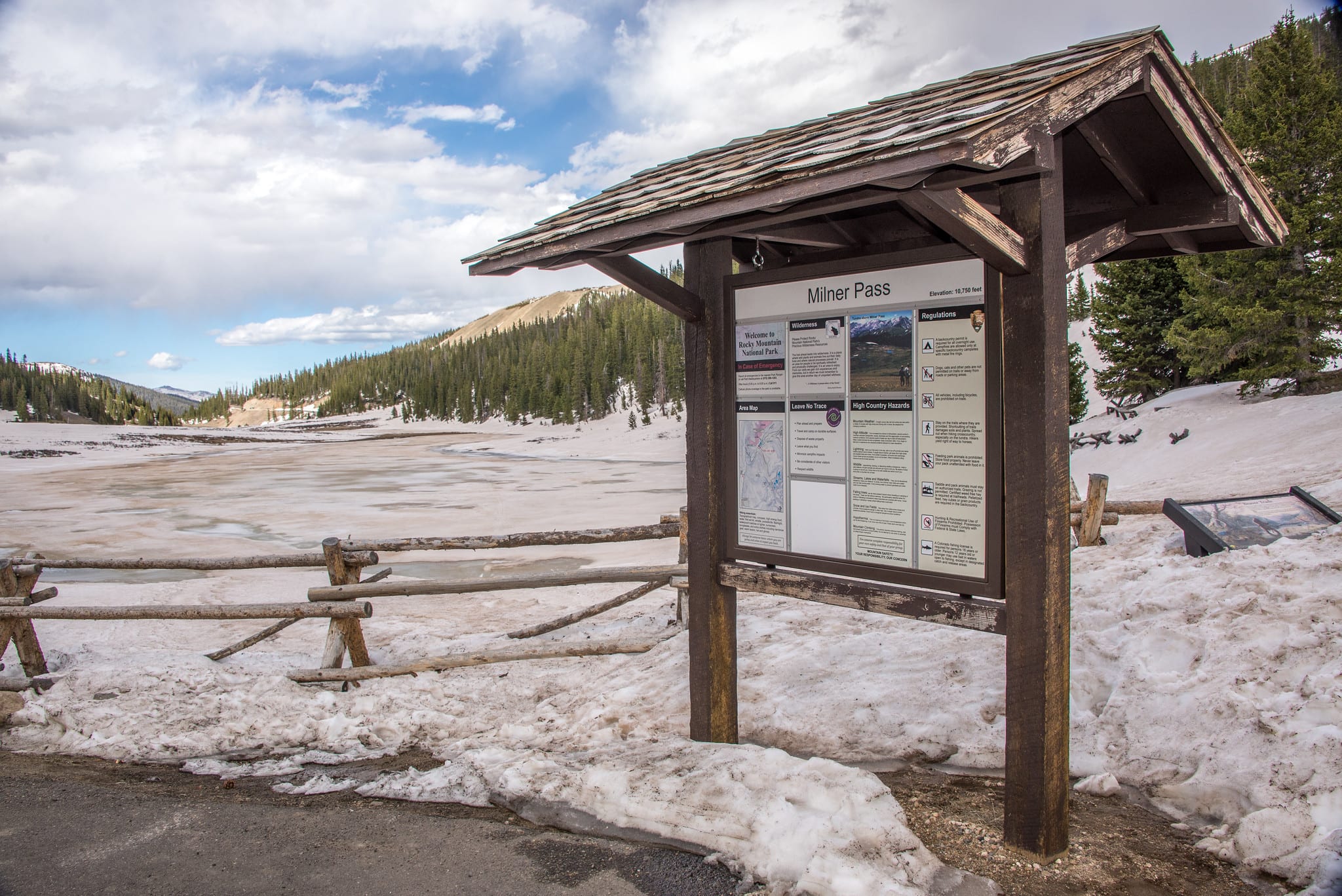
As the highest continuous paved road in the country, Trail Ridge Road is one of the best ways to experience the Continental Divide without leaving your car. Passing through Rocky Mountain National Park between Estes Park and Grand Lake, this road provides epic landscapes and never-ending mountain views.
It crosses the divide at Milner Pass at 10,759 feet. While the whole portion closes in the winter, you can drive along the beginning of Trial Ridge Road near both Estes and Grand Lake.
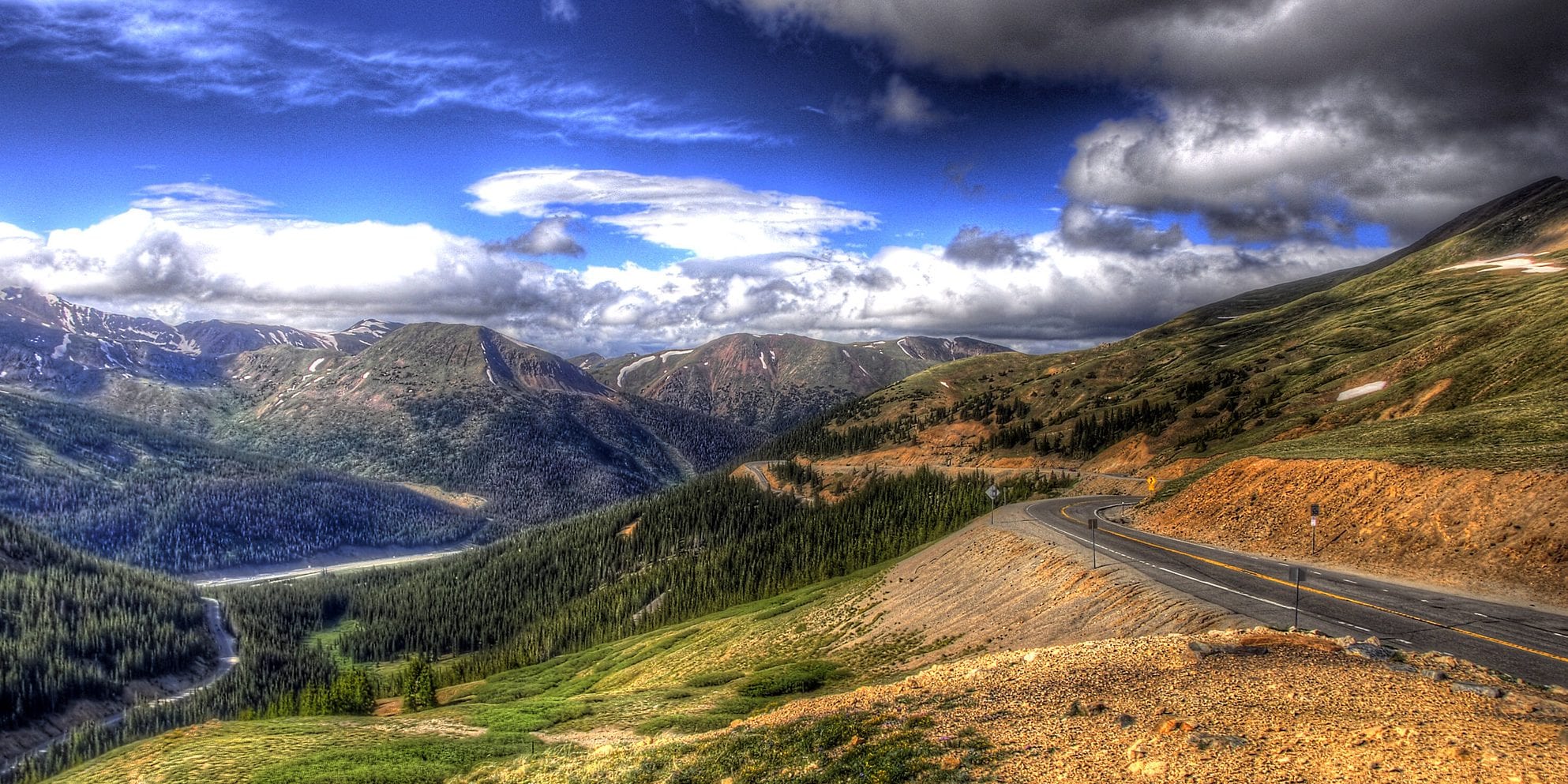
Loveland Pass
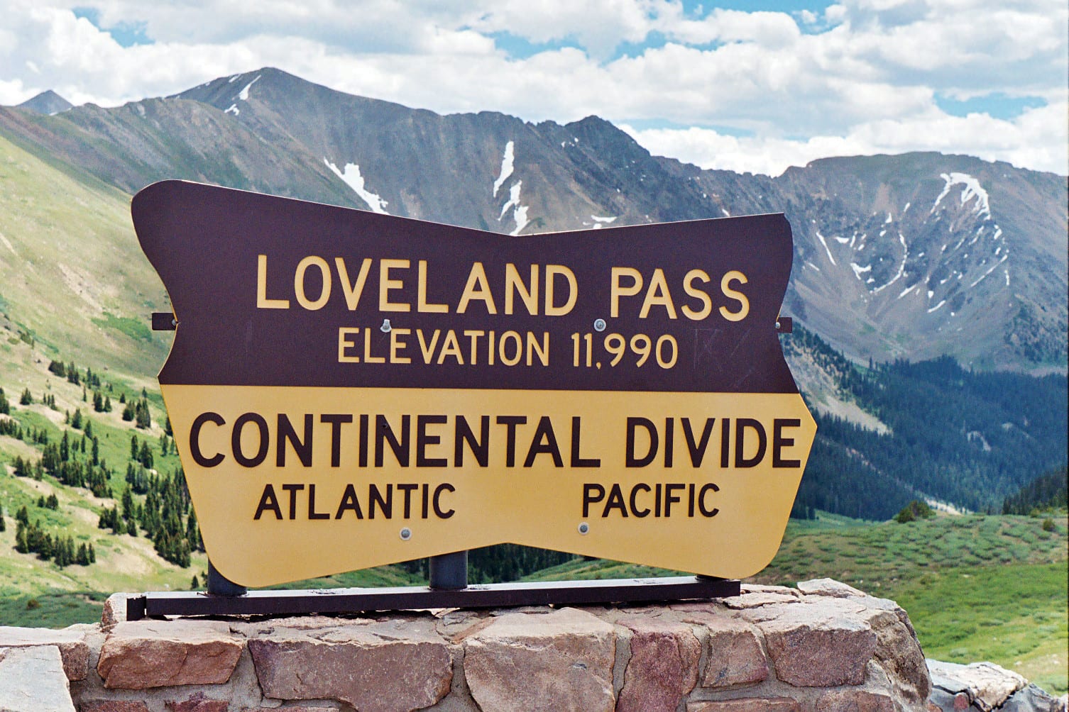
Skip the I-70 traffic between Denver and Summit County and hop on up to Loveland Pass, where it meets up with the divide at 11,900 feet. This twisted road is considered to be dangerous in winter but passable and usually open, with its hairpin turns and steep grade. You can get out the top for some photos and a short trek.
Cottonwood Pass
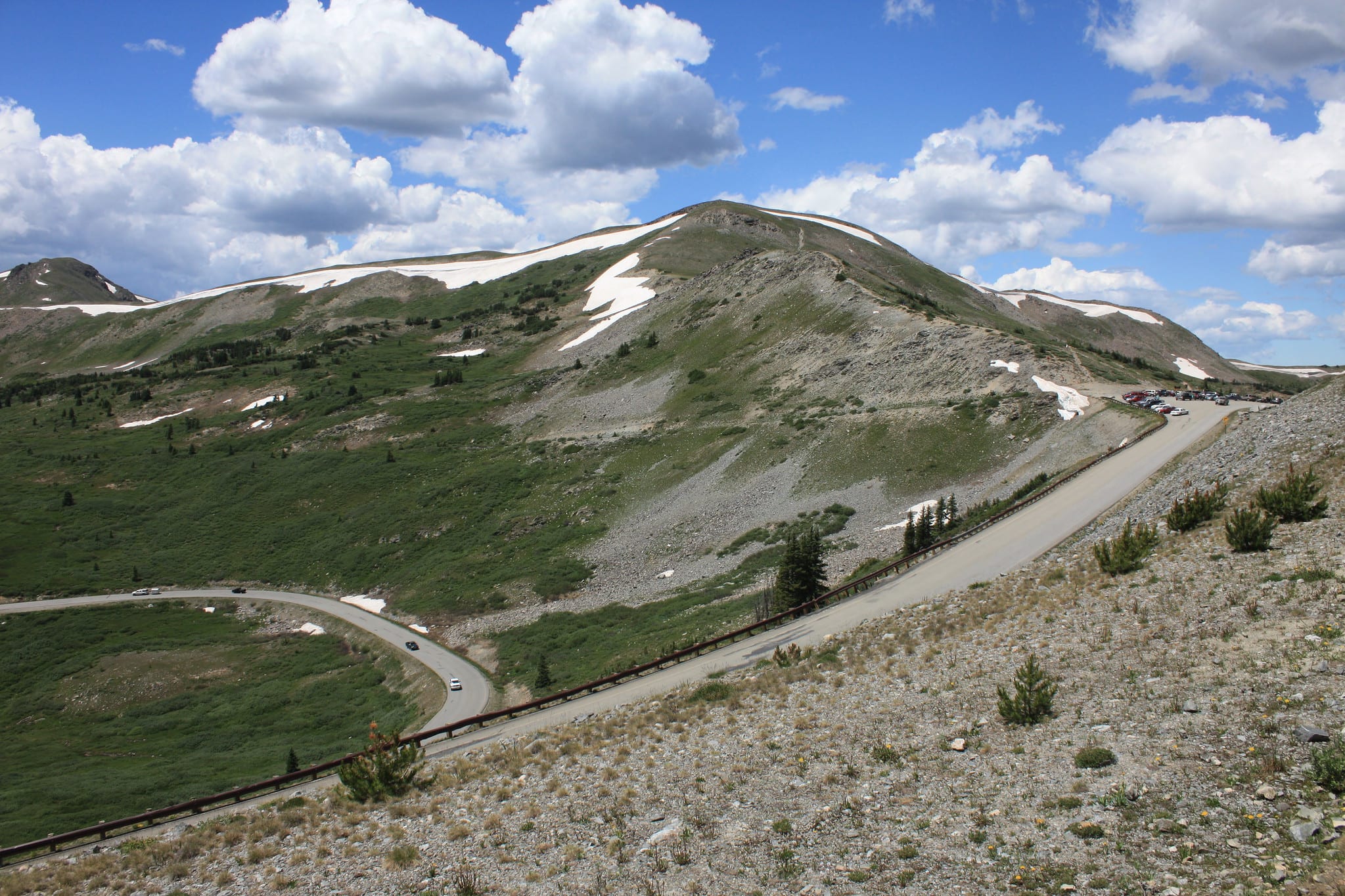
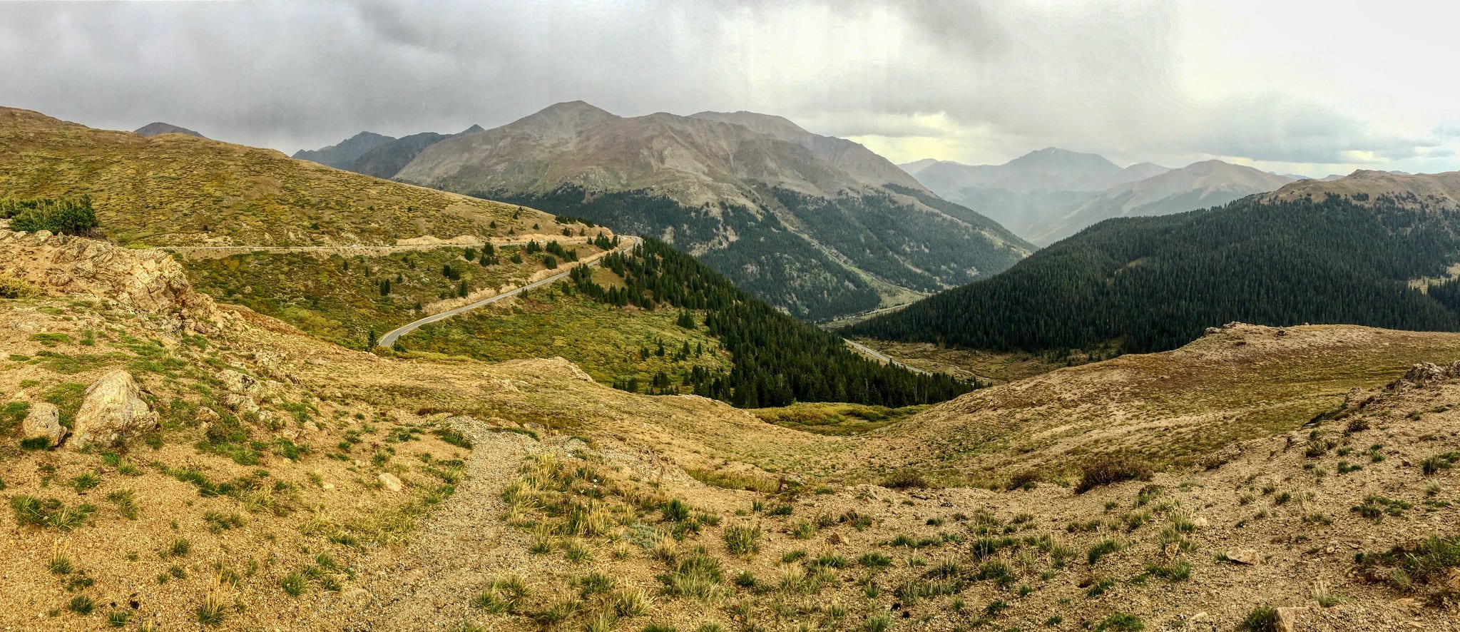
Now newly paved all the way through, Cottonwood Pass is even more accessible to travelers. Located in south-central Colorado, near Buena Vista, Cottonwood Pass reaches as high as 12,119, and at its saddle, it meets with the Continental Divide. It is the highest paved crossing of the divide. There are several parking areas for getting out to explore.
It does close in the late fall; you can check these seasonal pass closures.
Monarch Pass

Monarch Pass is located at the southern end of the Sawatch Mountain Range and crosses the Continental Divide at 11,312 feet. For a unique vantage point of the divide, hop aboard the Monarch Crest Scenic Tramway. Soaring over 12,000 feet, take in panoramic views while you straddle the divide. It’s even a known spot that accepts hiker packages for those hiking the entire length of the divide.
Independence Pass
Independence Pass is a scenic mountain pass that takes travelers from Leadville and Aspen. As the second-highest paved road crossing the Continental Divide, the pass reaches 12,095 feet. It’s a fascinating high alpine pass, with a ghost town to explore on the Aspen side. It closes before the winter.
Wolf Creek Pass
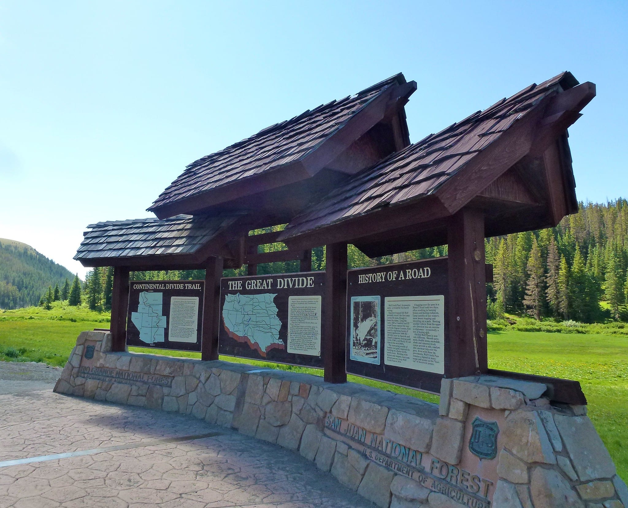
The divide crosses Wolf Creek Pass in southwestern Colorado in the San Juan Mountains, marked by a line symbolizing the division. The year-round pass is very steep and treacherous in the winter. The Lobo Overlook, at 11,760 feet, offers beautiful views of the divide. The overlook is about 1.5 miles from the road, or extends your walk to Rock Lake for an 8-mile round-trip hike.
Other Notable Drives over the Continental Divide
There is a slew of stunning mountain passes that cross the continental divide from the front range to the western slope. On top of that, there are a couple of tunnels that do so as well, namely the Eisenhower Tunnel for automobiles and the Moffat Tunnel for Amtrak trains.
Auto Mountain Passes Over Continental Divide, from north to south:
- Buffalo Pass – Walden to Steamboat Springs
- Milner Pass – along Trail Ridge Road in RMNP from Estes Park to Grand Lake
- Rabbit Ears Pass – west of Kremmling to Steamboat Springs
- Loveland Pass – Loveland Ski Area to Keystone
- Webster Pass – near Dillon (4×4 only)
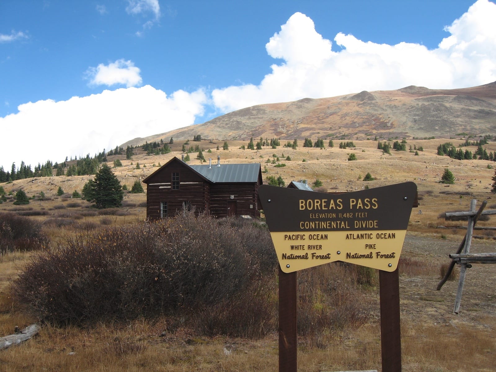
- Boreas Pass – Como to Breckenridge (4×4 recommended)
- Hoosier Pass – Alma to Breckenridge
- Independence Pass – Twin Lakes near Buena Vista to Aspen
- Cottonwood Pass – Buena Vista to Almont (near Crested Butte)
- Tincup Pass – St Elmo near Buena Vista to Tincup (near Gunnison)
- Monarch Pass – Monarch Mountain by Salida to an hour east of Gunnison
- Wolf Creek Pass – South Fork to Pagosa Springs
Whether you’re driving, hiking, or even skiing its slopes, enjoy your time on one of America’s most iconic natural landmarks.
 Colorado’s Rugged North Park Basin