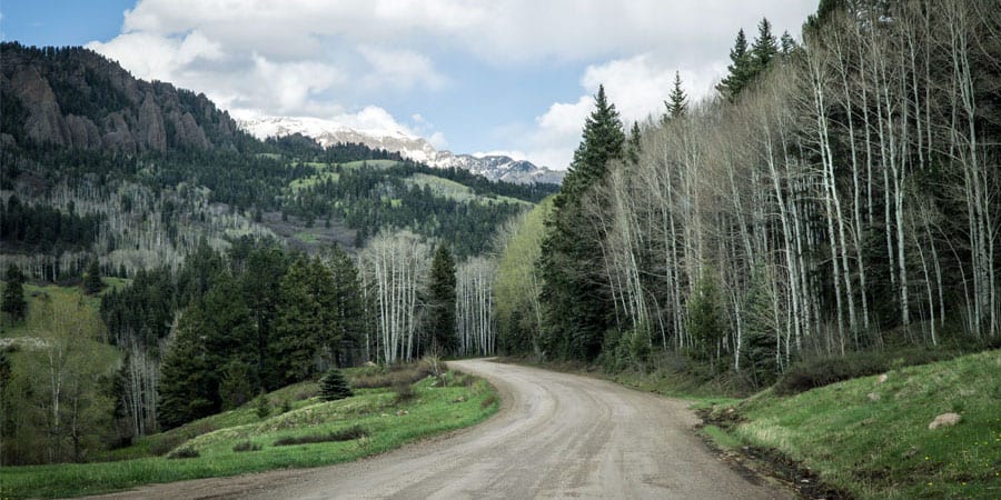
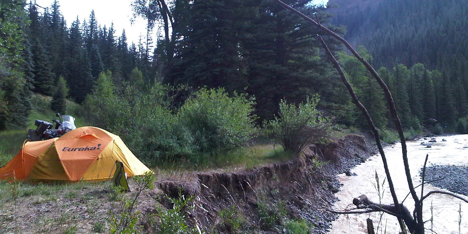
Home to the deepest geothermal hot springs aquifer in the world, Pagosa Springs is a renowned recreation destination. Each summer, Archuleta County comes alive with campers, seeking out the endless rolling mountains and evergreen forests.
The county seat and largest town in the county, Pagosa Springs is secluded on the west side of Wolf Creek Pass, surrounded by a national forest. There is camping available in all directions, with several notable campgrounds closer to town. One of the most popular places to camp is at Williams Creek Reservoir.
List of campgrounds by Pagosa Springs, CO, in order of proximity:
Camping near Pagosa Springs
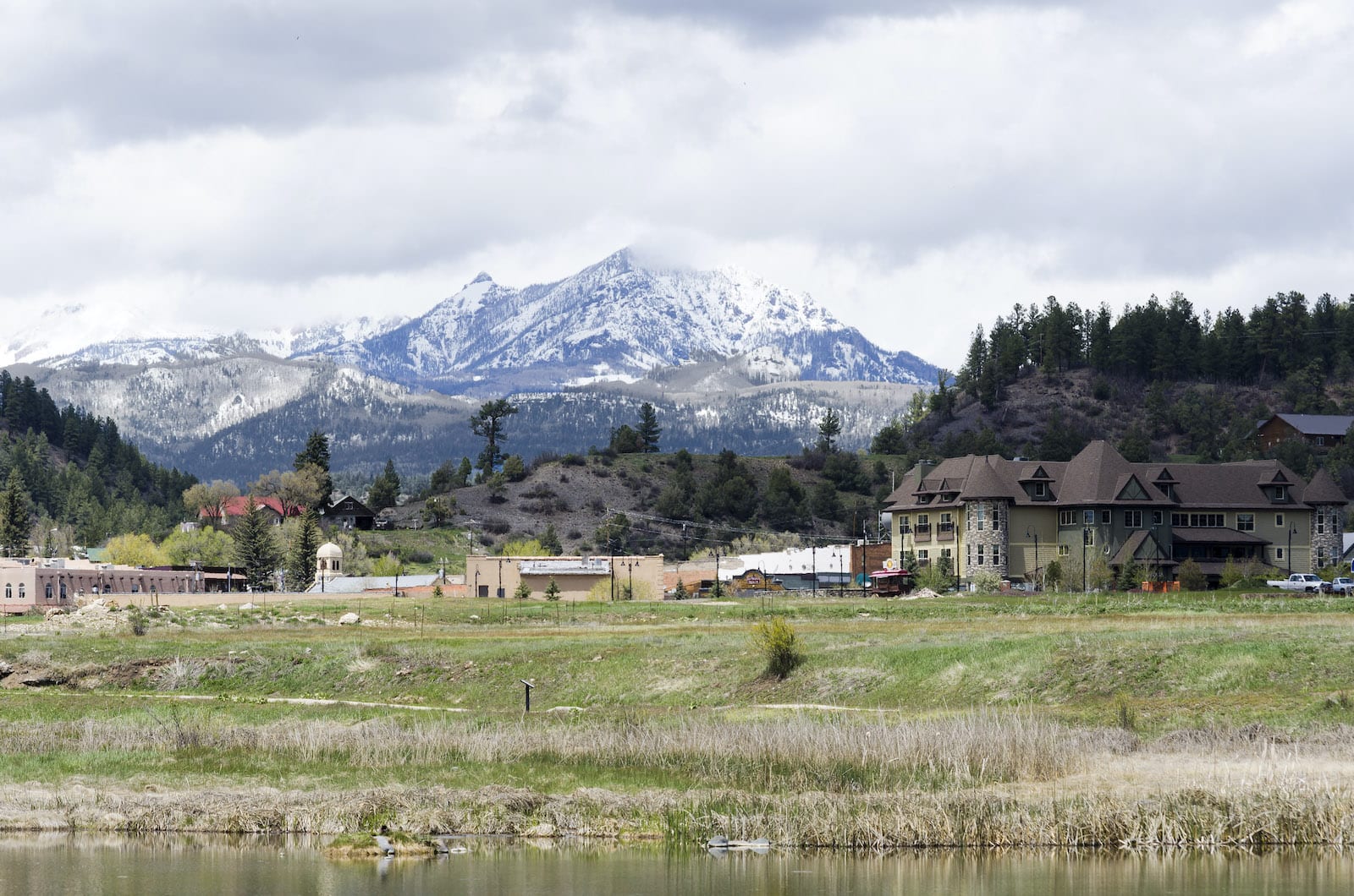
People love Pagosa Springs for its scenic San Juan Mountain views, charming downtown, and hot springs-rich waters. There are three hot springs resorts in town, plus multiple RV parks to accommodate travelers. This Archuleta County Seat is a hot spot for outdoor recreation, such as to nearby Chimney Rock National Monument.
Pagosa Pines RV Park
Located just a mile from the heart of Pagosa Springs, this campground is arranged on seven scenic acres of Ponderosa pine forest, offering ample shade during warm summer afternoons. The campground is stocked with amenities, including walking trails, dog runs, and a restroom/shower complex that is steam-cleaned each day. The location is a short distance from stores and restaurants in Pagosa Springs.
- Closest town: Pagosa Springs (1mi)
- Specs: 23 sites, water, restrooms, open May to September; reservable
- Amenities: Pull thru sites, 20/30/50 amp service, full hookups, showers, laundry, TV, Wifi
- Address: 1501 West Highway 160 #3, Pagosa Springs, CO 81147 (Map)
Pagosa Riverside Campground
A full-service RV park just two miles from downtown Pagosa Springs. This RV park is packed with amenities and has a large stock of RV parts and repair supplies in the campground store. Fishing is available at a pond inside the park or on 1200 feet of pristine, camper only, access to the San Juan River.
- Closest town: Pagosa Springs (2mi)
- Specs: 57 sites, water, restrooms, open April to November; reservable
- Amenities: Pull-through sites, 50 amp service, store, laundry, showers, RV parts, TV, Wifi
- Address: 2270 East US Highway 160, Pagosa Springs, CO 81147 (Map)
Mountain Landing Suites & RV Park
A full-service RV park, combined with suites located within walking distance of many of the shops and restaurants in Pagosa Springs. This RV park has a taste of the wilderness in its many large Ponderosa pine trees, mixed with the convenience of staying in town. Visitors enjoy the nearby hot springs, rafting on the San Juan River, hiking, or just relaxing in the mountain atmosphere.
- Closest town: Pagosa Springs (3mi)
- Specs: 49 sites, water, restroom, open April to November; reservable
- Amenities: Showers, full hookup, 30/50 amp service, WiFi, covered pavilion
- Address: 345 County Road 600, Pagosa Springs, CO 81147 (Map)
Hide-Away-RV Park
A basic RV park with all the regular amenities, set in a 20-acre wooded site covered by Ponderosa pine. This campground’s location just nine miles from Pagosa Springs sets you in the wilderness, without the isolation of long distances to settlements. It is open year-round for winter recreational enthusiasts.
- Closest town: Pagosa Springs (9mi)
- Specs: 24 sites, water, restroom, open year-round; reservable
- Amenities: Laundry, showers, horse-friendly
- Address: 8880 US Highway 160, Pagosa Springs, CO 81147 (Map)
Happy Camper RV Park
A basic grass-covered campground with some amenities. It offers deluxe campsites along a stream that runs through the camp. Open year-round, it is a good spot for winter enthusiasts looking to cross country ski, snowshoe, or ride snow machines. Its proximity just a few minutes’ drive from Pagosa Springs makes it a popular spot.
- Closest town: Pagosa Springs (9mi)
- Specs: 37 sites, water, restrooms, open year-round; reservable
- Amenities: Laundry, playground, WiFi, 70 full pull-through sites
- Address: 9260 US Highway 160, Pagosa Springs, CO 81147 (Map)
Pagosa Springs RV Park
A premier RV park set along a mountain stream in the midst of the Colorado countryside. This deluxe RV park has all the amenities, plus a gorgeous location. You can explore the countryside near the park or just rest and relax in the ample spaces surrounding many of the RV sites. There is a site with dimensions and amenities to fit the needs of every traveler at this campground.
- Closest town: Pagosa Springs (10mi)
- Specs: 50 RV sites, water, restrooms, open mid-May to mid-October; reservable
- Amenities: Full hookups, 30/50 amp service, pull-through sites, two shower facilities, laundry, ATV rentals
- Address: 10 Leisure Court, Pagosa Springs, CO 81147 (Map)
Last Resort RV Park & Campground
Nestled away from civilization this RV park has the basic amenities, plus riverside access to the Blanco River, a great spot for catching rainbow and brook trout. Kids under 16 can fish free, but 16 and older require a Colorado fishing license. There is no cell service available in the campground, but can be picked up five miles away.
- Closest town: Pagosa Springs (11mi)
- Specs: 29 RV sites, 9 tent sites, water, restroom, reservable
- Amenities: Showers, 23 full hookup sites, 6 riverside sites with electricity, Wifi
- Address: 256 County Road 339, Pagosa Springs, CO 81147 (Map)
East Fork Campground
Located on a scenic ridge above the East Fork of the San Juan River, this campground is an angler’s haven. A steep hike down the ridge finds excellent trout fishing. At 7,700 feet of elevation the summer weather is a little warmer than campgrounds higher up. Ponderosa Pines and Gambel oaks provide good shade during the warm afternoons.
- Closest town: Pagosa Springs (11mi)
- Specs: 26 sites, water, vault toilet, open May to early September; reservable sites and first-come, first-serve sites
- Amenities: Fire grates, picnic tables, maximum RV length 35 feet,
- Address: Forest Service Road 667 NF,, Pagosa Springs, CO 81147 (Map)
Turkey Springs Road Dispersed Camping
This area gets its name from the flocks of wild turkeys that live in the area. You can hear them at night just as the sun sets. Coyote howls are common night music as well, along with many mule deer. This is a primitive area, with a solid link to the undeveloped past of the Colorado wilderness. There are no amenities aside from being free. This is a pack-it-in, pack-it-out area.
- Closest town: Pagosa Springs (13mi)
- Specs: Dispersed camping, no water, no toilet, open year-round; first-come, first-serve
- Address: Forest Service Road 628, Pagosa Springs, CO, 81147 (Map)
- Directions: From Pagosa Springs take US Highway 160 West / San Juan Street 2.4 miles. Turn right onto Piedra Road, go 6.5 miles. Turn left onto Turkey Springs Road go 2.5 miles. Turkey Springs becomes US Forest Service Road 628, go 2 miles.
Blanco River Group Campground
Located on the banks of the Blanco River, this group campground offers a perfect spot for family reunions, business retreats, or just for friends to gather. Fishing and hiking are popular pastimes. Large cottonwood and Ponderosa pine trees offer shade during summer months when the weather can get hot. Rainbow and brook trout await the angler on this lightly fished section of the Blanco.
- Closest town: Pagosa Springs (15mi)
- Specs: One group campsite, water, vault toilet, open mid-May to mid-September; reservable
- Amenities: Group camping up to 100 people, four parking spurs, three picnic areas able to handle large RVs, volleyball court, fire rings
- Address: Forest Service Road 656, Pagosa Springs, CO 81147 (Map)
West Fork Campground
This is a quiet, secluded campground on Wolf Creek Pass. Located on 10 acres of pristine forest, there are open campsites and others that are well-shaded. Hiking, fishing on the West Fork of the San Juan River that flows adjacent to the campground, and nature viewing are popular activities.
- Closest town: Pagosa Springs (16mi)
- Specs: 28 sites, water, vault toilet, open May to September; reservable and first-come, first-serve sites
- Amenities: Fire grates, picnic tables, can handle larger RVs
- Address: County Road 648, Pagosa Springs, CO 81147 (Map)
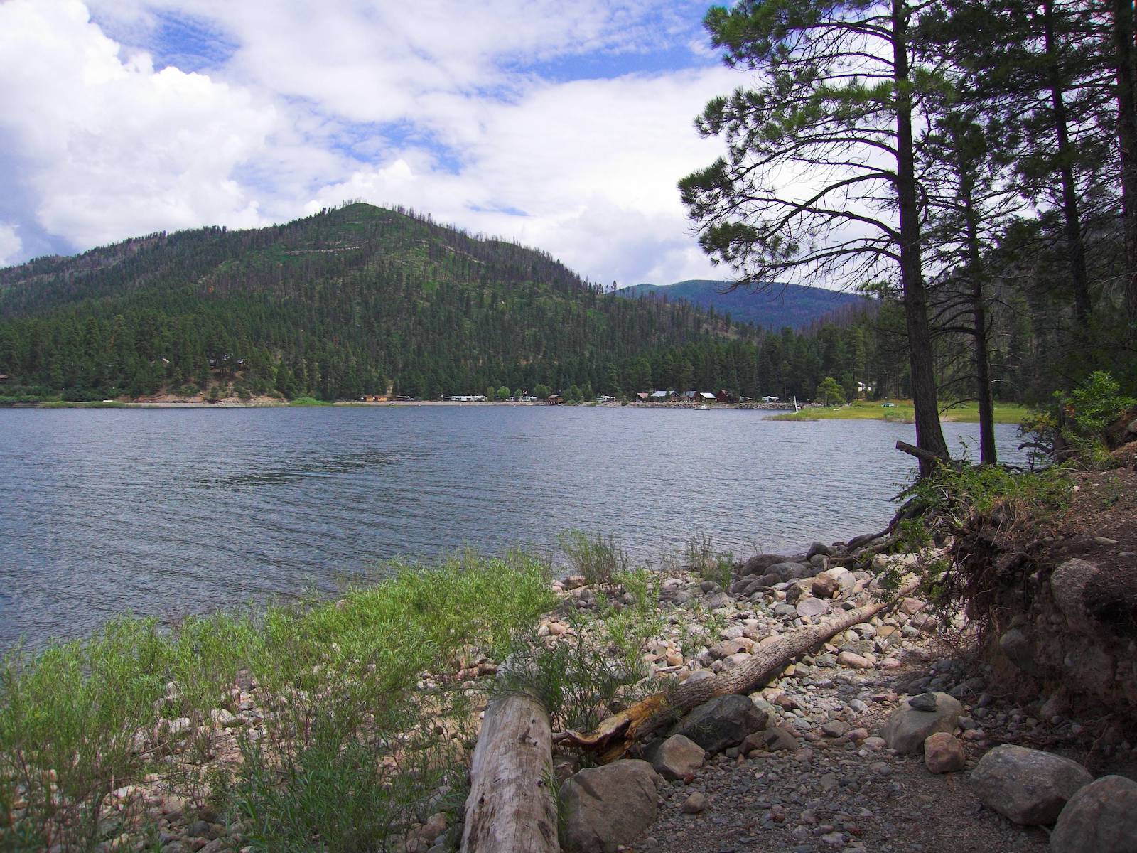
Camping near Williams Creek Reservoir
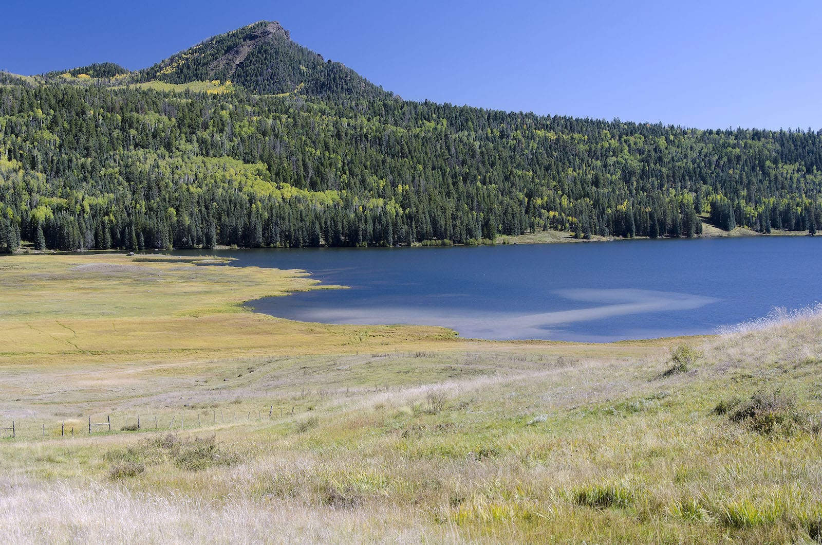
Less than an hour north of Pagosa Springs lies the Williams Creek Reservoir. It features tremendous fishing, hiking, and kayaking, common throughout the summer. The lake is stocked with trout and kokanee salmon. It’s open to motorized boating, but only wakeless, so no water skiing or sail surfboards.
There are two campgrounds near the lake, but Teal is the closest lakeside, whereas Williams Creek Campground is a short driver or 20-minute hike in. There are a range of trails in the area, some suitable for ATVs.
Sportsmans Campground
A family-owned, well-established campground that began operation in the 1960s. This RV park is packed with every conceivable amenity and offers pristine mountain views, in a cozy, shaded setting. Fishing, hiking, ATV riding, horseback riding, and other outdoor activities can quickly fill your days with recreational adventure. History rides in this historic RV park, one of the original ones established in the area, but upgraded to modern standards.
- Closest town: Pagosa Springs (20mi)
- Specs: 32 RV sites, water, restroom, open mid-May to early November; reservable
- Amenities: 20/30/50 amp service, full hookups, showers, arcade, community kitchen, laundry, general store
- Address: 2095 Taylor Lane, Pagosa Springs, CO 81147 (Map)
Bridge Campground
This basic campground offers all the basics you’d expect in wilderness camping. It is a popular spot for trout fishing with many mountain streams flowing through the area near the campground. In Septemer, elk and deer hunting are in season, with many hunters using this campground as a base camp. Hiking with access to the Weminuche Wilderness and the Piedra Area are also popuar outdoor activities.
- Closest town: Pagosa Springs (21 miles)
- Specs: 19 campsites, water, vault toilet, open May to early September; first-come, first-serve
- Amenities: large campsites, flat surface
- Address: San Juan National Forest, Forest Service Road 715, Pagosa Springs, CO 81147 (Map)
Williams Creek Campground
Situated 45 minutes north of Pagosa Springs, you’ll find a myriad of campsites, some with shade others not, and some creekside. It gets busy on the summer weekends, so plan your stay accordingly and reserve a spot in advance. Fishing is available on Williams Creek on the east side of campground. There’s a great nearby hike to Piedra Falls.
- Closest town: Pagosa Springs (25mi)
- Specs: 67 sites, 1 double site and two triple sites for large families, some with water and sewer hookups; some pull thru and back-ins for large RVs; reservable
- Amenities: Vault toilets, drinking water
- Address: Forest Service Rd 640 A, Pagosa Springs, CO 81147 (Map)
Teal Campground
This prized campground is lakeside to Williams Creek Reservoir, therefore receives heavy use from Memorial to Labor Day weekends. Arrive early on summer weekends. Most of the campground is open and sunny, whereas the aforementioned Williams Creek CG has some shade. There are a limited number of campsites that can accommodate large RVs. Lighter boats can be carried to the lake, bu the official boat ramp lies 1/2 mile to the north.
- Closest town: Pagosa Springs (26mi)
- Specs: 16 sites; first-come, first-serve
- Amenities: Potable water, vault toilets, trash service, no showers
- Address: Forest Rd 640, Pagosa Springs, CO 81147 (Map)
FREE – Dispersed – Piedra River Road: Turkey Spring Road/CR 146
- Closest town: Pagosa Springs (9+mi)
- Address: Co Rd 146, Pagosa Springs, CO 81147 (Map)
- Directions: Less than twenty minutes from Pagosa Springs and you’ll reach free primitive camping in the San Juan Nation Forest. You’ll take Highway 160 West 2.5 miles from Pagosa Springs. Take a right onto Piedra Rd and go 6.5 miles. Make a left onto Turkey Spring Road/County Roat 146. It’s FSR 129 on this MVUP map. This is also a Trailhead for Coyote Hill and Turkey Springs trails. Drive down Turkey Spring with dispersed camping permitted alongside preexisting campsites. Continue looking as it becomes County Road 146 or make another left onto FSR 923. (Directions)
FREE – Dispersed – Piedra River Road: FSR 631/633
- Closest town: Pagosa Springs (18+mi)
- Address: Piedra River Rd/FSR 631, Pagosa Springs, CO 81147
- Directions: Head towards Williams Creek Reservoir. Piedra River becomes Forest Service Road 631. When there is a fork to take right toward 633, this is where dispersed camping starts. You can take either one for dispersed camping, with 631 leading to 640 and the lake. Camping is on permitted along 631 before the lake. You won’t find dispersed camping on the road beside the lake. There are two paid campgrounds by the lake.
Camping near Chimney Rock
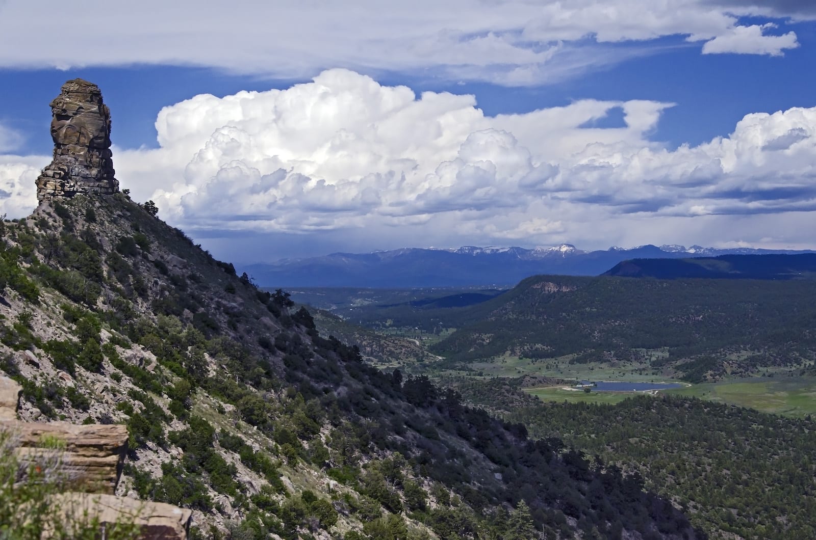
One of Colorado’s marvelous national monuments, Chimney Rock is a rewarding stop while in town. It holds Ancient Puebloan ruins, including a great kiva. Schedule a guided tour to make the most of your trip. Chimney Rock National Monument is located thirty minutes west of downtown Pagosa Springs, so these following campgrounds put you conveniently halfway to Durango.
Lake Capote Campground
This unique campground is located on the historic Ute Indian Reservation. No alcohol is allowed on this campground. With an emphasis on tent campers, this has all the amenities an RV camper can expect as well. Enjoy a bit of history along with the wonders of the Colorado wilderness at this spacious, shaded campground.
- Closest town: Pagosa Springs (17mi)
- Specs: 40 sites, water, restrooms, open April to October; reservable
- Amenities: 10 RV sites, 30 tent sites, showers, dump station, 30 amp service
- Address: Colorado Highway 151, Pagosa Springs, CO 81147 (Map)
Ute Campground
Shade is a premium in the summertime at this campground. It gets hot here during July and August. The campground offers one group campsite and offers excellent views of the nearby Chimney Rock Archaeological Area. Ponderosa pines offer shade on the gradual slopes of the south-facing campground.
- Closest town: Pagosa Springs (17mi)
- Specs: 26 sites, water, vault toilet, open May to late September; first-come, first-serve
- Amenities: Fire rings, picnic tables, group campsite
- Address: San Juan National Forest, US Highway160, Pagosa Springs, CO 81147 (Map)
Lower Piedra Campground
A basic campground that offers fishing, hiking, and lots of shade below the towering Ponderosa pines. Adjacent to the Piedra River which is a very popular fishing spot for campers and locals alike, there are still good catches taken despite the heavy number of anglers. Dispersed camping is available near the area but is marked and must be at least 100 yards from the nearest established campsite.
- Closest town: Pagosa Springs (24mi)
- Specs: 17 sites, water, vault toilet, open May to September; first-come, first-serve
- Amenities: Picnic tables, fire grates
- Address: Forest Service Road 621, Bayfield, CO 81122 (Map)
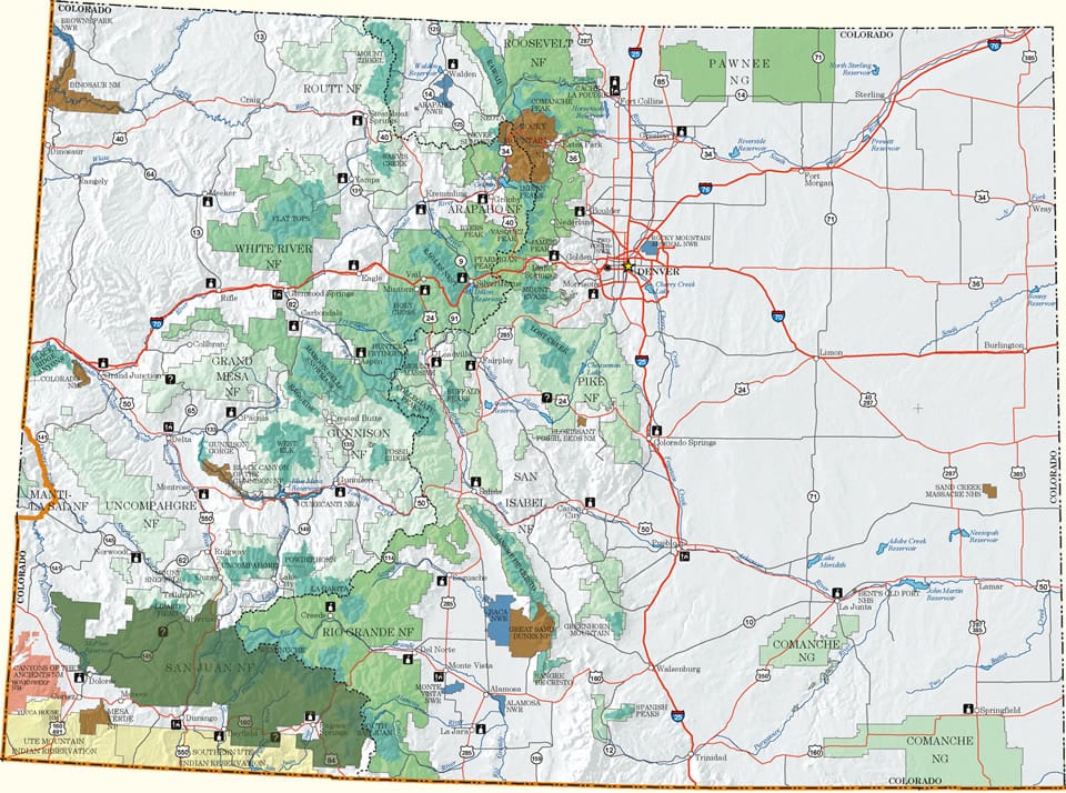
Additional Dispersed Camping in San Juan NF
The massive San Juan National Forests engulf Pagosa Springs on all sides. Within it are a range of managed campgrounds, most open from Memorial Day to Labor Day or beyond, weather pending. Whatever recreation you’re looking to do, from hiking and biking to boating and climbing, the San Juan National Forest offers it.
Dispersed Camping – If you know where to look, you can find free dispersed camping within the San Juan N.F. When using these primitive campsites, always use a preexisting campsite, as evidenced by a fire ring rock setup. There are certain forest service roads where camping is permitted in the forest alongside them, providing easy car camping opportunities.
Look for pull-offs where you can park and check to see if a preexisting site exists. Look at the Motor Vehicle Use Maps below for the Pagosa Springs area. Dispersed camping is marked by a couple dots on either side of the road. We’ll list a few spots in the writeup below, otherwise scope your gem.
Map: San Juan (shown in dark green) (.jpg)
Motor Vehicle Use Maps: Large, PDFs from the USFS. They show forest service roads and where dispersed camping is permitted.
- Columbine – Silverton, Durango, Bayfield
- Columbine – Table – Silverton, Durango, Bayfield
- Columbine – Beaver Meadows/Sauls Creek – Bayfield
- Columbine – HD Mountains & Lakes – Bayfield
- Columbine – Lakes Area – Bayfield, Durango
- Mancos-Cortez – Dolores, Cortez, Mancos
- Pagosa – Pagosa Springs
Consider Durango or South Fork
A little over an hour west of Pagosa sits the lovely community of Durango. It’s much larger than Pagosa, so it’s perfect for those looking for more a city feel. Before you reach town, you’ll pass Bayfield in about forty-five minutes, there you can head north for lakeside camping by Vallecito Reservoir. It’ll put you within twenty minutes of Durango’s historic district.
On the opposite side of Wolf Creek Pass from Pagosa rests the quiet village of South Fork. It’s nice as a gateway to a multitude of attractions, including the Silver Thread Byway to the north, and the San Luis Valley just east of town. There are a lot of campgrounds near South Fork to choose from, especially those accommodating RVs.
That’s a roundup of some of the best camping in Pagosa Springs. Remember to leave no trace when camping. Safe travels!
 Camping near Pueblo and its Reservoir