When Colorado’s famous snow melts in the spring, it fuels the state’s gorgeous rivers. This large Western state is home to more than 107,000 miles of rivers, most of which arise in the state but some of which only pass through.
From big desert rivers flowing across high plateaus and through red rock canyons to clear, sparkling streams rushing through the mountains, there is something for every river lover here. They fill the major lakes and reservoirs. Colorado has hundreds of named waterways—many are just small creeks but some are substantial; seventeen drain areas larger than 3,900 square miles (roughly the size of Delaware and Rhode Island combined).
As one of the driest states in the nation, water has always played an important role in Colorado’s history, settlement, and economy. But Colorado also provides water to more than a dozen states and portions of Mexico, and billions of dollars of agriculture, shipping, and recreation from California to the Mississippi River rely on water that originates in Colorado’s Rocky Mountains.
The Longest Rivers in Colorado and Beyond
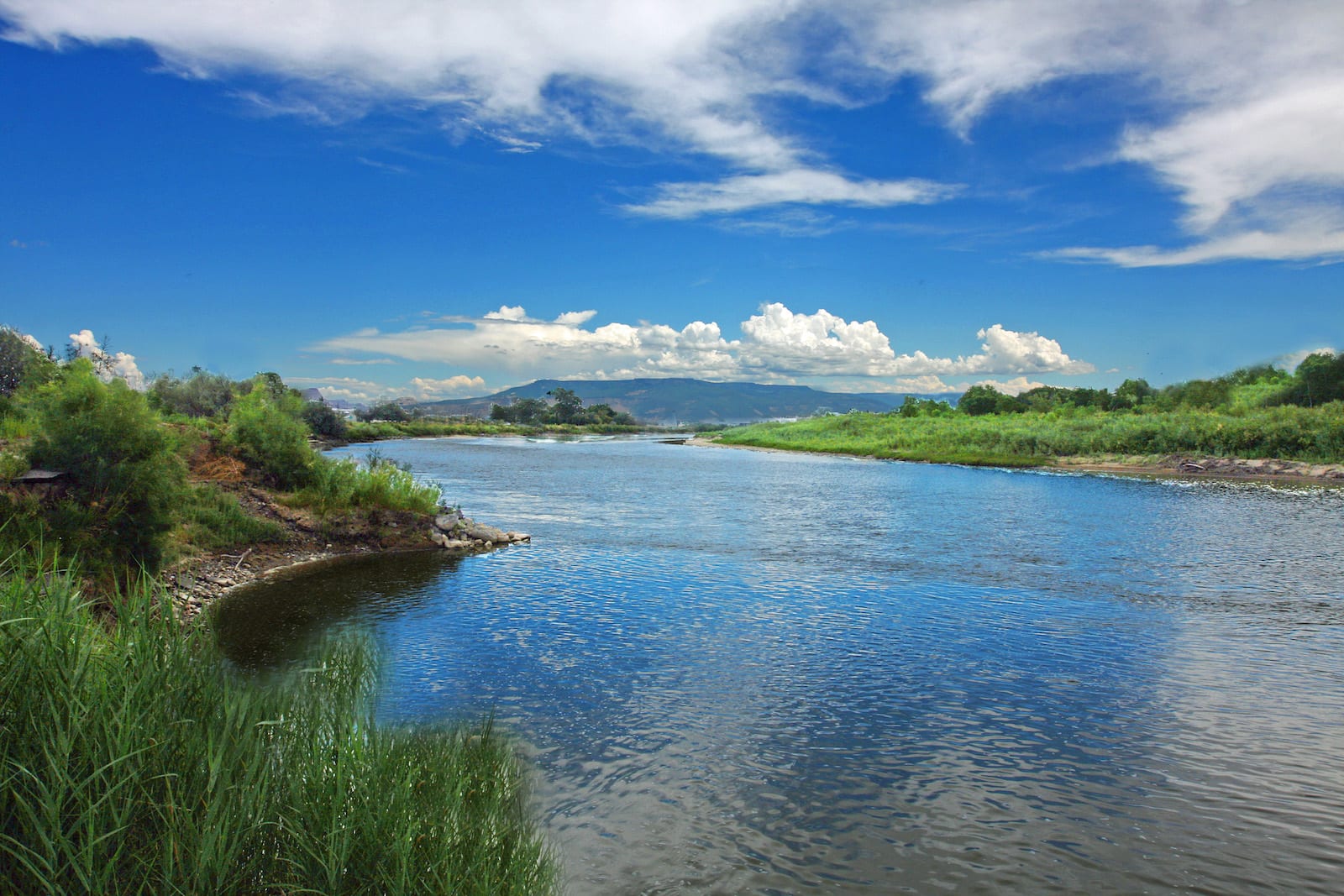
This refers to the length of the entire river, not just the section in Colorado. And because river channels change a lot, these numbers are approximate.
- Rio Grande River ~ 1900 miles
- Arkansas River ~ 1470 miles
- Colorado River ~ 1450 miles
- Canadian River ~ 900 miles
- Green River ~ 730 miles
- North Platte River ~ 720 miles
- Cimarron River ~ 700 miles
- Smoky Hill River ~ 575 miles
- South Platte River ~ 440 miles
- San Juan River ~ 385 miles
- Yampa River ~ 250 miles
- Dolores River ~ 241 miles
- White River ~ 195 miles
- Gunnison River ~ 180 miles
- Cache La Poudre River ~ 126 miles
- Animas River ~ 125 miles
- Mancos River ~ 85 miles
- Uncompahgre River ~ 75 miles
- San Miguel River ~ 72 miles
- Roaring Fork River ~ 70 miles
- Clear Creek ~ 66 miles
- Blue River ~ 65 miles
Pacific Ocean—Western Slope | Atlantic Ocean—Eastern Slope
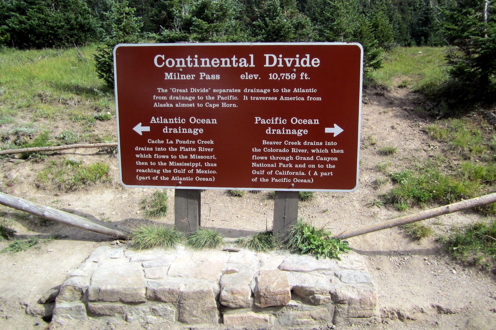
Hydrologists divide the state’s rivers into those that arise in the Rocky Mountains and flow west ultimately to the Gulf of California (the Western Slope rivers), and those that start on the eastern side of the Continental Divide mountain range and flow through the Front Range ultimately to the Gulf of Mexico (the Eastern Slope rivers).
Although roughly 80 percent of Colorado’s water comes from the Western Slope, the majority of the population lives along the Front Range. This means that a lot of Western Slope water is diverted to the Front Range to support its population. Given this fact, it makes sense to start with the river that provides so much of that water, the one that gave the state its name: the Colorado River.
Although most of the water comes off the Western Slope, six of the ten longest rivers in the state flow off the eastern side of the mountains, and many of these have played a major role in Colorado’s (and the country’s) history and economy.
The western slope of Colorado has its share of major rivers. Let’s start with the most iconic one in the state, which goes by the same name.
Colorado River — Pacific Ocean
- Name: means “red river”
- Length: 1450 miles
- Headwaters: Never Summer Mountains in Rocky Mountain National Park
- Mouth: Gulf of California
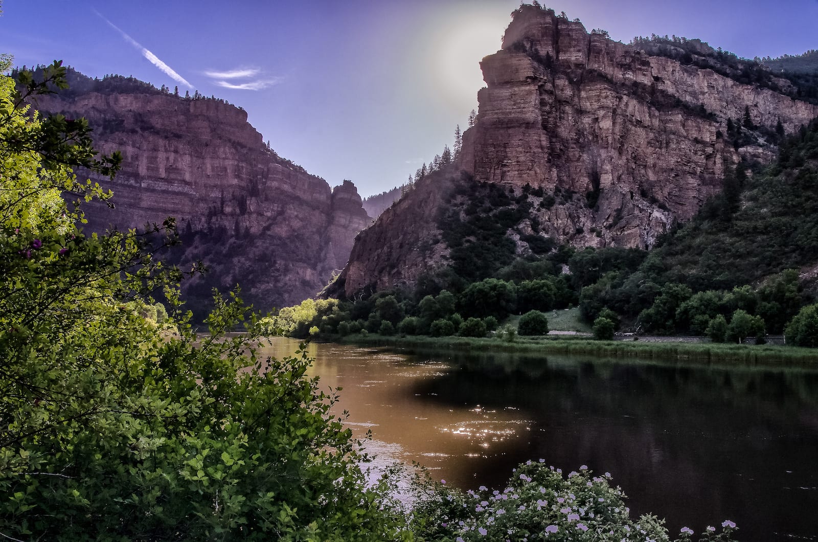
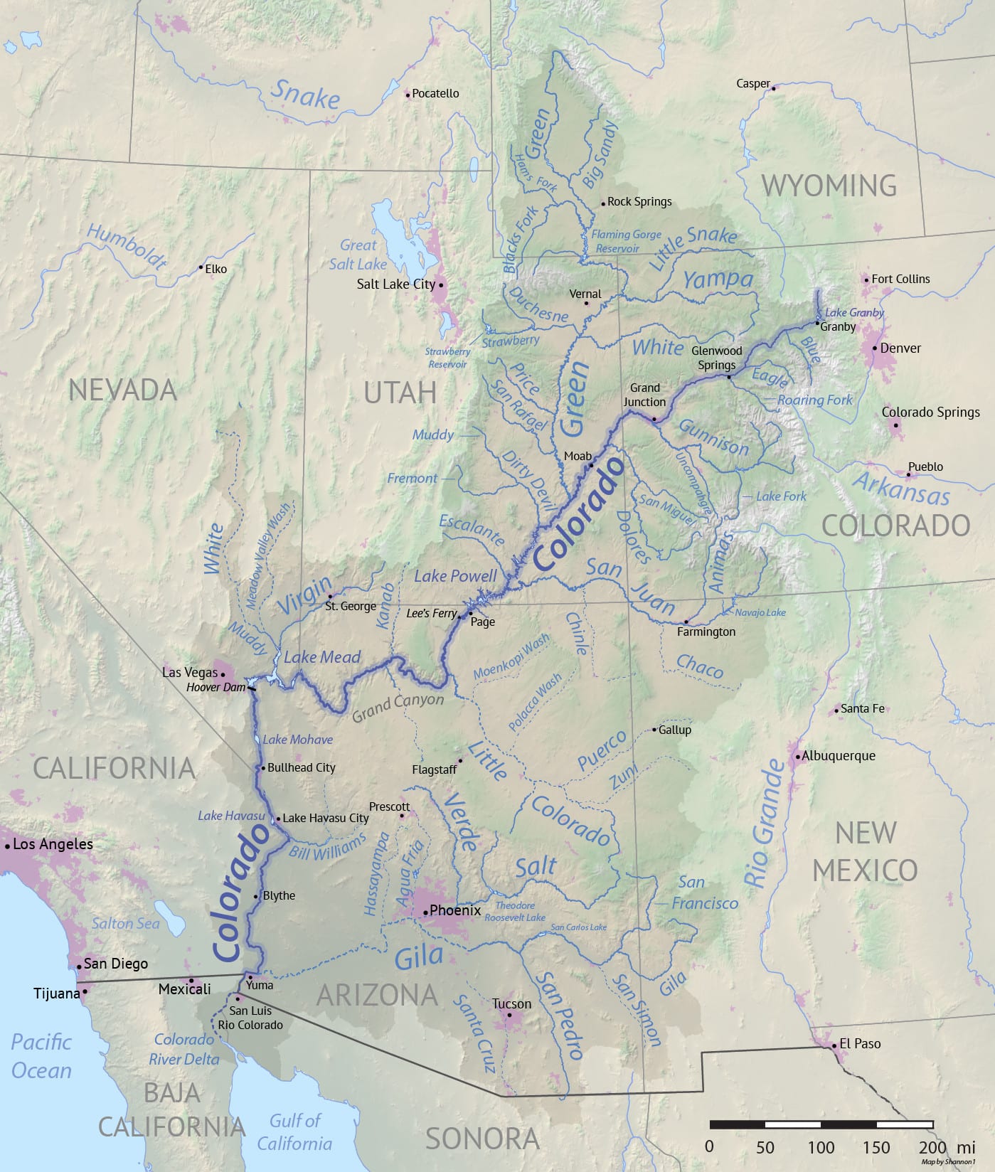
From a tiny trickle beginning in a sodden bogland near Poudre Pass in the Never Summer Wilderness, the Colorado River flows south and then west, crossing Colorado, Utah, and Arizona and growing in size until it becomes the powerful desert river capable of carving the Grand Canyon.
In Colorado, the river is mostly a clear mountain stream, although just before it enters Utah the river begins to look more like the sediment-filled canyon carver it will become downstream. It’s the red silt for which the river is famous that gave the river its name.
The Colorado River was named in the early 1700s by Eusebio Francisco Kino, a Jesuit priest who explored southern Arizona and northern Mexico. The section of the river from its headwaters to its confluence with the Green River in Utah was originally called the Grand River.
Through a clever bit of political wrangling in 1921, Colorado Congressman Edward Taylor convinced the United States Congress to change the name of the portion of the river between its headwaters and the confluence from the Grand River to the Colorado River, reasoning that the section of the river within the state should have the same name as the state.
The Colorado River began to supply the cities of the Front Range with water in 1890 when the Grand Ditch was built to divert water into Long Draw Reservoir. Since then several enormous dams and reservoirs, pipelines, and aqueducts have been built along the Colorado’s length.
In Colorado, the largest dams and reservoirs on the river are the Grand Dam and Lake Granby. These were built in the 1930s to provide water to the Front Range via the Alva B. Adams Tunnel, which carries water through the Rocky Mountains to the Eastern Slope.
Within the state, the Colorado River runs from high alpine to plateau desert lands, and along the way, there are exceptional rafting and kayaking opportunities. Gore and Glenwood canyons offer technical whitewater, and Ruby and Horsethief canyons give the boater a chance to experience the high desert canyonlands. The upper stretches of the river near Kremmling are also known for excellent fly fishing.
The Colorado River has dozens of tributaries on the Western Slope; some are major rivers in their own right. Its biggest tributary is the Green River (which is longer and drains a larger area). Some of the notable Colorado towns it crosses in its journey, east to west, include Kremmling, Glenwood Springs, Rifle, Palisade, Grand Junction, and Fruita.
Green River — Pacific Ocean
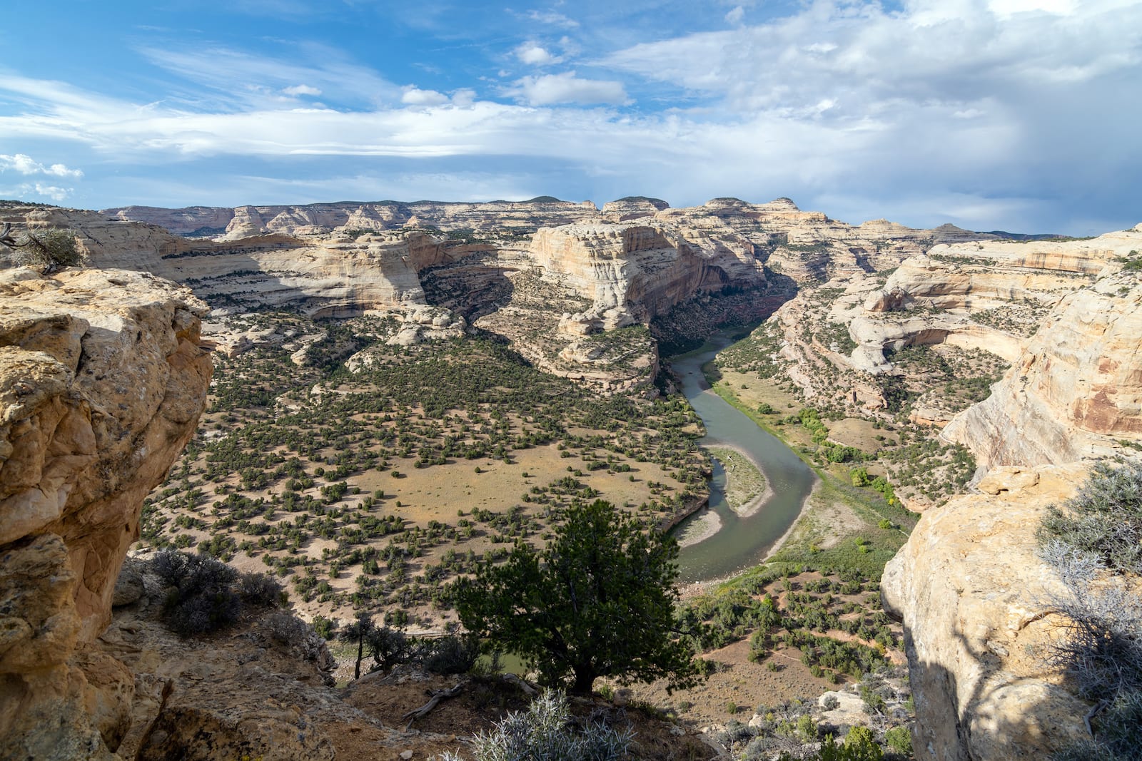
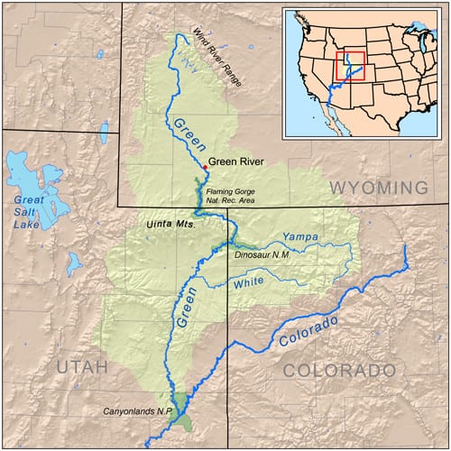
- Name: for the greenish-gray silt that fills the river in its lower stretches
- Length: 730 miles
- Headwaters: Wind River Mountains in Wyoming
- Mouth: Colorado River in Canyonlands National Park
The Green dips briefly into the state of Colorado at Dinosaur National Monument, so a rafting trip through the Canyon of Lodore will take you through the Uinta Mountains from Colorado into Utah. The Green River is famous for being the river that carried John Wesley Powell and his men on their 1869 and 1871 expeditions to explore the “terra incognita” of the Colorado Plateau.
Yampa River — Pacific Ocean
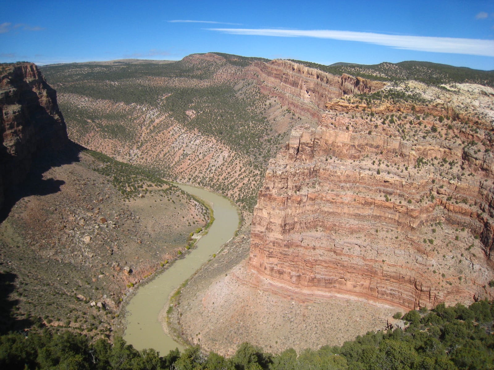
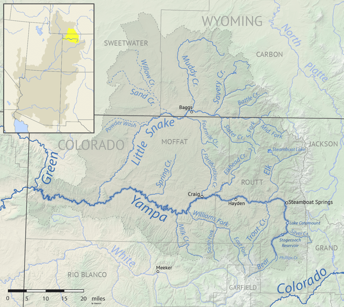
- Name: comes from the Snake Indian word for the edible root of the Perideridia plant
- Length: 250 miles
- Headwaters: Park Range
- Mouth: Green River in Dinosaur National Monument
The Yampa River is the last major tributary in the Colorado system to remain essentially undammed (except for the small Stagecoach Dam), so it retains much of its original wild character in terms of seasonal flows. The Yampa flows as a clear mountain stream through Steamboat Springs, where kayakers play in the energetic waters and the Yampa River Festival occurs annually in early June.
The Yampa River Preserve lies west of Steamboat Springs and protects a very rare riparian forest that was once much more common in the Upper Colorado River Basin but has disappeared due to damming and diversion of the rivers. The Yampa’s silty and seasonally warm waters are also some of the last remaining spawning grounds and refuge for native fish that have essentially disappeared from other rivers in the region.
By the time the Yampa reaches Dinosaur National Monument to join the Green River at Echo Park, it has grown to a sizeable river. The Yampa and the Green were at the center of a huge environmental battle in the mid-1950s, fighting a proposed dam that would have submerged Echo Park and the confluence of the two rivers.
The publicity around this fight made rafting the Yampa through the national monument extremely popular and it’s still one of the premier river trips in the Southwest; because the river has such a short season, it is considered a prime catch to obtain a permit.
White River — Pacific Ocean
- Name: was originally Rio Blanco
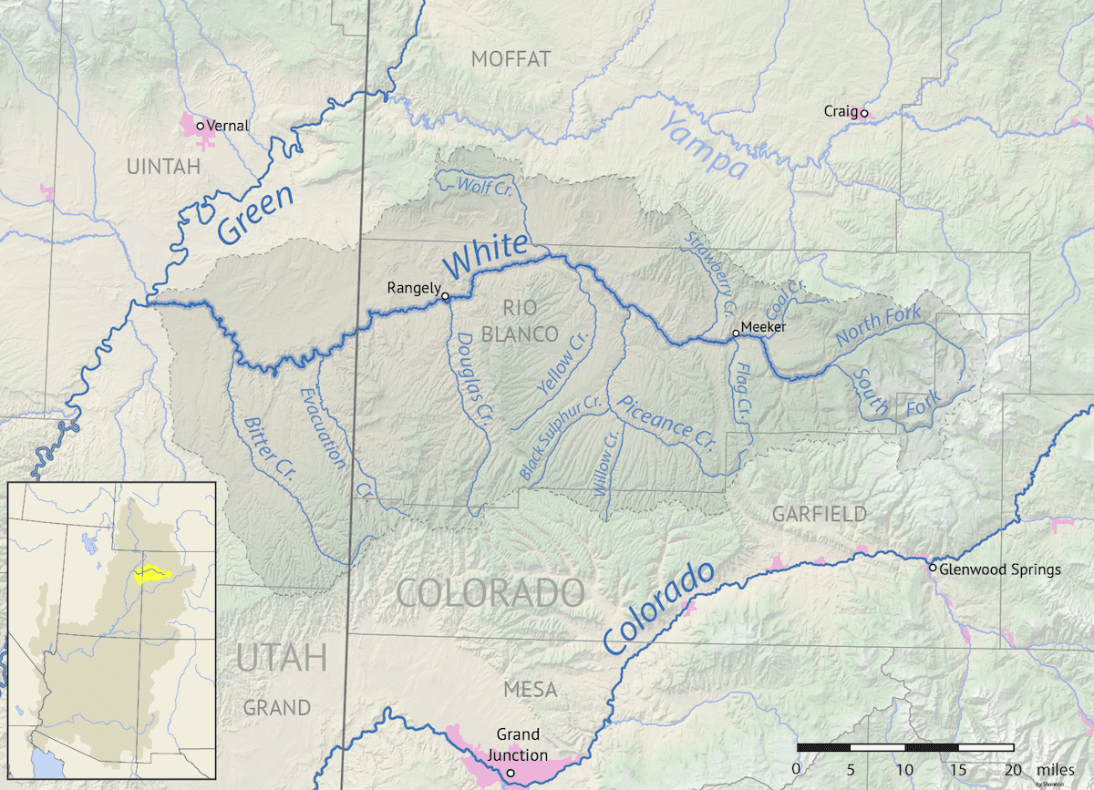
- Length: 195 miles
- Headwaters: Flat Tops Wilderness Area
- Mouth: Green River near Ouray, Utah
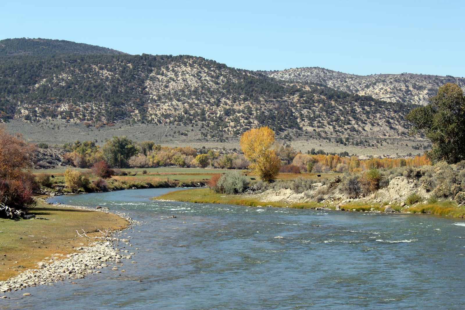
From the glacially carved valleys of the Flat Tops Wilderness, the White River flows west across the Piceance Basin, through hay fields and wide vistas. Named by Spanish explorers for the white sandstones through which it flows in its lower reaches, it drains an area of more than 5,000 square miles, from some of the most famous wilderness in the state to the high desert plains near its end.
Much of the upper White River is an excellent freestone fishing destination for several different species of trout, and it is said that some of Colorado’s largest fish can be found in the White River. Try fishing the river around Meeker near the Flat Tops.
Blue River — Pacific Ocean
- Name: for the color of its clear waters
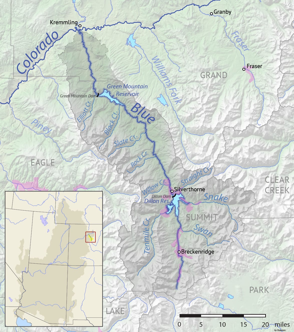
- Length: 65 miles
- Headwaters: Ten Mile Range
- Mouth: Colorado River at Kremmling
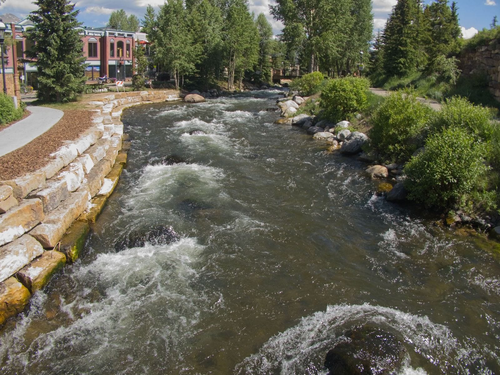
The Blue River begins near Quandary Peak by Breckenridge and flows to the north to join the Colorado River at Kremmling. Along its course is the Dillon Reservoir, also in Summit County, from which water is pumped to the Front Range (the reservoir is controlled by Denver Water). The Blue River was important in the early European history of the area, as it became a settlement focus for gold miners flocking to its gold-rich headwaters in the mid-1800s.
The Blue River is known for excellent fly fishing and also for whitewater rafting in the section between Dillon Reservoir and the Green Mountain Reservoir to the north near Kremmling. The Blue River flows into and out of both aforementioned reservoirs.
Roaring Fork River — Pacific Ocean
- Name: for its sound
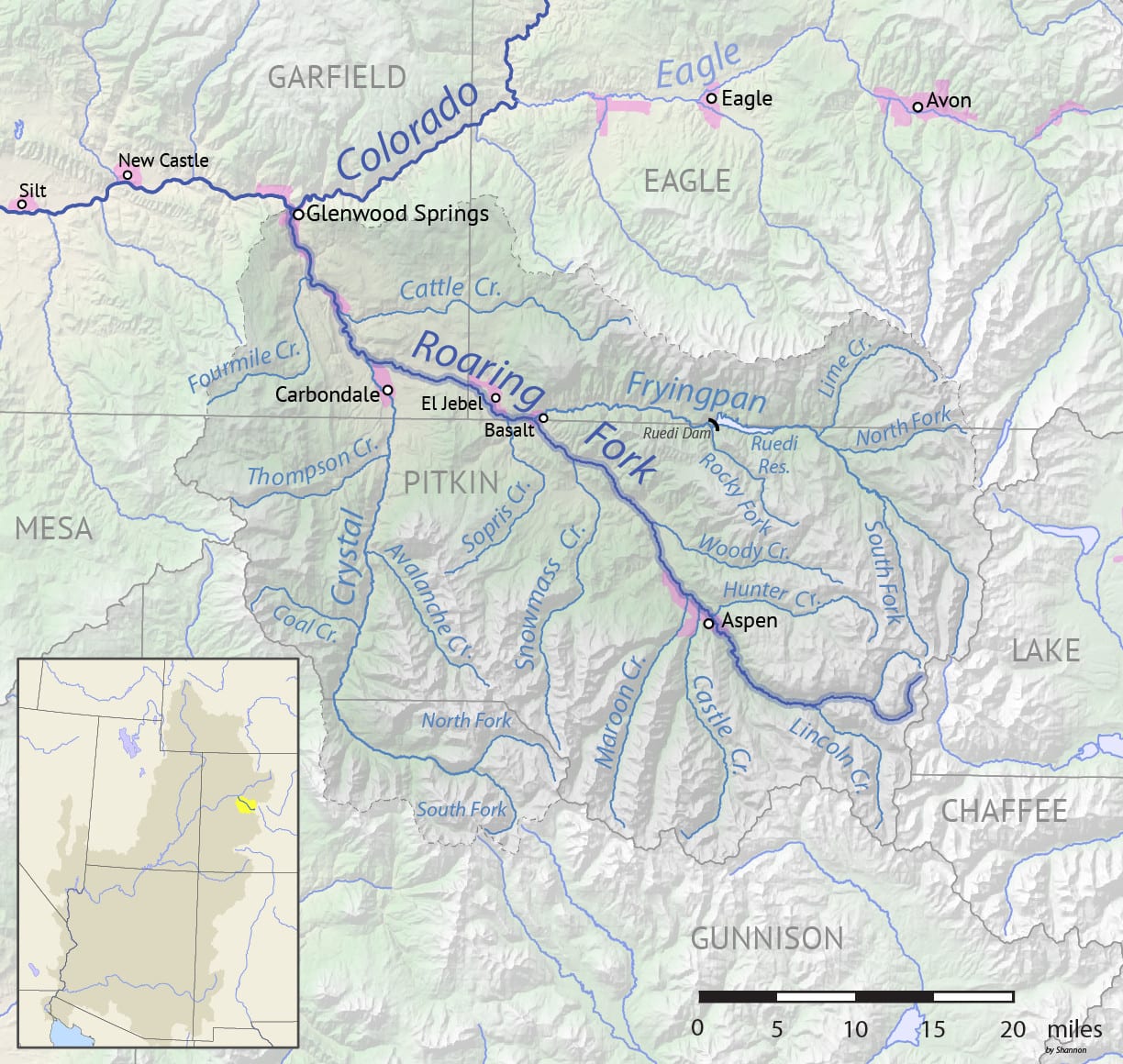
- Length: 70 miles
- Headwaters: Sawatch Range in Pitkin County
- Mouth: Colorado River at Glenwood Springs
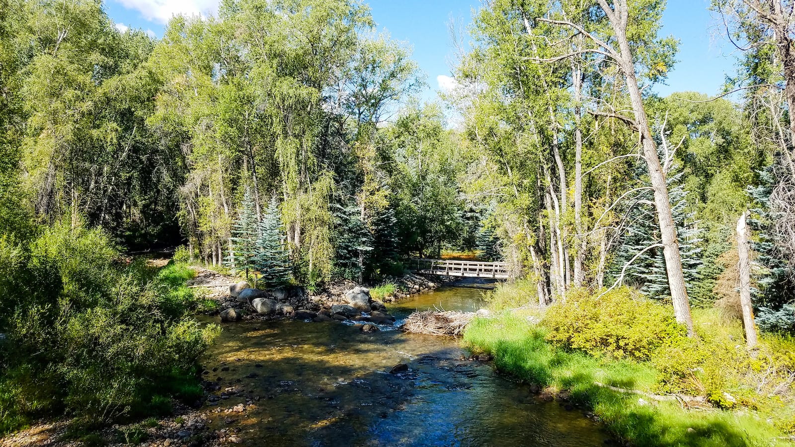
The Roaring Fork and its biggest tributary the Fryingpan are small rivers (the Fryingpan is only 42 miles long), but they are classic Rocky Mountain rivers and are both famous for excellent fly fishing. The Roaring Fork runs through the Roaring Fork Valley where Aspen and Snowmass are located and at Basalt, the Fryingpan joins the river.
The Roaring Fork Conservancy was established in 1996 to help preserve and protect the Roaring Fork Watershed. Today, it is one of the largest watershed conservancies in Colorado and has taught over 100,000 students as part of its educational mission. And the Fryingpan has one of the greatest names ever. Legend has it that a couple of trappers were attacked by members of the local Ute tribe. The survivor hung a frying pan on a tree to mark the place where his friend was killed.
Gunnison River — Pacific Ocean
- Name: for topographic engineer John Gunnison
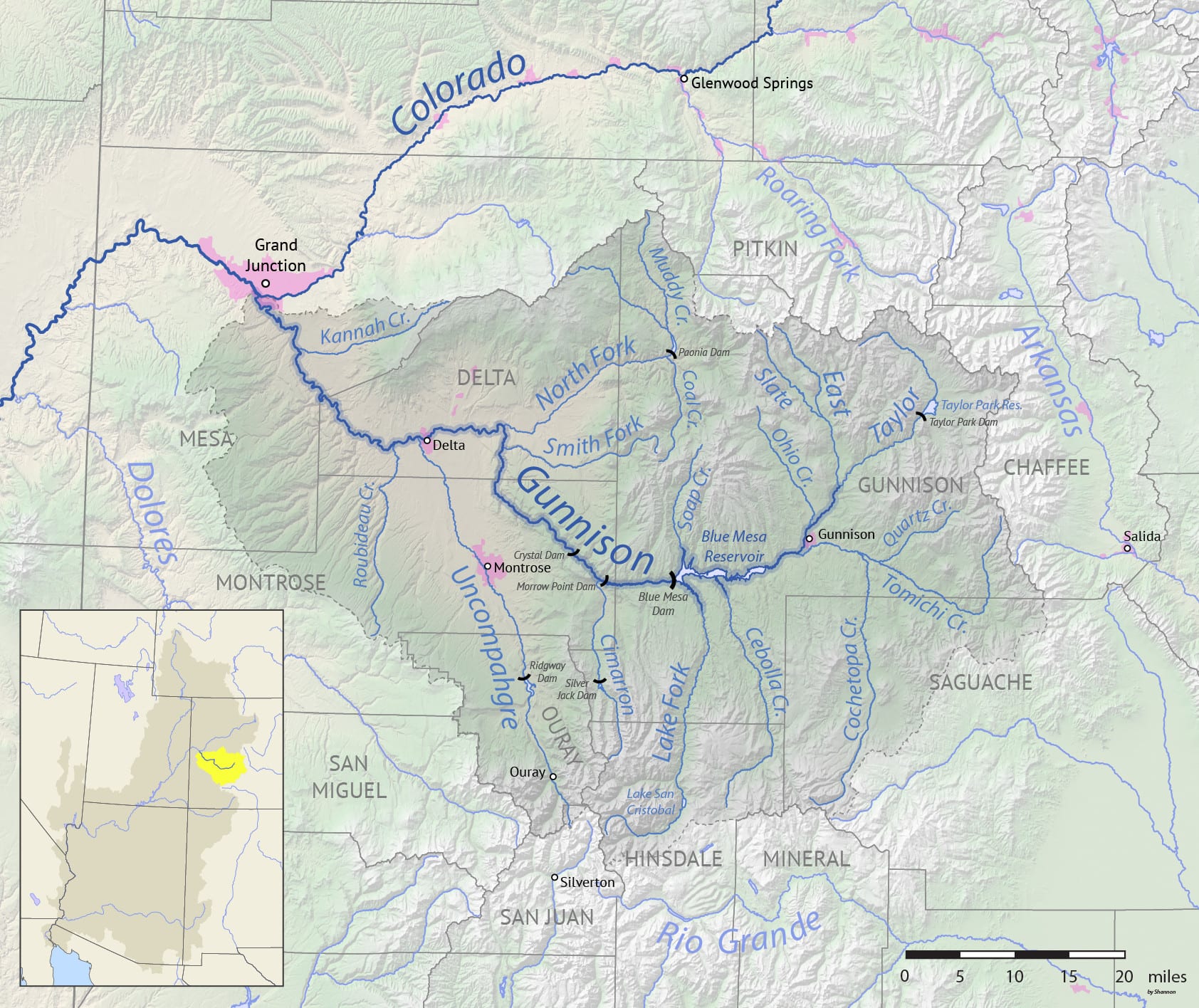
- Length: 180 miles
- Headwaters: east of Gunnison near Almont
- Mouth: Colorado River at Grand Junction
The Gunnison River is the largest river to join the Colorado within the state, with an enormous drainage basin of 8,000 square miles. The river flows the pines of the Continental Divide near the town of Gunnison to the sagebrush deserts of the Colorado at Grand Junction (so named because it was the junction of the Gunnison and the “Grand” rivers before the Grand was renamed).
Since the Gunnison has such a large drainage basin, it has been dammed in several places to control its flow and distribute that water, largely for agriculture in the Uncompahgre Valley. The Blue Mesa Dam, Morrow Point, and Crystal Dams were all built in the 1950s and 1960s as part of the Colorado River Storage Project, which also created Flaming Gorge Dam on the Green, Glen Canyon Dam on the Colorado, and Navajo Dam on the San Juan River.
The Gunnison River’s name has been a source of confusion for explorers for a couple of centuries. Originally called the Tomichi by the local Utes, in the mid-1700s Spanish explorer Juan Maria de Rivera thought it was the Colorado. Maps from the mid-1800s called it the Grand River. It was finally “named” for John Gunnison, who was killed while mapping a route through the region in 1853.
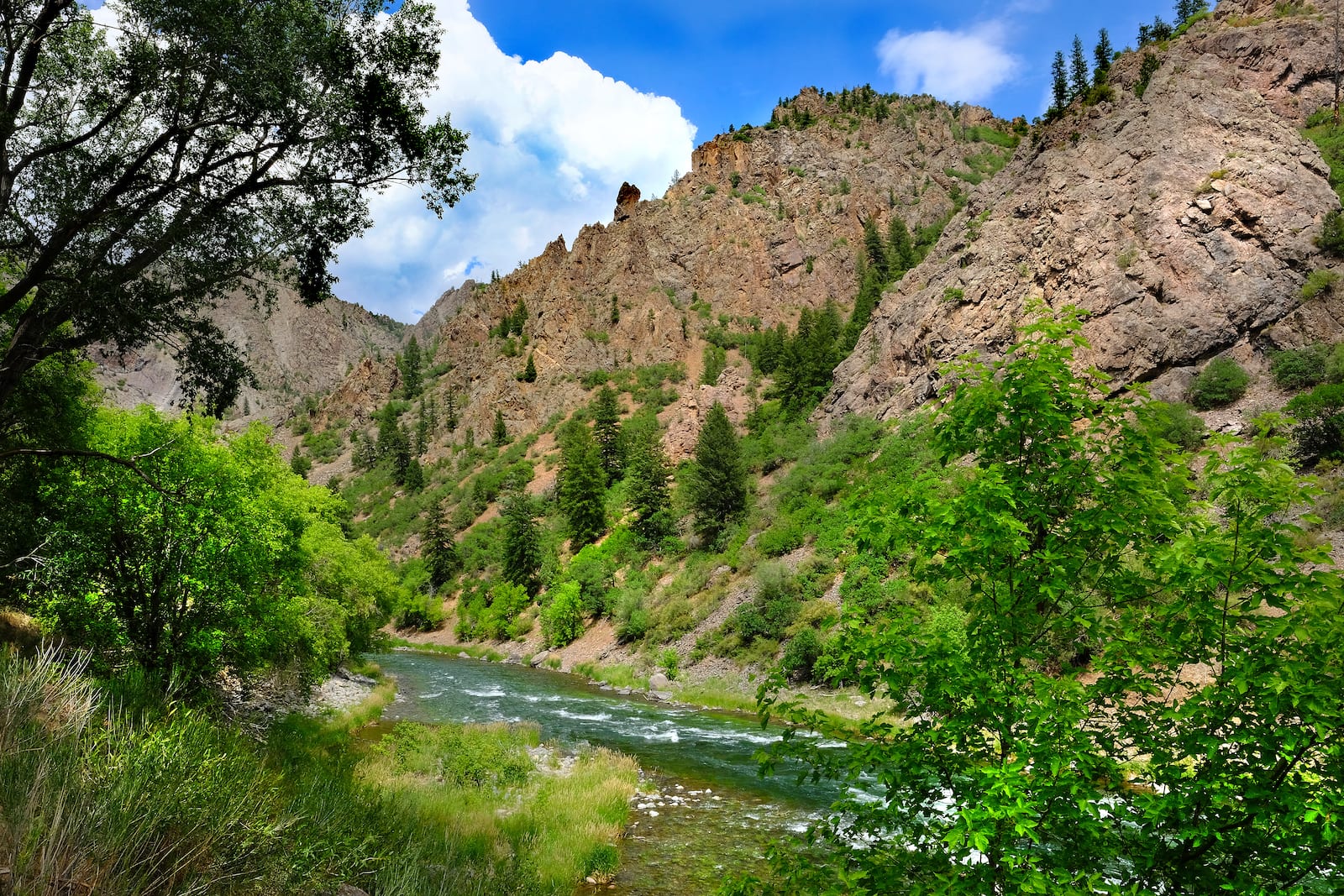
The Gunnison is perhaps best known for the extraordinary Black Canyon, where sheer walls of 1.7 billion-year-old metamorphic and igneous rocks rise more than two thousand feet above the river. The canyon is so narrow that it is often hard to see the river and sunlight reaches the bottom only briefly during a summer day.
Black Canyon of the Gunnison National Park is one of the best places to look down this precipitous drop and see the veins of pink granite snaking across dark schist and gneiss like a spiderweb, the river thrashing through boulders far below.
The Gunnison River is an excellent destination for whitewater rafting and offers anything from class I to V+ in several sections from Gunnison almost to Grand Junction. The section in the Black Canyon is peppered with huge rapids and portages. It’s not navigable by raft; it is a challenging kayak stretch but requires an expert hand. Below Crystal Dam, the Gunnison is a Gold Medal trout fishery.
Uncompahgre River — Pacific Ocean
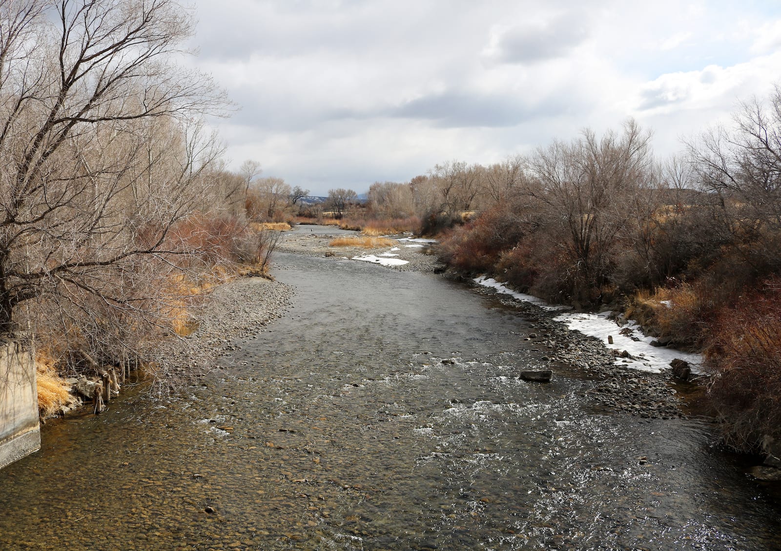
- Name: Ute word meaning “red water spring”
- Length: 75 miles
- Headwaters: Lake Como
- Mouth: Gunnison River at Delta
The Uncompahgre River starts in the northwestern San Juan Mountains and makes its way through Ridgway, Ouray, and Montrose on its way to the Gunnison. The river was named by the Utes for the numerous hot springs near Ouray and Ridgway. These hot springs are part of the geologic story that created major mineral deposits in the region, and the upper watershed was a mining boom area in the late 19th century.
Ridgway Reservoir was completed in 1988 and in 1994 the U.S. Bureau of Reclamation, Colorado Parks and Wildlife, and Trout Unlimited worked together to help create and restore fish habitat below the reservoir. Together with mine cleanups upstream, these efforts have created excellent fishing in the reservoir’s tailwaters, next to Pa-Co-Chu-Puk Campground. Locals call the area “Paco.”
Dolores River — Pacific Ocean
- Name: Rio de Nuestra Señora de Dolores (Our Lady of Sorrows)
- Length: 241 miles
- Headwaters: San Miguel Mountains
- Mouth: Colorado River near Moab, Utah
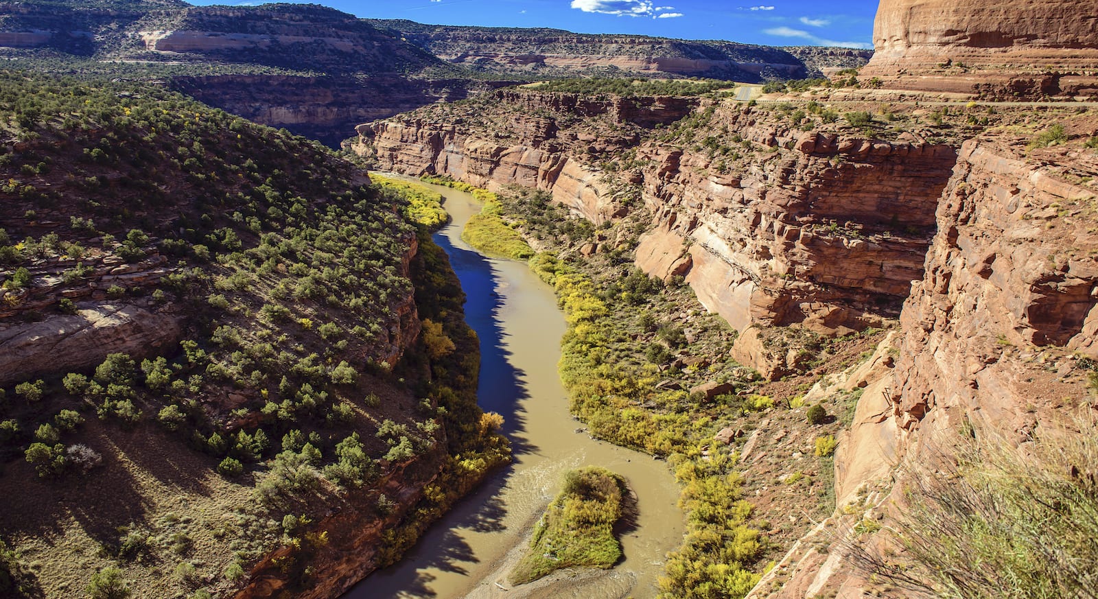
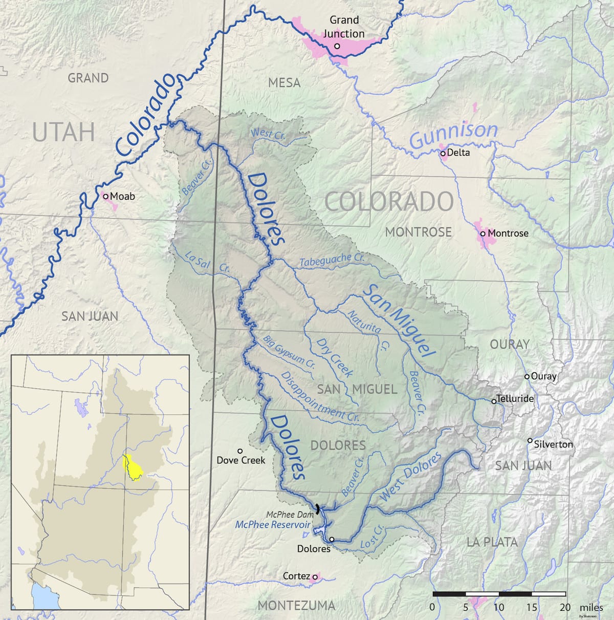
Rising near Hermosa Peak, the Dolores River flows west toward its confluence with the Colorado in Utah. It passes through the town of Dolores. The river was originally named in 1776 by Spanish explorer and priest Silvestre Velez de Escalante during his journey from Santa Fe to seek a route to the west coast, but long before the Spaniards “found” and named the river, native Americans had lived in the region.
Archeological sites from ancient hunters and gatherers, Ancestral Puebloans, and the Fremont People are common along some stretches of the river, although most archeologists think that the river corridor was the “suburbs” to the main populations to the south and north. Utes followed the ancient peoples into the land and were present when Europeans began ranching and farming the area.
In 1881, the Utes were forcibly removed from most of the region and settled on their reservations in southwestern Colorado. The Dolores River became the territory of prospectors and cattlemen.
In the late 1800s, the discovery of the uranium compound carnotite downstream of the settlement of Bedrock ushered in several uranium booms that lasted off and on until the 1970s. Between 1906 and 1923, the mines along the river supplied 90 percent of the world’s radium, a component element of carnotite.
The Dolores River performs an odd geological shenanigan when it reaches western Colorado’s Paradox Valley. Usually, rivers flow along the length of a valley. But the Dolores instead cuts directly across the valley, a phenomenon caused by unique geological circumstances—the uplift of the land and collapse of the valley occurred slowly enough that the river could maintain an ancient course instead of being constrained by the shape of an already existing valley.
The McPhee Dam stops the majority of the river’s flow except in high-water years. When there is enough water, the rafting on the Dolores is incomparable. Starting in pine forests, the lively river descends through pinyon and juniper and into slick rock canyonlands. Rock art, wildlife, hiking, and extraordinary redrock scenery make a Dolores River trip unique among Colorado’s rivers. There is also some impressive whitewater along the river, including Snaggletooth and Stateline rapids.
San Miguel River — Pacific Ocean
- Name: for the Saint Michael
- Length: 72 miles
- Headwaters: San Juan Mountains
- Mouth: Dolores River near Uravan
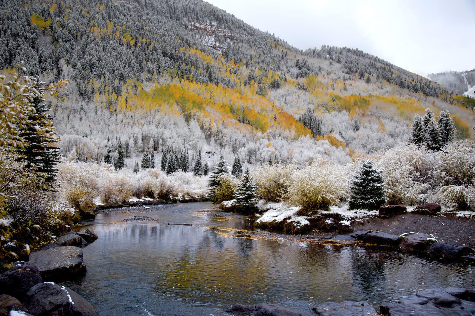
The main tributary of the Dolores is the San Miguel River, which begins in the mountains near Telluride and flows to its confluence with the Dolores about 15 miles from the Utah state line near the abandoned uranium town of Uravan. The San Miguel drops roughly 7,000 feet in its course, and several sections of the river offer popular kayaking and boating through class II and III rapids.
The Nature Conservancy’s South Fork Preserve protects a section of rare and endangered riparian habitat along the river near Telluride.
San Juan River — Pacific Ocean
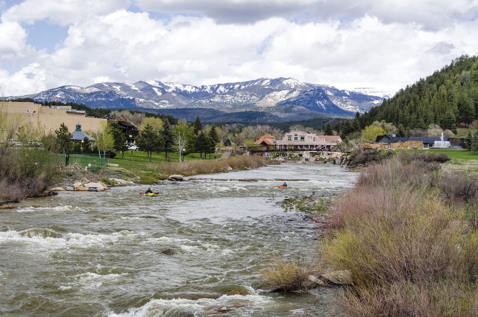
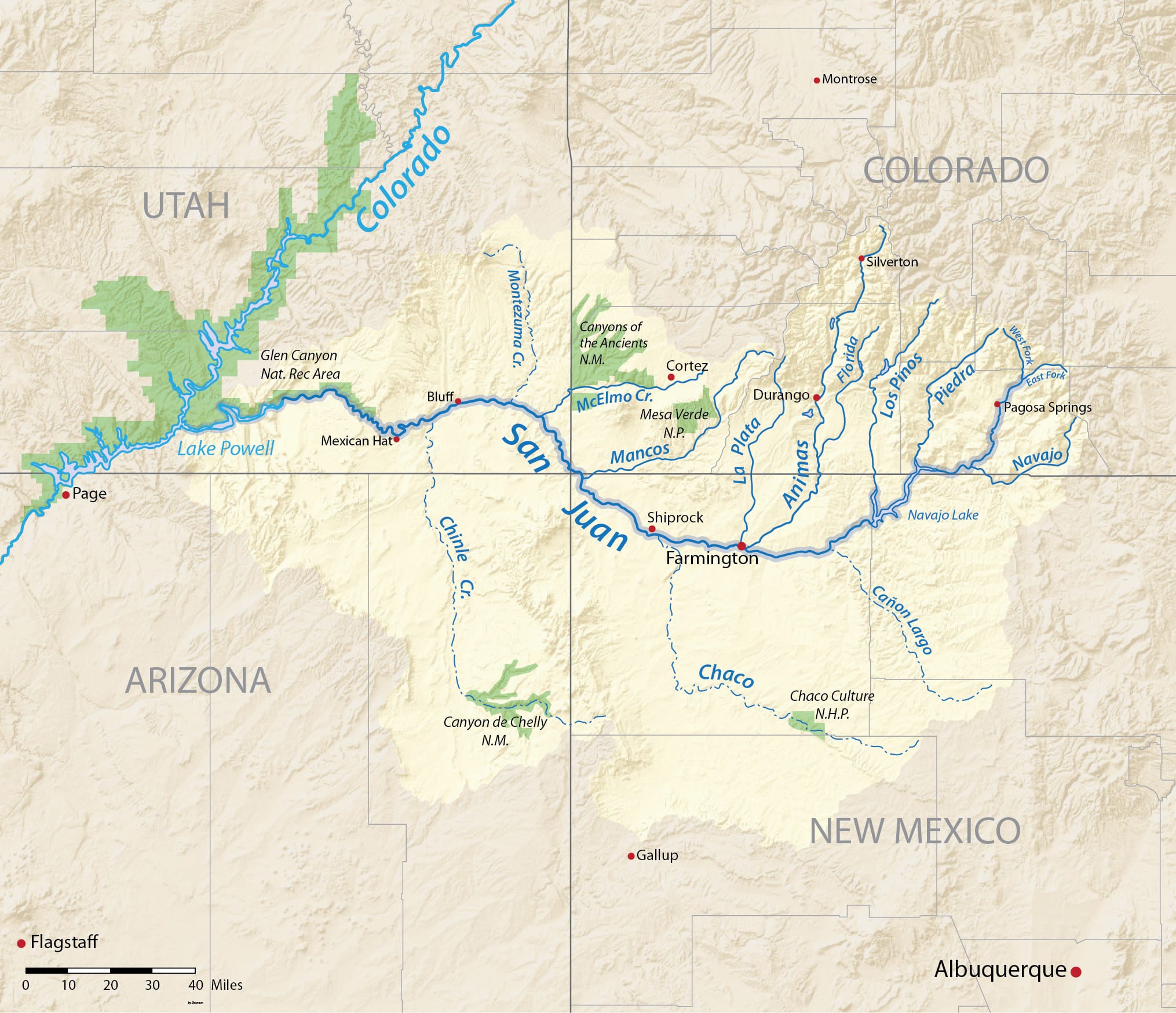
- Name: for John the Baptist
- Length: 385 miles
- Headwaters: southern San Juan Mountains
- Mouth: Colorado River in Utah’s Glen Canyon (Lake Powell)
One of the largest tributaries to the Colorado River is the San Juan River, which drains more than 24,000 square miles of southwestern Colorado. The San Juan River travels from alpine forests to canyonlands desert, running through Pagosa Springs, Farmington, Four Corners, and Mexican Hat before joining the Colorado River in Utah’s Glen Canyon (now under Lake Powell).
The San Juan has been a center of civilization for thousands of years; evidence of human habitation along the river goes back at least 10,000 years, and continues almost unbroken to today, from Archaic hunters and gatherers and Ancestral Puebloans to the Ute and Navajo people. Spanish explorers “named” the river, followed by Mormon pioneers and Anglo miners, who made their way through the area and left a major imprint on the landscape.
A gold rush in the San Juan Mountains in the 1860s brought thousands of people to the region, with tourists following them not long after. Pagosa Springs (from the Ute word “pah-gosah” meaning “water with a bad smell”) was founded in 1885 around the sulfur hot springs located along the banks of the San Juan River. The main spring is the world’s deepest geothermal hot spring, and the area has been attracting tourists seeking the medicinal qualities of the hot springs since the late 1800s.
In the mid-20th century, the San Juan River became an important source of water for the surrounding states, and Navajo Dam was built as part of the Colorado River Storage Project. Navajo Lake is a popular recreation area. The upper San Juan above Pagosa Springs is known for gorgeous fall colors, excellent fly fishing, and lively whitewater rafting day trips (you have to go to Utah’s canyons to do multi-day rafting trips on the San Juan).
The largest tributaries to the San Juan are the Animas and Mancos rivers, in the southwestern corner of the state. The Animas and its main tributary the La Plata River figure prominently in the mining history of that part of the San Juan Mountains. Miners discovered gold in the 1850s, and silver along the rivers in 1871; the area boomed.
La Plata is the Spanish word for silver and of course, the town of Silverton was named for the precious metal.
Animas River – Pacific Ocean
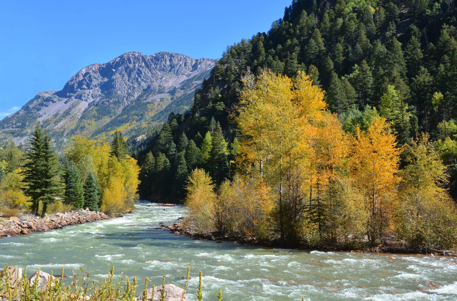
- (Original) Name: Rio de las Animas Perdidas (River of Lost Souls)
- Length: 125 miles
- Headwaters: San Juan Mountains north of Silverton
- Mouth: San Juan River at Farmington, NM
The Animas River was named in 1765 by Spanish explorer Juan Maria de Rivera. South of Silverton the river flows into the Animas Gorge, which is an extraordinarily beautiful and narrow mountain canyon. The Durango and Silverton Narrow Gauge Railroad trip through the gorge affords incredible views of the river as it rushes through the canyon far below.
The river is the literal heart of the town of Durango. People can kayak, canoe, or boat right through town, and Animas River Days occur every year in June. Originally started in 1983 as a whitewater kayak “rodeo” competition, the event has now grown to include education and conservation, and a very popular costumed river “parade.”
Although the Animas is undammed, the Animas-La Plata Water Project (completed in 2015) pumps water from the river to fill Lake Nighthorse, which then provides water to the Southern Ute tribe.
Mancos River – Pacific Ocean
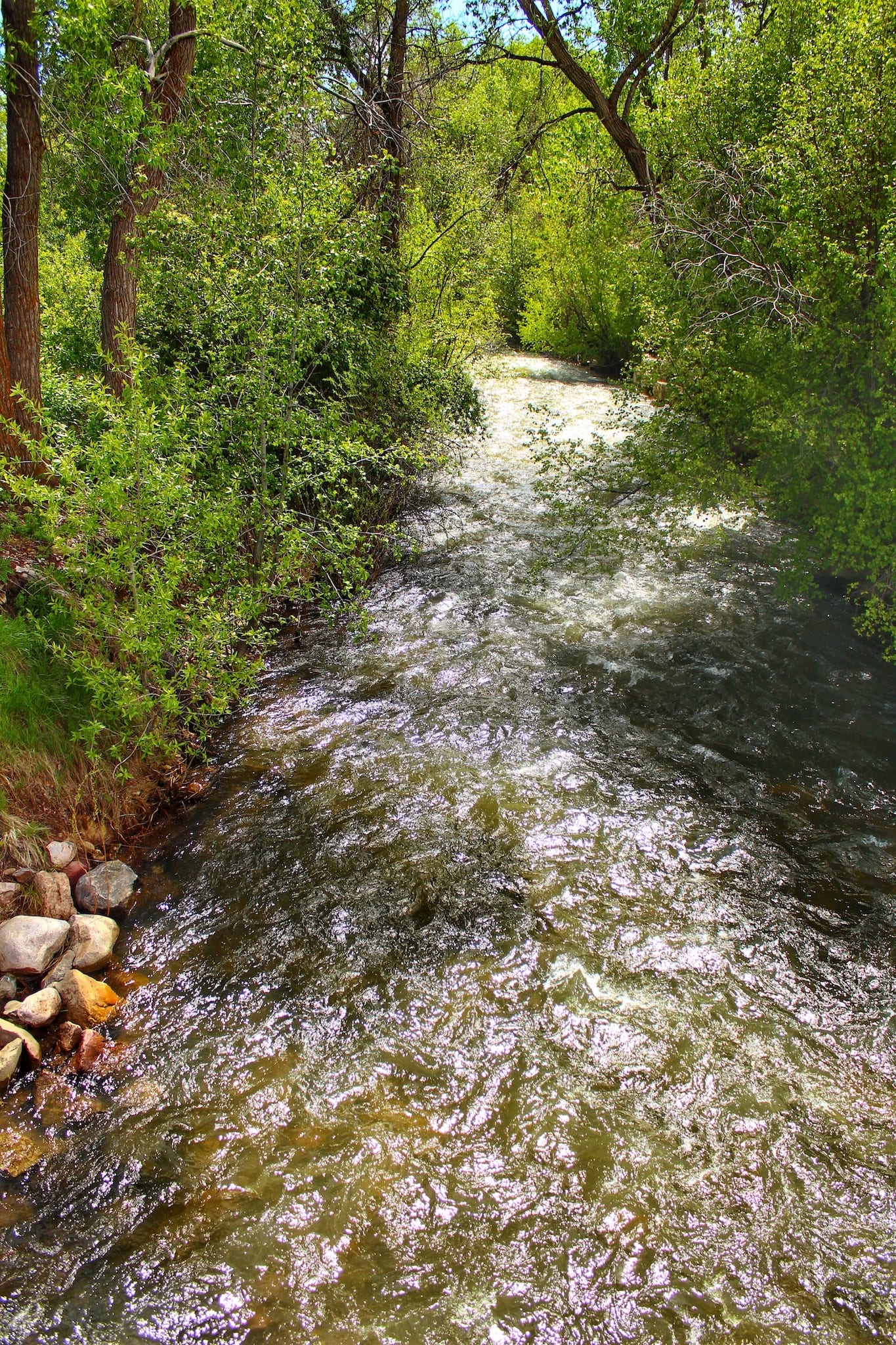
- (Original) Name: Rio de San Lazaro
- Length: 85 miles
- Headwaters: just east of Mancos
- Mouth: San Juan River near Four Corners
The Mancos River is Colorado’s westernmost tributary to the San Juan River. It runs from the mountains just east of the town of Mancos to its confluence with the San Juan and forms the eastern boundary of Mesa Verde (both the national park and the actual mesa).
The current name for the river comes from the Spanish word for “one-armed.” Although no one seems to agree, it appears that someone hurt or lost a hand during an early crossing of the river, thus rendering him “one-armed.”
The river flows across lands that were densely populated during Ancestral Puebloan times, around 800 years ago, and was an important lifeline for those peoples. More recently, the Mancos River has formed a focal point for the town of Mancos, which is experiencing a renaissance of sorts, with outdoor gear makers headquartered there, microbreweries, art galleries, and farm-to-table restaurants.
In 2017 the town even started an annual Mancos Valley River Film Festival and it is a designated Colorado Creative District.
Rio Grande River — Atlantic Ocean
- Name: means “Big River”
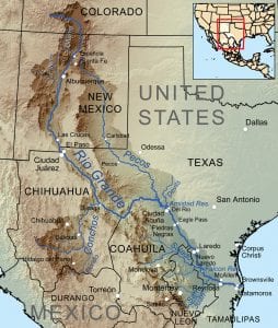
- Length: 1900 miles
- Headwaters: base of Canby Mountain
- Mouth: Gulf of Mexico
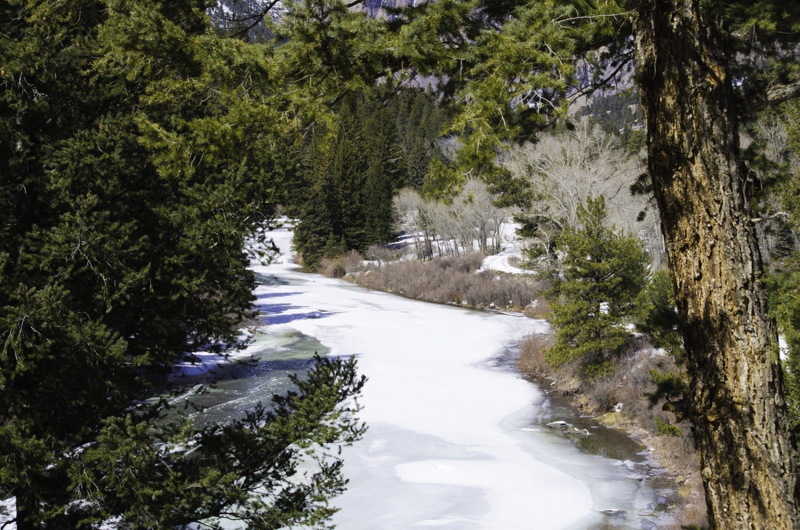
The state’s longest river is also one of the Southwest’s great rivers and something of a Colorado River oddball. It begins just east of the Continental Divide but it flows south from there to the Gulf of Mexico, forming the international border between the United States and Mexico for more than half of its length. In Mexico, the river is called the Rio Bravo, and it has an enormous watershed, draining parts of Colorado, New Mexico, Texas, and Mexico.
The Rio Grande is a river of history. It is the route used for thousands of years by Native Americans, Spanish soldiers, traders, and cultural exchange. Even all the Native American names for this river before the arrival of Europeans translate to “Big (or Great) River.”
In Colorado, the river starts as a collection of tiny mountain trickles, but by the time it reaches the San Luis Valley, it is a large enough river to provide water for irrigation. The river slices southeast across the valley and forms the core of the San Luis Valley National Wildlife Refuge Complex, which comprises the Alamosa, Monte Vista, and Baca refuges. The Alamosa Refuge is immediately adjacent to the river on the east bank. It is an excellent place to see an extraordinary number of bird species including the annual sandhill crane migration, when more than 20,000 cranes move through the valley in the spring and fall.
Most of the river is blocked by dams and diversions throughout its length. The first of these is the Rio Grande Dam southwest of Creede. The dam and accompanying reservoir were built between 1910 and 1914 to provide irrigation water for the San Luis Valley. By the time the river reaches southern Texas, there is usually no water left; so much has been taken out for irrigation and municipal use along the way.
Although most people are more familiar with the rafting that occurs in New Mexico or Texas (in places like the Taos Box or Big Bend National Park), the Colorado section of the Rio Grande near Creede has excellent fly fishing and whitewater rafting.
North Platte River — Atlantic Ocean

- Name: comes from the French word for “flat”
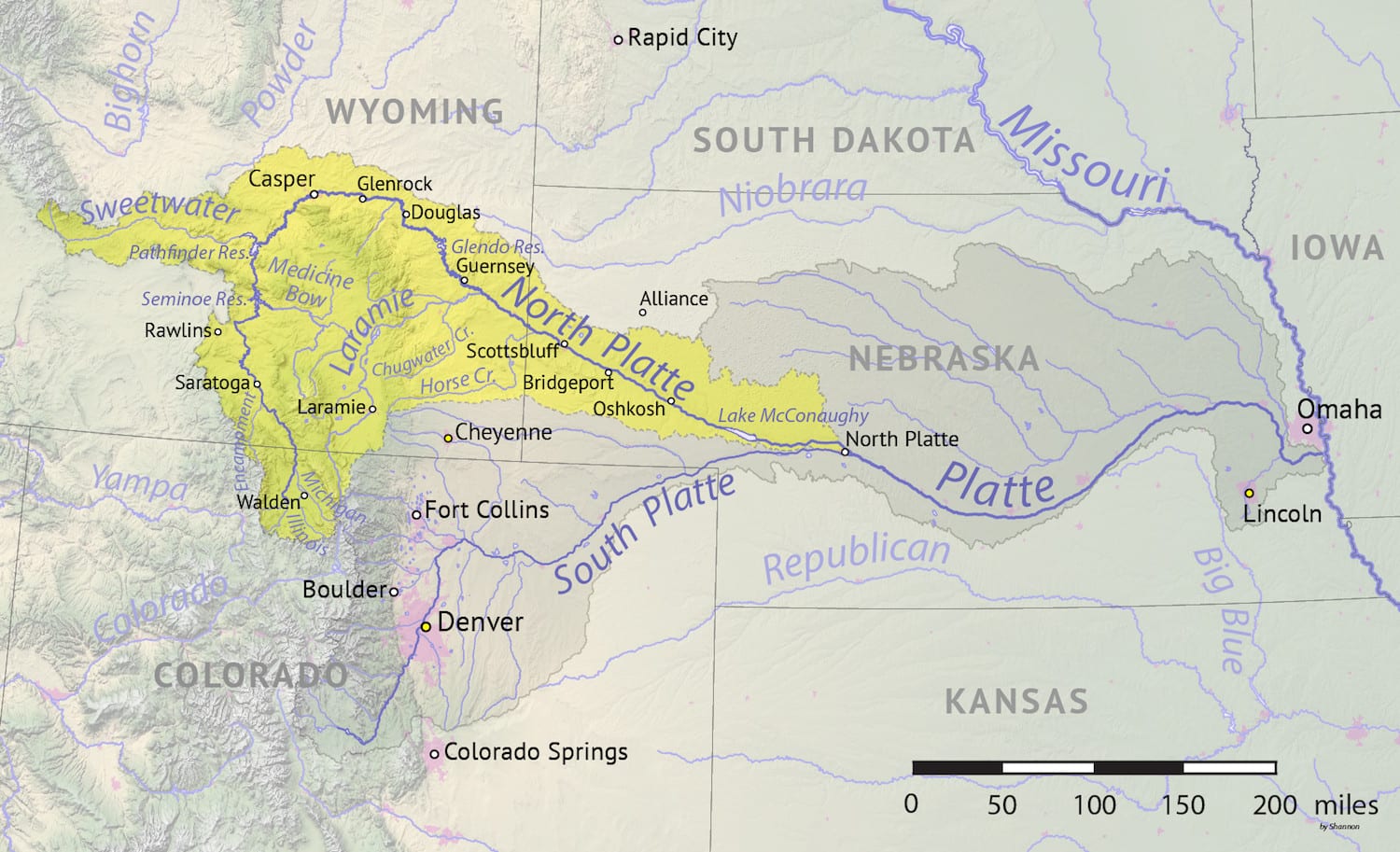
- Length: 720 miles
- Headwaters: Jackson County near Walden
- Mouth: Platte River at North Platte, Nebraska
The North Platte River begins just across the Continental Divide from the headwaters of the Yampa River near Walden. It flows first north into Wyoming and then west to its confluence with the South Platte in Nebraska to form the Platte River. It may have one of the most spectacular beginnings of any river in the state; nearly a dozen peaks of over 11,000 feet drain into its headwaters.
The North Platte in Wyoming and Nebraska was an important path used by trappers and pioneers on the route west, but the Colorado section of the river is too small, high, and rocky to have been used for travel. Accordingly, there are no dams on the Colorado portion of the river, although it is blocked by several further downstream. The river flows into Wyoming through Northgate Canyon, which is a popular 10-mile rafting and kayaking section.
South Platte River — Atlantic Ocean
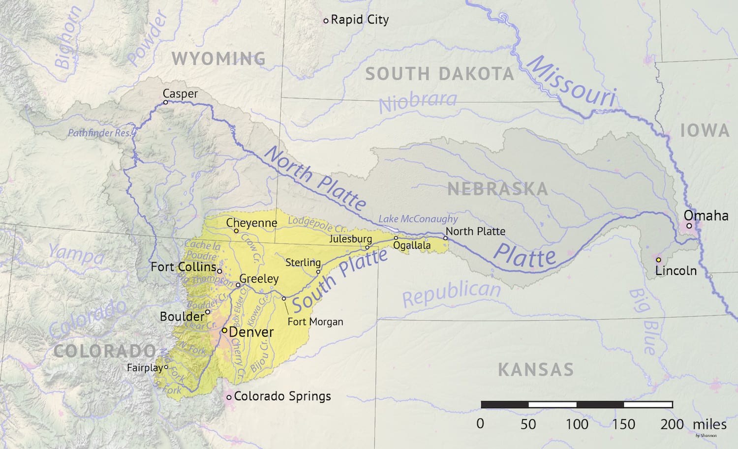
- Name: comes from the French word for “flat”
- Length: 450 miles
- Headwaters: Mosquito Range near Fairplay
- Mouth: Platte River at North Platte, Nebraska
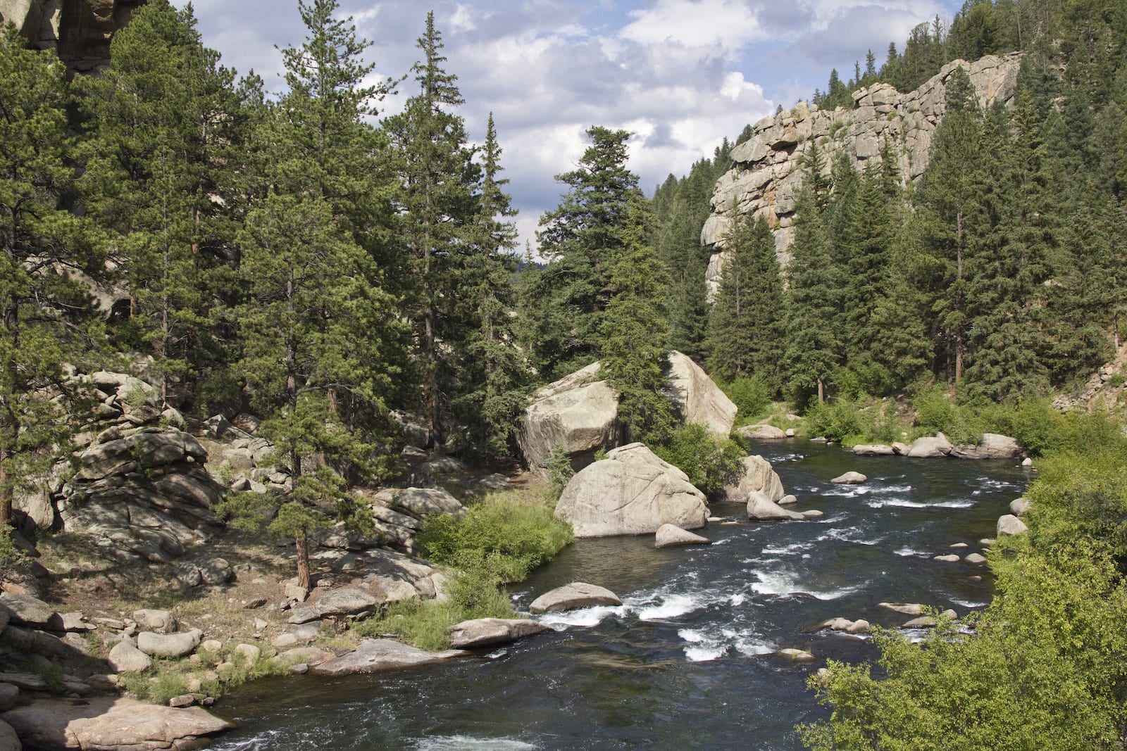
The North Platte’s sister river, the South Platte, spends much more of its time in Colorado before exiting into Nebraska. In the mountains, it passes through the fishing destinations of Fairplay, Hartsel, and Deckers.
The river drains an enormous portion of the Front Range; it is the main water source for eastern Colorado and has supported agriculture on the otherwise arid to semi-arid High Plains. Denver owes its existence to the South Platte River (the city was founded along its banks at its confluence with Cherry Creek), and the river’s valley has served as the route for interstates and railroads.
The South Platte was originally the territory of the Arapaho tribe and was later exploited by trappers and settlers who wanted to escape the aridity of the plains. Dam-building began early in Colorado’s settlement; there are currently seven dams and reservoirs on the river, both above and below Denver.
The South Platte Scenic and Historic Byway in Julesburg is only 19 miles long but is rich with the history of eastern Colorado. The state’s only Pony Express Station was located in Julesburg on the banks of the South Platte. Several sections of the river in the mountains are known for excellent whitewater rafting, and a quick search on the Internet produces more than a dozen sites for fly fishing on this Gold Medal trout stream, best known for its tailwater fishing.
Cache la Poudre River — Atlantic Ocean
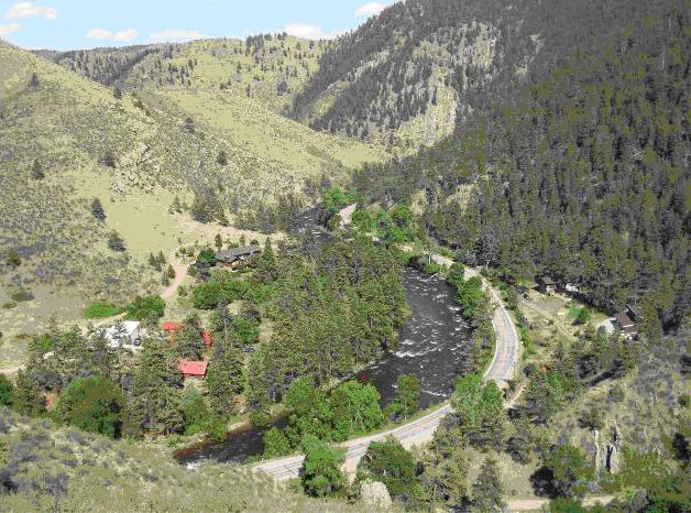
- Name: is French for “Hidden Powder”
- Length: 126 miles
- Headwaters: Poudre Lake
- Mouth: South Platte River near Greeley
One of the South Platte’s many tributaries is the Cache la Poudre River, known locally as simply the Poudre (poo-der). The river begins in Rocky Mountain National Park, then flows north and east through Fort Collins to join the South Platte River near Greeley.
The Poudre’s name comes from a story that a group of French trappers were caught in a snowstorm and buried their gunpowder near the mouth of the river for protection. By the late 1800s, miners and the railroad came to the area and began to settle.
Mining didn’t pan out (pun intended) and the railroad up the Poudre Canyon was never built, but the river was still a draw to settlers looking to farm the floodplains at the base of the mountains. Today, the river is critical to more than half a million people along the northern Front Range.
76 miles of the river were designated as Wild and Scenic in 1986 and is the only waterway in Colorado with that designation. It is an extremely popular whitewater rafting and kayaking river, with popular hiking trails and fly fishing as well.
The Cache La Poudre River Corridor National Heritage Area is a 45-mile-long nationally designated heritage area that extends from the base of the mountains to the South Platte confluence. It was the first national heritage area west of the Mississippi and was created to promote and protect the historical and cultural features of the river and its surroundings. You can drive the Cache La Poudre-North Park Byway, a scenic drive from Fort Collins west to Walden.
Clear Creek — Atlantic Ocean
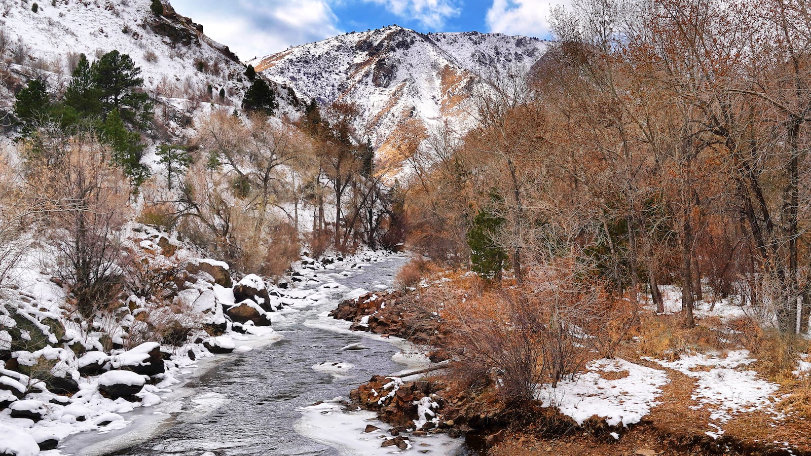
- (Original) Name: called Cannonball Creek for the sound of the rocks rolling in its bed
- Length: 66 miles
- Headwaters: Loveland Pass
- Mouth: South Platte River at Thornton
Because of Clear Creek’s proximity to Denver, it’s a popular kayaking, rafting, and fishing stretch. But long before this river became known as a place to escape the heat of Denver’s summers, it was an important part of the early mining history of the area. During the Colorado gold rush of 1859, the creek served as the thread that bound together mining towns like Idaho Springs and Georgetown and was the center of some of the most concentrated mining activity in the region.
Clear Creek and its canyon provided the perfect route through the Rocky Mountains; they became the path for the railroad, and later for Interstate 70 and Highway 6. Along the way, Clear Creek passes the Coors Brewing Company’s facility in Golden, and some of its water is used in the plant’s operations (although not to make the beer).
Arkansas River — Atlantic Ocean
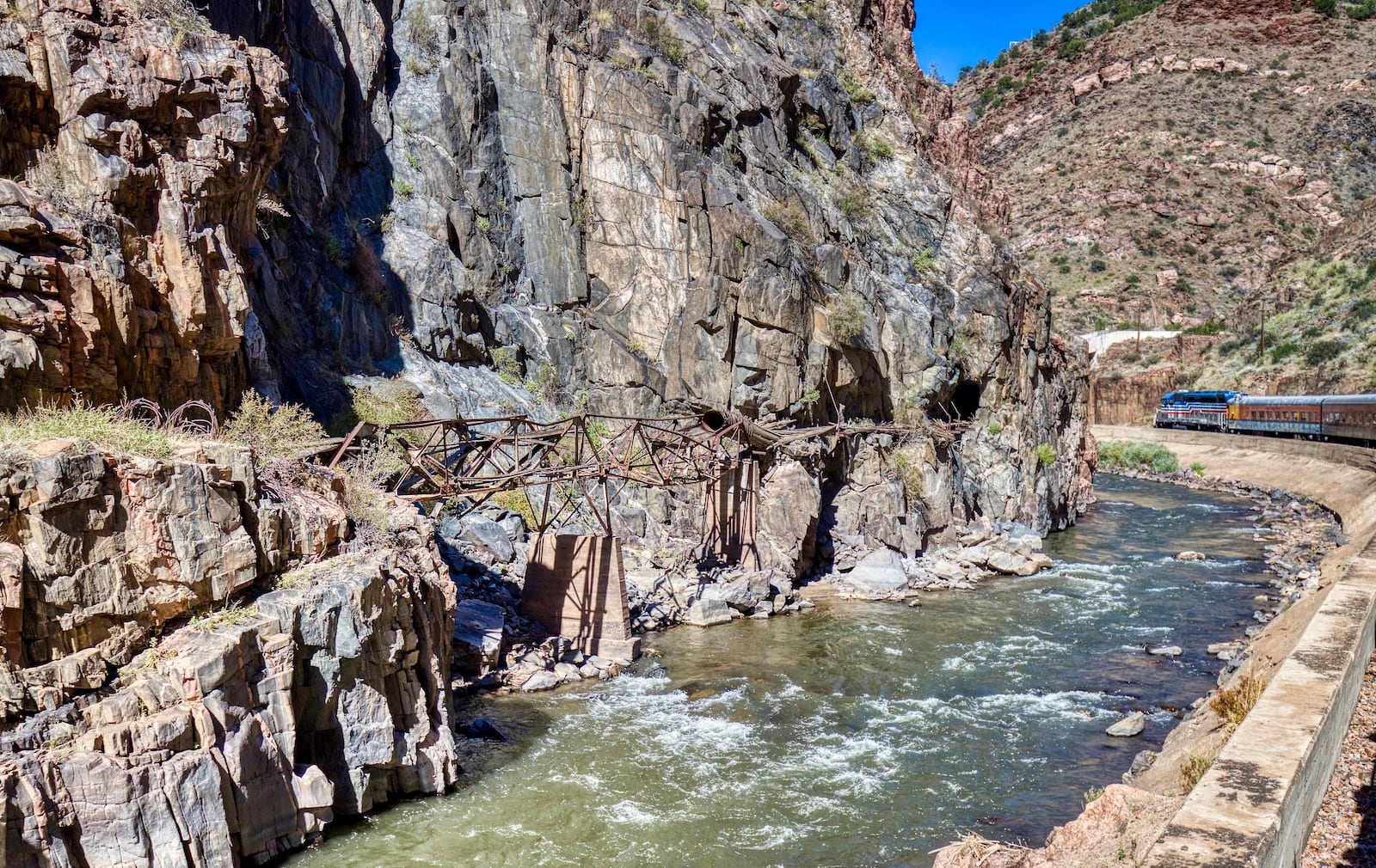
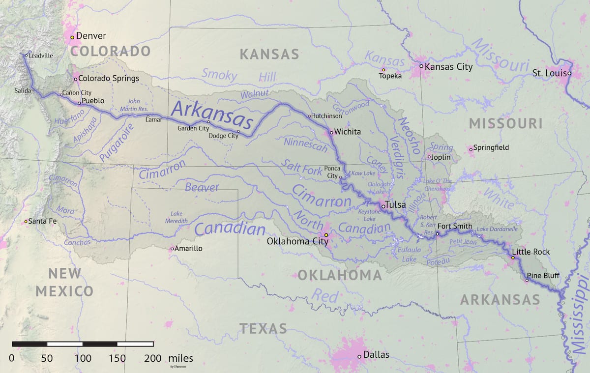
- Name: for the state
- Length: 1470 miles
- Headwaters: Near Leadville
- Mouth: Mississippi River
The Arkansas River is the sixth-longest in the entire country. It begins in the Mosquito and Sawatch ranges and flows south and then east across Kansas and Oklahoma before joining the Mississippi River in Arkansas. On the Great Plains, the river picks up several large tributaries such as the Purgatoire, Huerfano, Cimarron, and Canadian rivers.
These and many other tributaries (as well as several dams and reservoirs connected by locks) make the Arkansas a huge river capable of carrying barge traffic when it reaches the Mississippi. Due to its length and size, the river has been an important route for exploration and settlement, military expeditions, and trading throughout the country’s history.
However, in Colorado’s mountains, the Arkansas River is still the small mountain river that greeted miners who found gold and silver in the middle to late 19th century. And this is the river that has turned towns like Leadville, Buena Vista, Salida, and Cañon City into world-class tourist destinations.
The 152-mile-long Arkansas Headwaters Recreation Area between Leadville and Pueblo is famous for whitewater rafting and fly fishing; nearly a third of Colorado’s Gold Medal trout fishery river miles (102 to be exact) are on this section. The Royal Gorge is one of the most famous whitewater stretches in the country. The Arkansas River is the most popular whitewater river in the United States.
The hundreds of rivers in Colorado each have their own history, geography, and recreational opportunities. You could fish, boat, hike, bike, and learn your way down Colorado’s rivers for the rest of your life and never see them all. But it’s worth trying, so what are you waiting for?

 8 Great Museums in Denver, Colorado